

Day 153 of Year Long Road Trip Along America’s Scenic Byways
So I didn’t look for the cache at Wal-Mart this morning as the landscape crew was nearby. But I did decide to drive inland toward Crater Lake today. The scenic byway began at a lower elevation in Roseburg, so I figured I could at least enjoy a handful of stops in Umpqua National Forest if Crater Lake wasn’t feasible.
Colliding Rivers Viewpoint
As I headed east in the rain to Colliding Rivers Viewpoint at less than 1,000 feet elevation, I wondered if that meant snow when I reached the 5,000 foot pass. The Colliding Rivers Viewpoint, which for millions of years sat beneath the Pacific Ocean, is now the location where the Little River and the North Umpqua River collide. The two rivers collide due to resistant sills of Basalt that deflect the rivers into a collision course. The combined force of the two rivers, however, broke through the Basalt and travel west to the Pacific Ocean.

Susan Creek Falls
After a few short minutes in the cold rain watching the rivers collide, we moved on to Susan Creek Falls. A crushed stone pressed trail led Petey and me 0.8 miles to a fan shaped waterfall that drops 50 feet over mossy rocks. As I donned my goulashes, parka, and hooded rain jacket, poor Petey braved the constant drizzle. I felt a bit sorry for him, but at the same time, I think he’d rather be on the trail than in VANilla.

Fall Creek Falls
Upon our return to VANilla, he got a good toweling off and rested in the warmth of the van while I took another hike at Fall Creek Falls just a few miles down the road. The path leads hikers through a narrow bedrock crevice, past lush vegetation and beneath moss covered trees to a lovely double falls with tiers of 35 and 50 feet.
A spur route leads curious trekkers to a basalt outcropping as well. Knowing I had a long day in store for me, I almost skipped this two-mile jaunt, and I’m so glad I didn’t. The walk through the forest with rain dripping from the rocks and leaves was just gorgeous.


Steamboat Falls
We continued a little further up the road to Steamboat where we took a six-mile side trip to Steamboat Falls located at the Steamboat Campgrounds. I was too early to see the summer ritual of steelhead attempting to jump the 25-foot falls adjacent to the fish ladder, but the falls and river still granted a fine view.

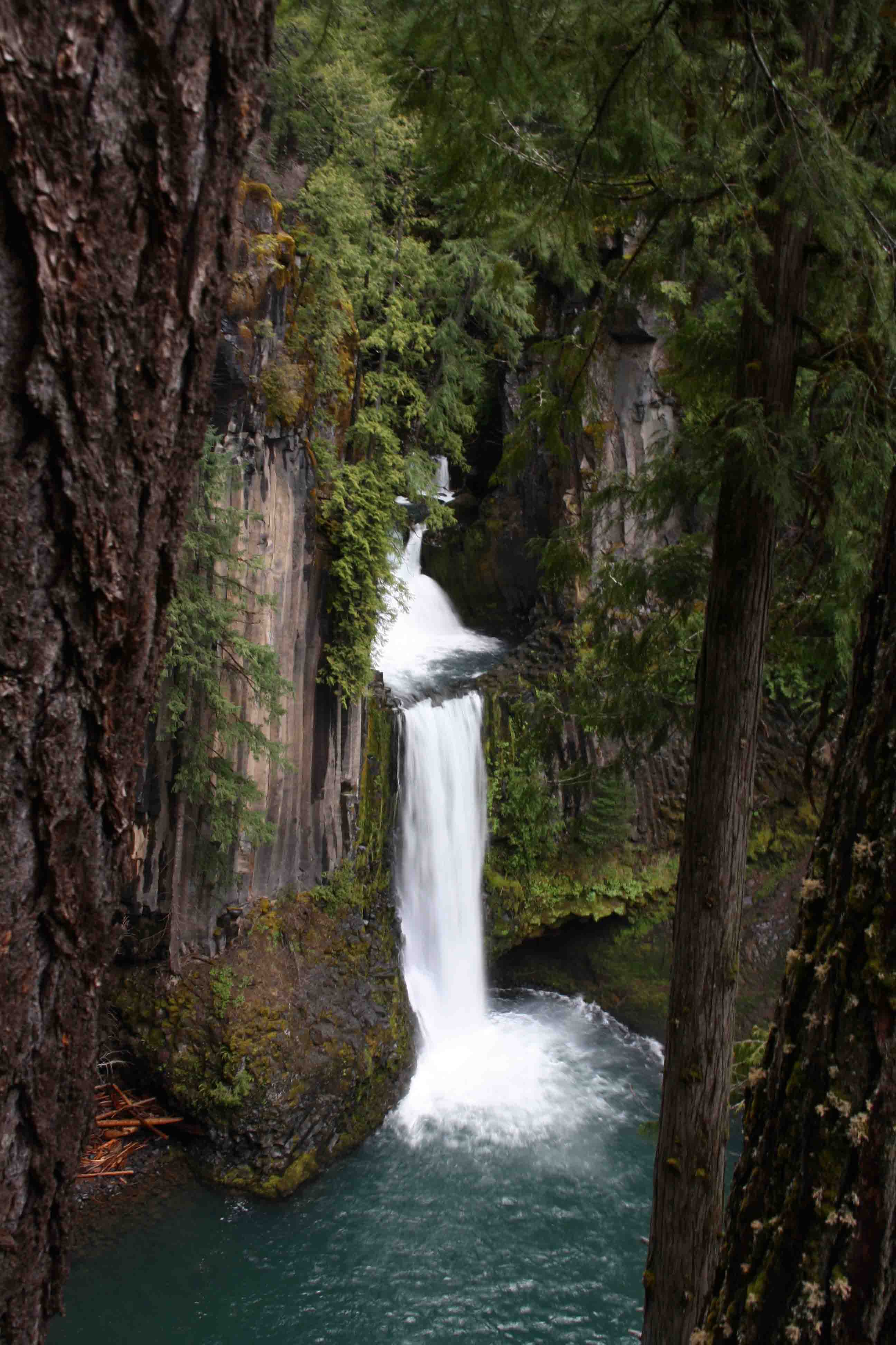
Toketee Falls
Our next stop was to see yet another waterfall…the Toketee Falls. The nearly half mile path led us past mossy logs and rocks recently dusted in a light snow to a two-tiered falls that cascades through a narrow rock gorge. The upper falls drops 40-feet while the lower falls plunges 80-feet over a sheer wall of volcanic basalt. In the Chinook language, Toketee means pretty or graceful which are perfect words to describe this cascade.

North Umpqua Hydroelectric Project
Here I met a group of six ladies from Eagle Point about 100 miles south of the area. They were members of a women’s group that offers a variety of activities, one of them being a monthly outing to hike. Their route required them to pass through the highest point in the area during heavy snowfall.
“Could I make it over the pass?” I asked.
Gerene, the driver, responded that she had her SUV in 4-wheel drive, but she didn’t think she needed it. Another lady in the group showed me her pictures of four to six inches of fresh snow. Hmmm, the precipitation had finally let up and the sun began poking through the clouds, so hopefully with a little traffic and sand, the roads would be passable for VANilla.
Petey and I walked back to the parking lot with the ladies. Gerene, Renate, and Joan posed for a picture for me in front of a 12-foot diameter redwood-stave flowline. This pipeline is part of the Toketee development of the North Umpqua Hydroelectric Project. Completed in December of 1949, the Toketee development was the first component of the project to be built.
Water from a 102 acre reservoir enters the intake structure at the dam located about 1 mile upstream from the falls. It then passes through this flowline for 1,500 feet before it transitions to concrete just before entering a tunnel through Deep Leap Rock. The water powers three generator turbines that produce enough electricity for 22,500 homes. As we said our good-byes, Renate handed me her card and invited me to stay the night if I made it all the way down to the Medford area.

Watson Falls
My fifth waterfall stop was only a few miles up the road and the difference in snowfall was tremendous. Several inches, though slowly melting away in the afternoon sun, blanketed the rocky hillside and path which led up to Watson Falls. Plunging 272 feet, Watson Falls is the highest waterfall in southwest Oregon. As I urged Petey in and out of snow patches, I couldn’t help but think what troopers those ladies were as they visited these falls first. I’m certain they had to trounce through significantly more snow accumulation.


Crater Lake National Park
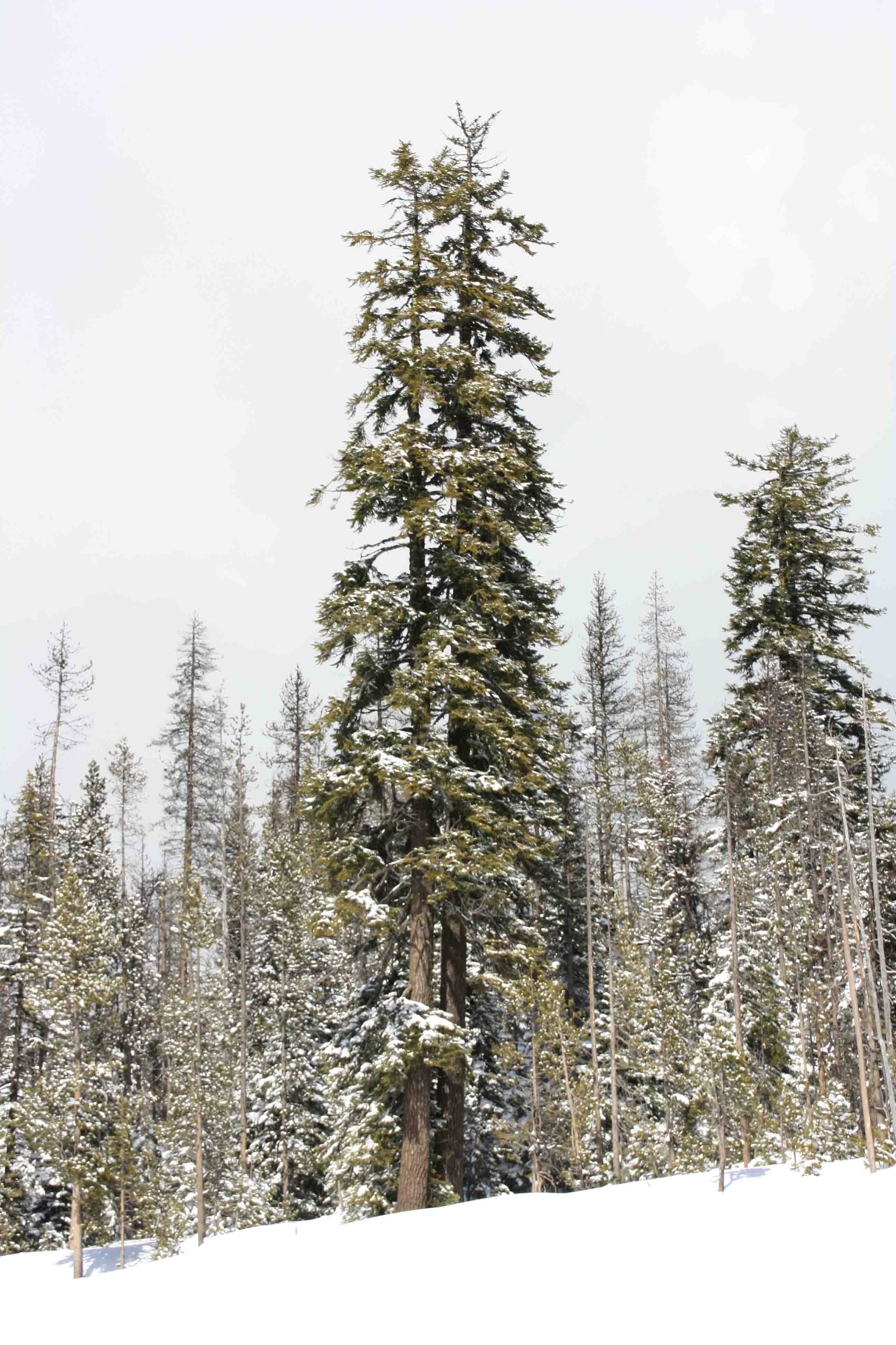
By now, it was late afternoon, and I was still faced climbing the 5,000 foot pass and deciding if I wanted to take the less traveled road to Crater Lake. Fortunately, I only met a spattering of drizzle and a few small snow flurries as VANilla powered over a relatively clear pass. Despite four foot snow banks on either side of the road, we only crossed a few patches of snow on the main scenic drive. When I reached the road to the crater, the path seemed clear, so I took a left to drive five miles, according to Gina my GPS, to Crater Lake National Park.
After five miles, I was on a two lane road with about 1.5 lanes snow plowed. The lane that was fully snow plowed was the opposite one to which I was traveling. I found myself having to drive on the wrong side of the road as I slipped around turns with 30 mph winding road signs hardly visible above the six foot snow banks. Furthermore, a SUV was barreling down the road behind me. The snow banks blocked any space available for slower traffic to yield. I was stuck plowing forward for several more miles.
Finally, I found a small carve out where somewhat flustered, I pulled off and turned around as I wasn’t sure how much further I was going to have to go. It turns out, I think I was about 4 miles from my destination, and as I sat on the roadside a snow plow cleared my lane, but at that point it was nearly 5 p.m.. I was tired and not knowing the weather forecast, I didn’t want to get stuck up there in a winter storm. Consequently, I will plan on revisiting the area in October.

Rogue Gorge
After backtracking to the main road, I made a brief stop at Rogue Gorge. The gorge is a chasm 500 feet long. It narrows to 25 feet across and drops 45 feet to the river. The average water temperature is 44 degrees and enough water flows through the gorge every minute to fill an Olympic-size pool. The gorge was likely formed by the collapse of lava tubes and the force of the river as it followed fractures between the layers of lava. About three miles downriver, the river turns below ground. I will have to check that out in October as well.


We continued on to cross a spectacular, rust colored bridge which spanned the aqua Rogue River that feeds into Lost Creek Reservoir. I wanted so much to find a pull off here for a photo. The only pull-offs weren’t conducive to a quick point and shoot photo opportunity, but rather required the photographer to hike up the highway a good quarter mile…maybe next time.
Alpacas at the Lone Ranch
After whipping up a quick meal, working a bit on the blog, and re-provisioning at Wal-Mart, I gave Renate a call and stayed the night at her and her husband Richard’s Alpaca Farm. Over a glass of wine, we had a wonderful chat before we turned in for the evening. ETB
Map of My Road Trip Across the USA
For a summary about my road trip across the USA, click HERE. For the interactive map, see the below link.

Beautiful pictures and exciting blog about that part of the country.
great photos
Beautiful!
Incredbile, loved it, can’t wait for you to go back in October. Mary