
Sightseeing in Curacao
Christoffel Park (Mountain Side)
We had to schedule a day on land after diving so we could off gas before flying. As such we planned on spending our morning at another national park called Christoffel and our afternoon in Willemstad, the larger town near the airport.
We thought it would be best to hike and enjoy nature before it got too hot. It’s a good thing we did, the park doesn’t even allow visitors to hike up the “mountain” after 11am for this very reason. Originally, we thought we would hike the orchid trail. The online information suggested this would be a two hour hike and not too strenuous.
Upon arrival, we entered the office to pay our admission, and the ranger asked what we planned to do in the park. It seemed like an odd question to me. In the states, we pay and go and have to specifically ask the ranger if there is something we should/shouldn’t do. I said we thought we’d hike the orchid trail that was to lead us through the white tailed deer habitat, past manganese mines, and to beautiful views all while enjoying the unique flora and birds.
The ranger explained the orchid trail wasn’t open because it wasn’t the season for the flowers to bloom and the trail wasn’t cut back so we’d be trekking through thorny brush. Another closure marked in the books! If we drove the green, mountain route however, we could hike up and down Christoffel Mountain for beautiful views in two hours. Two hours sounded perfect to Ruth, so she pronounced, “Let’s go!” I warned, “Ok, but it’s steep.” With her typical gung-ho attitude, Ruth declared, “We can hike two hours,” so off we went.
We took the long way around the one-way car route to the mountain so we could stop at a few of the noted sites on the map. First, we visited Zorgvlied Ruins. Only a few walls of this plantation house with a view of the north shore remained standing. We both enjoyed the quick stop before continuing around the loop. Next we stopped at two overlooks one with a view of Boka Tabla where we had already visited and the Plantation House of Knip which now houses the Tula Museum which we tried to see yesterday. As such, both views were uneventful relative to what we expected to see on the 375 meter “mountain” summit, the island’s highest point.

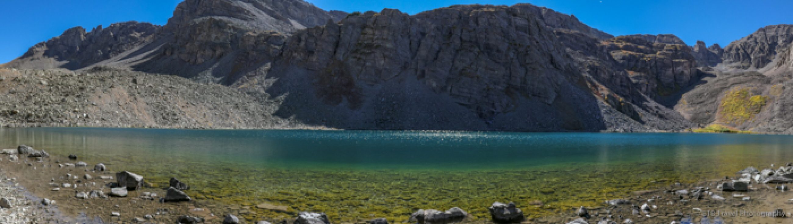
Christoffel Mountain
Coming from Colorado and its 14,000 feet mountains, I keep using quotation marks for Christoffel “Mountain” given its height is more like a hill to me. But from its base, the hike up one of the hardest rock formations in Curaçao did look steep. In a semi-arid climate, we started out beneath a canopy of trees which were mostly short and thorny. Bromeliads lined both sides of the trail as orchids and beard moss grew from the trees. I could only imagine how colorful this trail would have been if the cacti and orchids were blooming.


In the shrubs the wind was still, but every once in a while we came to a clearing for a beautiful view of the coast and a cooling off period. We continued along the dirt path that soon turned rocky and steep as it stair stepped up the mountain with out switchbacks. I had altitude and age on my side, and wasn’t winded by the climb. Ruth, on the other hand needed a few breathers. Eventually, we needed our hands to scramble up the trail and not much longer after that with ledge of rocks facing us, Ruth bowed out. She exclaimed, “I’m not going unless you get up through that crevice of rocks and say you are at the top.”


So I kept going. First I climbed behind a few rocks to get away from the ledge as I’m not fond of them. Then I lifted myself through the rock crevice. I had to scramble more on this hill than I had to on several 14,000 foot mountains! Once I got through this part, it was only a minute from the top, so I walked back down a little and encouraged Ruth to join me. She rocked it! No pun intended. We enjoyed a 360 degree view of the island with a handful of fellow climbers. We both felt glad we did it, but I think if I were to return, it would need to be during flower season!


Video of Ruth climbing through the crevice
Christoffel Park (Ocean Side)
After our descent, we planned on following the blue car route to see the Oceanside of the park. Now I know why the ranger asked where we were going. The main road intersected the park. We needed a special coin to pass through the automated boom that raises up and down. She only gave us one coin for the mountainside. Now we needed one for the Oceanside. A coworker had to go empty the box at the barrier to bring me another coin!
With coin in hand, we followed the blue car route on the map. At this point, we were in the drive by and check if off the list state. We saw the woods, the water tanks, and north coast in seconds as we waved in passing. We skipped the salt flats because the person in front of us was lost and confused. It was a one-way road, but it didn’t seem like the person knew where to go.
Soon we reached the caves and Indian drawings which were on my radar. We wandered through the brushy forest to a giant rock. It looked super cool though we didn’t know this is where we would find the Indian drawings dated 500-2000 years ago. We kept going to the caves where we thought we’d see the paintings. Instead, I got buzzed by a bat as I ventured deep inside with the flashlight on Ruth’s phone. The cave was so cool! It looked like stalagmites and stalactites once grew, and now they were covered by moss or lava. I have never seen a cave quite like it! I suppose it is hardly active given there is very little evidence of limestone re-depositing to create new formations.


I was thankful that Ruth humored me since she is not a big cave fan. Along the way to the cave, we both enjoyed the countless lizards scampering nearby. They were everywhere and in all shapes and sizes…some green, some brown, some with white spots. One of the prettiest ones I saw was by the copper mine that I failed to mention we stopped at before leaving the mountain route. The mine was simply a fenced in hole in the ground but some of the surrounding red rock took on a turquoise color like copper does when it oxidizes. This lizard had a green body with white spots and a turquoise tail! It looked like it had been eating copper.

On our way out, we snapped a photo of the Mata Piska tree which in Papaimentu means fish killer. Twigs from the tree, sporadically found on the north coast, was used by fishermen to drug fish in order to catch them!

Just as we were talking about how we hadn’t seen much wildlife aside from some parakeets, flamingos and a glimpse of a deer that Ruth caught, we nearly ran over an iguana sunning in the road. We spotted two more before we made it back home for a quick lunch prior to heading to Willemstad.


Willemstad
Forty minutes later, we arrived at a town of casinos, resorts, cruise ships, shops, and restaurants. We felt like we were on an entirely different island. It was unbelievable to see the colorful storefronts in the highly commercialized area. We crossed the floating bridge, Queen Emma, and made a circle through town in the stifling hot streets as we quickly window shopped. Neither one of us like shopping so our circle was finished in minutes. I think we actually only went in one store and that was to stand in front of the fan.


Back at the cruise ship harbor with a light breeze, we stopped for a drink and a snack on a restaurant patio. Once we had cooled off, we hopped in the car and left. We didn’t even use the full two hours of paid parking. Wow…depending on what part of the island one visits, the vacation could be entirely different. We were happy with the quiet, natural side that we picked.

Westpunt
We had hoped to try Jaanchies, a restaurant that served local food for dinner, but they closed at 6 and wouldn’t seat anyone later than 5:15. Given we had just grabbed a snack in Willemstad, we weren’t hungry for dinner yet so we went home and planned on trying the local spot by Playa Forti.
It turns out it was closed too, so we went just around the cove (20 yards) to Blue View that was the only restaurant open on a weeknight that we knew of aside from the resort. Our dinner was fine and it was a perfect last place to eat. Had we driven less today, we may have tried Trio Pinotti at the recommendation of our boat captain, but we didn’t want to drive another thirty minutes for dinner. We had a great trip in Curaçao. ETB

Other Articles About Curacao You Make Like
Shop
Check out the photographic note cards and key chains at my shop. Each card has a travel story associated with it. 20% of proceeds are donated to charity.


Published by