
My final stop on my three-and-a-half-week road trip around the State of Washington, was at Mount St. Helens National Volcanic Monument. I didn’t have any intention of visiting the monument when I first arrived in Washington, but when I realized it was sort of on the way to Mendocino, my next destination to see friends, I jumped on the chance to see it.
Mount St. Helens erupted in May of 1980. I was seven years old. My mom’s hairdresser, Bill Cotton, went to see it and collected ashes. I don’t know if he went right after the eruption or much later. All I can say is I envisioned him walking on the mountain collecting them and thought it was so cool! For all I know, he bought the ashes, but at the time, it made a big impression on me when he gave me a tiny vile of them.
Perhaps I should have been a volcanologist because I still have them today! I was totally enthralled by the Mt. St. Helens eruption without understanding the death toll and the devastation it caused to the area.
Now, over 40 years later, I found myself standing at the overlook at Mt. St. Helens Forest Learning Center taking in the view of the volcano. I didn’t know what the Mt. St. Helens Forest Learning Center was when I pulled in the parking lot. I just noticed I suddenly had cell service, so I stopped to look up some information about the Monument, like maps and trails.
It turns out, there are a handful of spots to see along 504, also known as the Spirit Lake Memorial Highway, on the way to Mount St. Helens. Fair warning, this is long post, but remarkably interesting for those intrigued by natural disasters.
Mount St. Helens Visitor Center
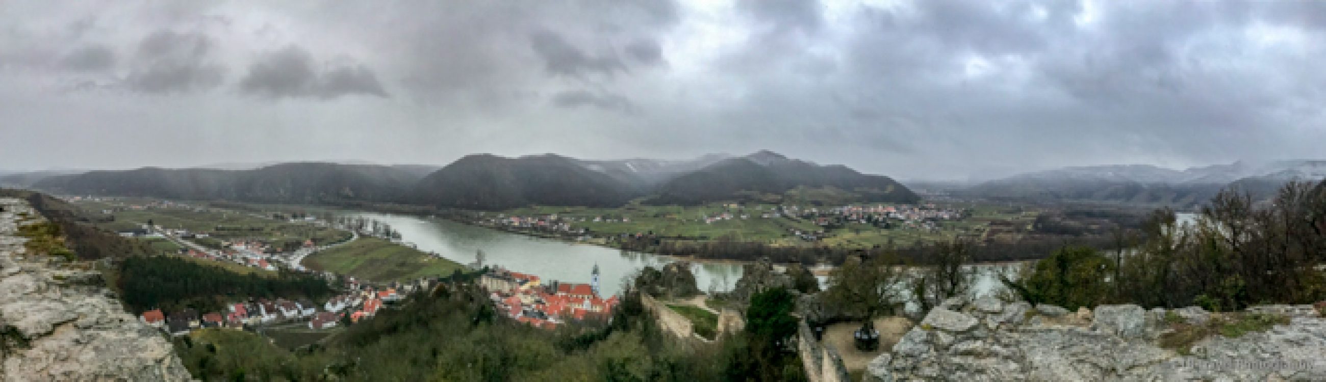
The first place is the Mount St. Helens Visitor Center at Seaquest State Park near Castle Rock. This is at the beginning of the 53-mile journey up Spirit Lake Memorial Highway. Had I known about it, I definitely would have sought information here first.
That said, somehow, I doubt if it were open, as the Forest Learning Center and the Visitor Center at Mount St. Helens Monument were closed. For that matter, even the Washington State Parks had limited staff on duty. I rarely found anyone manning the entrance booth when I visited for my $1, 6-minute showers!
Anyway, under normal circumstances when COVID is no longer a threat, I recommend stopping here.
Toutle River Sediment Retention Structure
The next interesting turnout is at the Toutle River Sediment Retention Structure about 13 miles up the Spirit Lake Memorial Highway. I skipped this stop on the way up but am thankful for taking the short detour on my way down as I was headed to California.
A Little Information About the Mount St. Helens Eruption
To genuinely appreciate the Sediment Retention Structure, it is necessary to understand a little about the Mount St. Helens eruption. The eruption of Mount St. Helens triggered the largest landslide in recorded history which in turned caused the lateral blast.
The landslide deposited more than 3 billion cubic yards of sediment into the Toutle River Basin. The avalanche debris covered 32 square miles with an average depth of 150 feet and mudflows filled the rivers.
Emergency Flood Mitigation
As a result, the US Army Corp of Engineers and other partners commenced emergency operations to mitigate the flooding risk to communities downstream. They removed 140 million cubic yards from the Cowlitz, Toutle, and Columbia Rivers by 1987. This is enough material to build a 12-lane highway, 1 foot thick, from New York to San Francisco.
The debris also dammed the natural outlet of Spirit Lake causing the lake to double in size. It was going to overflow the debris dam; thus, the Corp installed a pump station in 1982 to maintain a safe water level. From July 1984 to March 1985, they bore a 1.6-mile tunnel 11 feet in diameter through Harry’s Ridge to provide a new outlet for the water.
Finally, from 1986 to 1989 they constructed of the sediment dam. It stands 184 feet tall and is 1,888 feet wide. They also added island forming structures in the river to produce an eddying effect resulting in sediment deposits behind them. Furthermore, a Cross Valley Structure was added to slow down the river.
Even with all these efforts, the communities still face flooding risk as the basin continues to fill up with debris. In fact, in 2012 the Sediment Retention Structure had to be raised seven feet.
Interference with the Salmon and Steelhead
Of course, the Sediment Retention Structure blocks the upstream passage of salmon and steelhead. As a result, the Corp built a fish collection system. The State of Washington collects the fish on a tank truck and transports them to two different tributaries upstream.
I don’t tend to read all of the interpretive signs, but I found this information fascinating. I can’t imagine being a local resident and knowing what the river and landscape was like before and after the Mount St. Helens eruption.
Trail at the Dam
Anyway, the information boards are at a picnic area in the woods toward the beginning of the 1.2 mile loop trail to the Sediment Retention Structure. The first part of the loop passes through the forest on a single-track trail while the second part returns on the road. For a shorter and continuously shaded walk, just return on the first part of the trail.

Hoffstadt Creek Bridge
The next stop on 504 on the way to the Mount St. Helens National Monument, is the Hoffstadt Creek Bridge. The bridge, 2,340 feet long and 370 feet high, is the largest of the 14 new bridges built for the Spirit Lake Memorial Highway. It cost 12.6 million dollars to complete. The highway, which replaced the old, damaged one opened in 1991, 11 years after the eruption!
The interpretive signs at the bridge indicate, this overlook is located on the edge of the blast zone, 14.8 miles away from the crater! Because of the collapse of the north face of Mount St. Helens, the volcano blasted laterally. As a result, the rock fragments, gas, and steam blew across the region at hurricane forces and destroyed 150,000 acres of private and public lands.
The Weyerhaeuser Company
The Weyerhaeuser Company lost 68,000 acres of their tree farm. In addition to this damage, 3 logging camps, 22 crew buses, 30 log trucks, 39 railroad cars, 12 million board feet of logs, 650 miles of roads, 19 bridges, and 16 miles of railroad tracks were covered in ash or washed away by mud flows.
Within three months of the eruption, the Weyerhaeuser Company began a massive salvage and reforestation effort that lasted two years. The project involved 1,000 people and required a $9 million investment.
During peak summer hours, over 600 truckloads of salvaged logs were removed each day. This saved 850 million board feet of wood which is enough to build 85,000 three-bedroom houses.
In addition, they planted 18.4 million seedlings one-by-one over 45,500 acres. The tree species planted were native ones which could best survive the ash…Douglas fir in the lowlands and noble fir in the highlands. The reforestation project took until 1987, and the trees will be ready for harvest in 2026. The company did not realize any financial return until 2010 with the first commercial thinning of the forest.
Establishment of Mount St. Helens National Volcanic Monument
In contrast to these private efforts, in 1982 Congress established the 110,000-acre Mount St. Helens National Volcanic Monument for research, recreation, and education. Inside the boundaries no salvage or tree planting was allowed. The forest has been left to rejuvenate naturally. It is interesting to see contrast in the landscape.
Just as I was leaving the bridge overlook, I noticed a trail to left. Check it out is it could provide better views of the bridge than what I have provided in the below photo.

Mt. St. Helens Forest Learning Center
Just 3.8 miles up the road from the bridge is the Mt. St. Helens Forest Learning Center, which I previously mentioned, as this was the first place I visited on the highway.
The Forest Learning Center was established through a partnership between Weyerhaeuser, Washington State DOT, and the Rocky Mountain Elk Foundation. The center tells the story of Mount St. Helens and the recovery of the forests, fish, and wildlife.
Unfortunately, due to COVID, the center was closed, but the gift shop was open until 4pm. The gift shop featured mostly tourist items, so it wasn’t helpful for getting information about the monument. At least I satisfied my sweet tooth with some huckleberry licorice, just like we got in McCall, Idaho.
The center also provides some lovely views of Mount St. Helens, a viewing platform to spot elk in the below valley, and a picnic area. I didn’t see any elk, but I was there in the heat of the day.

Elk Rock Viewpoint
Continuing along the Spirit Lake Memorial Highway another 3.8 miles takes visitors to the Elk Rock Viewpoint. I didn’t visit this location, because I didn’t see any elk at the Forest Learning Center and couldn’t imagine the view of Mount St. Helens being much different. Now I wonder if I should have, as there were probably more interesting interpretive signs!
South Coldwater Lake Trailhead
Approximately seven miles further up Spirit Lake Memorial Highway, is the South Coldwater Lake Trailhead. CAUTION: There is a South Coldwater Lake Trailhead and the Coldwater Lake Trailhead.
I originally planned to stroll along the Coldwater Lake Trail for a moderate 8.8 mile out-and-back. According to AllTrails, the dog friendly trail has only 777 feet of elevation gain as it follows the water’s edge.
In reading the reviews, one hiker wrote, “If you’re thinking about it…do not start the loop on this end. Start at the South Coldwater Lake Trailhead. Makes more sense and will save you energy.” With that, I changed my plan to hike this easier to reach and clearly better trail. Little did I know that this 7.4-mile roundtrip to “Ridge Camp” with a little grassy knoll climbs substantially through the forest at the beginning.
The trail never follows the shore of the lake, though once atop the sunny ridge, it does provide nice views down into the lake. It also features logging equipment mangled by the volcanic blast, high meadows dotted with wildflowers, and glimpses of Mount St. Helens.


It was a very nice hike once I wrapped my mind around the fact I wasn’t strolling by the water or seeing waterfall. Looking back on it, I really don’t understand the review! The trails are completely different!!
While visiting the area, I would save the hike for a separate day from all the other activities. I did it the day after visiting Mount St. Helens National Volcanic Monument, and it was neat to see how the forest had regrown in this area. That said, for van lifers like me, there was little to no dispersed camping. I found a pullout off the road for a night that sufficed, but for a longer stay, it is best to make a plan.
Mount St. Helens National Volcanic Monument and Johnston Ridge Observatory
Not to be outdone, the final stop on the Spirit Lake Memorial Highway aside from the nearby Loowit Overlook with a hiking trail, is the Mount St. Helens National Volcanic Monument and Johnston Ridge Observatory. Currently, the Observatory is closed due to COVID, but it generally hosts interpretive displays that tell the biological, geological, and human story of Mount St. Helens.
Fortunately for Annie, who doesn’t like being left alone and wasn’t allowed in this paved area of the park, there were only about six interpretive signs outside the Observatory for me to read. These information boards and the short trail walk through a hillside of red Indian Paintbrush and purple Harebell, still kept me rather preoccupied. It’s a good thing going any further on the trail required a permit, or Annie would have really been bent out of shape!


After all I have written thus far about Mount St. Helens, it’s hard to believe there is still more! And some of this information was the most interesting to me.
Lives Lost From the Mount St. Helens Eruption
The precursor to the May 18,, 1980 landslide and lateral blast was a 4.1 magnitude earthquake on March 20th of the same year. Thereafter, in addition to more earthquakes, dozens of steam and ash eruptions began.
As a result, scientists issued a Hazard Watch and sent teams close to the volcano, including volcanologist David Johnston. Additionally, government agencies set up roadblocks based on the volcano’s eruptive past to keep the public what was thought to be a safe distance away.
Despite watching Mount St. Helens north side bulge, most scientists still predicted vertical eruptions, mudflows, and possible avalanches. Few foresaw the unprecedent landslide and lateral blast which ultimately took 57 lives, including Johnston, after whom the observatory is named. Since the blast, geologists have now been able to identify 200 similar volcanic landslides.
The Change in Mount St. Helens Topography
While much of the landslide was carried 14 miles down steam, large pieces of the mountain, the size of small hills, created hummocks on the valley floor. In addition, the landslide dammed Castle Creek and created a new lake, Castle Lake.
After the lateral blast, Mount St. Helens erupted 17 more times over six years and created a pumice plain of ash which covered six square miles of the avalanche debris. During these eruptions, it built up a lava dome 17 stories high within its crater. The dome grew 1,300 feet more as spines of lava extruded from the volcano for 3.5 years between 2004 and 2008.
Additionally, a glacier formed between the lava dome and the south crater wall. The glacier was split by lava spines in 2004, flowed around the lava dome, and reconnected in 2008.
Remarkably, Mount St. Helens is building itself with lava while a glacier is growing on it. Who knew? I was completely miffed! I thought all glaciers in North America were receding. Due to the trend of overall glacier shrinkage, you never hear about growing glaciers on the news.
But after a quick google search, not only is Mount St. Helens growing, many glaciers in Greenland and Asia are also growing. While they are receding in Antarctica, Antarctica’s ice sheet, which makes up 80% of the ice in the world, is expanding. But I digress and don’t want to take away from this intriguing story of Mount St. Helens. I was just pleased to see a tidbit of good news compared to the doom and gloom on television.
Overall, comprehending all the devastation caused by just one erupting volcano and seeing all the human intervention required to save surrounding communities was mind boggling. If you can’t visit Mount St. Helens, I highly recommend at least googling the before, after, and current pictures of the mountain. The change, which all has been in my lifetime, is astounding! ETB
Bill Cotton, the sweetest guy and best hair dresser! RIP Bill.
That was a long, but very very interesting. I had no idea how vast and devastating the destruction was.
Beautiful pic and story !!
Yes. Very long!! But very interesting!
Fascinating!
Wow, this is really interesting. I never knew all the details and I’m having trouble wrapping my head around the enormity of the eruption and destruction.
I know. It’s crazy!!
Beth, what a great story and time you have had coming out west.
Yes. Has been good!
Thanks for checking in and commenting!
The reforestation project sounds amazing! My ex was out there hiking soon after the eruption and brought me back a little plastic tub of ash. I was making pottery at the time and used it for glazing. Can’t remember which pots now or noticing any special effects, but I felt good about incorporating the ash in an earthy artform.
Wow. You have so many talents!!
Aw, thanks… I was an art major in college, and have always been a dabbler. 😉
Cool post! I did look up the before and after pics, wow!