
Hungo Pavi
For my second day in Chaco Culture National Historical Park, I visited Una Vida by the Visitor Center, Hungo Pavi, Kin Kletso, the Pueblo Alto Complex, and Pueblo del Arroyo. Due to the one-way, 8-mile driving loop in Chaco Canyon, I stopped at Hungo Pavi first.
Hungo Pavi great house is located at the mouth of Mockingbird Canyon near natural drainages, seeps, and springs. It is the most accessible great house in Chaco Culture National Historical Park. It takes little time to visit, and I popped in without Annie before continuing to my next back country hike with my crazy mutt.

Pueblo Alto Trail
The 5.2-mile loop hike to the Pueblo Alto Complex begins at the Pueblo del Arroyo parking area at the end of the Chaco Canyon Loop. The hike follows the dirt road to Kin Kletso before it ascends a crack in the canyon wall up to the mesa.

Before Annie and I scrambled through the narrow crevice we circled Kin Kletso. It is believed that the placement and width of Kin Kletso’s east wall provided observation points for predicting and confirming the winter solstice sunrise.
Kin Kletso was built late in the Chaco’s construction history between 1120-1230, and its masonry style is similar the sites in the Mesa Verde region. The rectangular shaped building was erected during one building episode. It lacks the enclosed plaza, great kiva, and D-shaped design associated with earlier great houses.

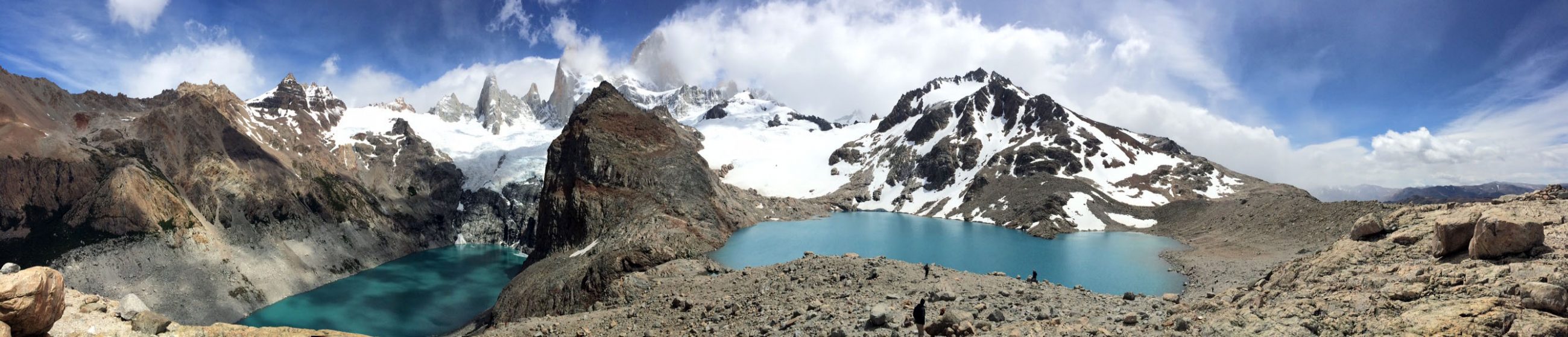
After a brief visit at Kin Kletso, Annie and I began our dog friendly hike for which I’m thankful I had the AllTrails map. While the loop is marked with cairns, the path is faint in many places with several cairns knocked down or missing. Two important turns were hardly marked, and if I didn’t know the general direction of the loop, I would have felt very nervous as I scanned the mesa for the path, once walked by Chacoans.
Despite my progress being slowed as I spun around in search of the correct direction, I loved this hike. The mesa provides outstanding views of Pueblo del Arroyo, Pueblo Bonito and Chetro Ketl. In addition, signs indicated pecked basins, stone circles, and even shrimp burrows from the Crustaceous times when this high desert valley used to be a seabed.

The shrimp burrows might have fascinated me the most! As the fact that Antarctica used to not have ice, the desert used to be an ocean floor, and dry arid climates used to feature jungles of tropical trees truly amazes me. It’s hard for me to fathom how much the earth changed in its natural environment without human influence.

Pueblo Alto Complex
But I digress. After following the mesa cliffside for a half mile or so, I veered inland toward the Pueblo Alto Complex. I got to climb up a Chacoan staircase and an old Chacoan road to a sandy path which passes through the desert landscape of cacti, grasses and greasewood until it reaches two sets of ruins.


The Pueblo Alto Complex, which includes Pueblo Alto, New Alto, East Ruin, and Rabbit Ruin, is strategically located next to the Great North Road which travels over 40 miles to distant communities. The roads from Chetro Ketl, Pueblo Bonito, and Penasco Blanco also intersect at the complex.
Interestingly, all Chacoan road were built in a straight line. If an obstacle like a mesa cliff was in the way, they would build a ramp or chisel a staircase into the rock.
New Alto
Anyway, I spent some time wandering around New Alto and Pueblo Alto, the two closest to the intersecting trails before continuing. New Alto was constructed with McElmo style masonry in AD 1100. The building includes 58 first and second story rooms arranged symmetrically around a kiva.

Pueblo Alto
Pueblo Alto was constructed during the same initial time period as Chetro Ketl, between AD 1020-1060. The initial stage included three rows of rooms in the northern section. Subsequent building stages added the east and west wings as well as the arced wall to enclose the plaza. Consequently, it takes on the typical D-shaped design.
Pueblo Alto differs from other great houses in that it is only one story with unusually high, 14-foot ceilings. Additionally, it includes the largest midden in Chaco. A midden is a sacred refuse area where living things return to the earth to complete their natural cycles.
Pueblo Alto’s midden was so large that archeologists believe it was used for feasting and ceremonies including pot breaking rituals, a practice presenting offerings to ancestors.
While the Park Service excavated a portion of Pueblo Alto between 1976 and 1979, much of the site is left undisturbed, so there is not a whole lot to see. As a result, for those wanting a shorter hike with views of amazing ruins, I suggest simply hiking to the Pueblo Bonito Overlook and not veering inland.

Once again, for me and Annie, just being out in the wilderness was quite the reward, especially after camping next to twelve children for two days! In fact, no one gets started until about 9:30 or 10 on these chilly October mornings, so most the time I was on my last mile before I ran into a soul. I basically had the entirety of Chaco Canyon to myself!
After the Pueblo Alto Complex, the trail extends east a mile through easy terrain before it turns back toward the canyon. Annie and I had to scramble down another crack in the canyon wall to reach a lower plateau. These cracks are rather narrow, and I was thankful for our small statures. Though Annie, donning her pack, had a hard time squeezing through in certain areas.


With a few more gradual descents, we skirted the edge of the canyon wall and overlooked a ramp and other staircases. We once again took in the view of the amazing ruins on the valley floor, before we descended through the final crack to Kin Kletso.
Pueblo del Arroyo
With everyone just beginning their hikes, I put Annie in VANgo and ventured over to the dog-free zone of Pueblo del Arroyo which I had all to myself. The Chacoans built Pueblo del Arroyo, which is Spanish for “village by the wash” over a short time period.
Pueblo del Arroyo, another great house, features a rare round, tri-wall structure on its western side. Additionally, it is situated to take advantage of unobstructed views of through the South Gap and toward Hosta Butte.

Una Vida
After my visit to Pueblo del Arroyo, I returned through the canyon to the Visitor Center to explore Una Vida. Annie had to wait in VANgo once more as the short walk to this unexcavated great house is not pet friendly. Buried under rubble, only a few of the walls can be seen.
Continuing past the ruins up a now steeper trail, led me to a wall of petroglyphs chipped into the sandstone. After visiting Pueblo Bonito, Pueblo del Arroyo, Chetro Ketl, and Kin Kletso, Una Vida was anti-climatic, but I wanted to hike every trail in the park. At this point, all I had left was the longest hike in Chaco Culture National Historical Park; 7.2 miles to Peñasco Blanco. I saved it for the following day. To be continued…ETB

Other Articles About Chaco Culture National Historical Park You May Like
Other Articles About New Mexico You May Like
- Three Fall Hikes Near Taos
- Fort Stanton State Monument
- Things to Do in Alamogordo
- Sunspot Solar Observatory
- PistachioLand
- Cerillos Hills State Park
- Salinas Pueblo Missions National Monument
Loved Chaco, a truly spiritual place. Your posting is a great road map. Love the photos.
It was really great! I had so much to say, I had to split into three posts, especially so I could include more photos. Really neat place!
It looks like a really special place – the history is fascinating.
It is remarkable!
I love the photo of Annie in the canyon.
Thank you so much!