Day 245 – Beartooth Country

Day 245 – Beartooth Country

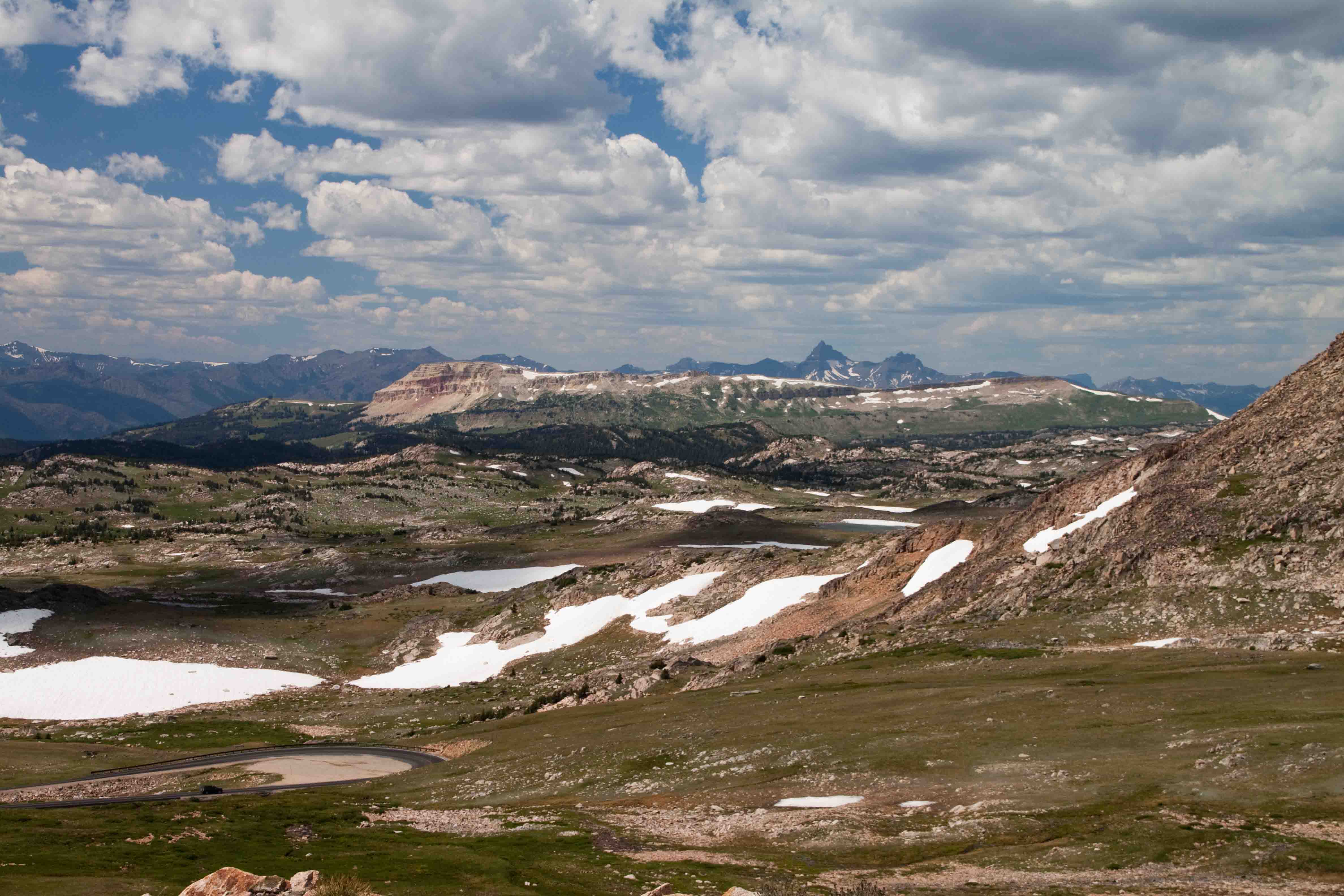
We spent most of today traveling across Beartooth Highway, a
68-mile stretch of road that opened in 1936 which zig-zags through Rock Creek
Canyon and climbs over almost an 11,000 foot pass, making it one of the world’s
highest.  As one would expect, the views
were spectacular, as evidenced by our first stop at Rock Creek Vista Point,
9,190 feet in elevation.

Our next stop was at Twin Lakes Headwall, where a long slope
is permanently covered in snow.  Olympic
hopefuls can be found skiing here on the 58 degree slope.

We continued stopping in many turnouts along way as we
traversed the highway above the tree line.
Eventually we descended to Gardner Lake where we took a walk on the
Beartooth Loop National Trail.  It led us
through fields of wildflowers, across narrow creeks and past a lake before we
turned around.  The whole trail is ten
miles which Petey and I opted out of.

The road was under construction near Beartooth Lake and the
road to Clay Butte Lookout and firetower was closed, so we continued on to
Chief Joseph Scenic Highway where we weaved through the foothills laced with
several beautiful blue streams and peppered with campgrounds and across a 1,200
foot gorge before reaching a dirt road turnoff to Sunlight Basin.

Sunlight Basin’s 50,000 acres were supposed to be home to an
array of wildlife.  We criss-crossed the
fields on gravel roads only to find one deer hiding out.  I supposed late afternoon wasn’t the right
time of day.

We ended up at a great campground just outside of Cooke City
and Yellowstone National Park for the evening.
The campground posted a sign, “Caution, known grizzly use…hardsided
camping only…no tents.”  I slept with
VANilla’s top down.  ETB

SHOP

For notecards and key chains, visit My Shop on this website.