
Day 104 of a Year Long Road Trip Along America’s Scenic Byways
Hot Springs Historic District
I started the morning in Big Bend National Park by taking the Hot Springs road to the Hot Springs Historic District located within the park. The dusty, narrow road wound around protruding rocks to the remains of an old town, petroglyphs, pictographs, the hot springs, and Tornillo Creek. I thought I was just going to see the hot springs. What a pleasant surprise to find rock art from 1000 – 200 BC.
The petroglyphs are images carved into the rock that look white. The pictographs are images painted in red on the rock. The red coloring is a pigment made from hematite, a mineral sometimes called “red ocher”. Pigments were mixed with blood, egg, or animal fat to help it adhere to the cliff.
The Hot Springs Historic District was settled by J.O. Langford in 1909. He believed the water was a healing source and built a post office/store and motel to serve as the local gathering point. He charged bathers ten cents a day or $2 for the 21 day healing process that he believed cured his malaria.
The spring water is 105 degrees. Given the outdoor air temperature was in the forties and my toes were still numb from the evening, I only dipped my hand in the springs. Five people visited the springs while I was in the area, so I guess I’m a pansy, but frankly I didn’t feel like going through the process while leaving Petey in VANilla.
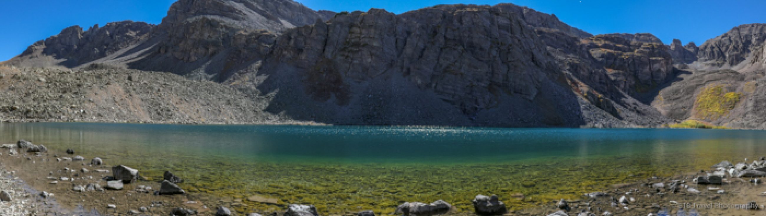
Chisos Mountains Basin
After a visit to the hot springs, we drove northwest through Big Bend National Park to the Chisos Mountains Basin, another campground within the park. As the name suggests, this area of the park is the mountainous region. It is at a higher altitude and cooler than the other areas of the park. This is the habitat where the mountain lions and bears live, though the bears are only just beginning a comeback. It is thought 10-20 bears live in the park.
I had heard that the Chisos Mountains are popular amongst the park visitors, so I was very excited to see the area. I took a short walk around the visitor’s center and managed to get another bad picture of a Texas deer. They are much more skittish than the ones in the Northeast, probably because they are shot at more often! While I enjoyed the Chisos Mountains, I appreciated the rugged beauty of the canyons more than the mountains in Big Bend.
Castolon and Santa Elena Canyon
From the Chisos Mountains Basin, Petey and I turned southwest toward the Castolon Visitors Center and Santa Elena Canyon. We passed by many roadside exhibits including Sam Nail Ranch, Homer Wilson Ranch, Mule Ears Viewpoint, Cerro Castellan, Goat Mountain, Fins of Fire, and the Badlands just to name a few. I know nothing about San Nail Ranch (because I forgot to read the sign) except clearly it isn’t there anymore. Regardless, I loved taking pictures of the old broken down windmill as well as the one that was intact.


Homer Wilson Ranch and Mule Ears
Homer Wilson Ranch includes the remains of the foreman’s house, a bunkhouse, a corral, and a dipping vat for goats and sheep. It was abandoned in 1945. I didn’t read about Mule Ears either. I just took some shots of this extraordinary scenery.
Cerro Castellan and Goat Mountain
Cerro Castellan (or Castolon Peak) reveals years of volcanic events. The tower consists of several lava flows, ash deposits, and layers of gravel and clay from periods of erosion between eruptions. Goat Mountain is the result of a lava explosion and an uplift. Magma surged upward through old volcanic rock (the lower dark area) and deposited a collar of pyroclastic material which appears greenish in color.
Over time the gas content in the magma reduced and the eruptions created a thick, slow moving lava which formed domes above pyroclastic material. Then 27 million years ago the region uplifted and erosion created the cracked landscape we see today and exposed a dike most likely where the magma originated.


Fins of Fire
The Fins of Fire exhibit describes the creation of dikes which are the spines of dark rock that march across the desert floor. Molten material follows the path of least resistance and wells up through faults. Softer material weathers away leaving the dikes exposed.

Even with the sign, I can’t really describe the Badlands accurately, so pictures will have to suffice.

Santa Elena Canyon
The Santa Elena Canyon can be seen from over ten miles away. The Rio Grande abruptly changes directions and has slowly carved away at the limestone cliffs to create a canyon that in part is only 30 feet wide. It might be the most awesome part of the whole park. It was well worth taking the Ross Maxwell Scenic Drive to all the amazing places. Normally I don’t like doubling back, but each way provided a different perspective.

Lajitas
Petey and I exited the park by Study Butte and Terlingua. We made a brief stop at the Terlingua Ghost Town Cemetery and then continued 17 more miles to Lajitas where we pulled into camp for the night. Lajitas is a resort that includes a golf course, hotel, restaurant, saloon with live music, an RV Park with a clubhouse and a pool, and some shops.

I’m told people from all over the world, including movie stars, come here. I was surprised because it is truly in the middle of nowhere situated between Big Bend National Park and Big Bend State Park. There isn’t even a gas station.
Given its notoriety, I decided to try dinner at the saloon. I ordered the Lajitas Salad, a margarita, and a banana nut bread ice cream sandwich drizzled with chocolate sauce. I must admit, the food and beverage were excellent.


What I found even more astonishing is the two bartenders were from Houston and Fort Worth. And my fellow diner, Cary, was from Garland and used to be the pro at Dallas Country Club, just one mile from where I grew up! Cary is now in the San Antonio area just east of Boerne where I just visited my aunt and uncle. What a small world! ETB

Map of My Road Trip Across the USA
For a summary about my road trip across the USA, click HERE. For the interactive map, see the below link.

Other Articles on Texas You May Like
- Day 97 – East Texas Ramble
- Day 98 – East Texas Ramble Part 2
- Day 99 – Texas Hill Country
- Day 100 – Texas Hill Country Part 2
- Day 101 – Texas Hill Country Part 3
- Day 102 – Travel Day to Big Bend
- Day 103 – Big Bend and Beyond
Like It? Pin It!

You must be logged in to post a comment.