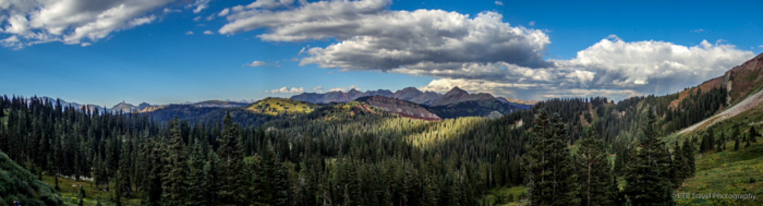
We started our hike around 3pm today, a little later than normal, but most of the group had to drive from Denver to Durango and then up Bolam Pass Road to the start of Segment 26. Bolam Pass Road required a high clearance vehicle and those of us who sat on the right-hand side of the SUV “leaned left” as the drop off on the right was a little disconcerting those who fear ledges. Continue reading “The Colorado Trail: Segments 26-28…The END!!!”
The Colorado Trail: Segments 16-17
The last time we tried backpacking Segments 15-17 on the Colorado Trail, we got washed out about four miles into Segment 16. It was time to make up Segment 16 and 17. We decided to do two day hikes rather than camp again. Segment 17 was 20.4 miles with an overall net declining elevation in the southbound direction which we completed first as it was longer than Segment 16 which totaled 16.2 miles. We had to tack on an additional 0.4 to each segment in order to get to the car parked on the 4-wheel drive road. Continue reading “The Colorado Trail: Segments 16-17”
The Colorado Trail: Segments 23-25…Spectacular Scenery!
Danelle, Nandi, and I drove up to Lake City and camped at the hostel in preparation for our 57 mile backpacking trip which would knock out segments 23-25 of the Colorado Trail over the next 5 days and give us time to make the seven hour drive home with a short hiking day on Monday.
We got to the trailhead around 8 after Danelle maneuvered her SUV over a rough four-wheel drive road. We planned on an easy first day as Danelle had fallen to altitude sickness on this segment the previous year for the first time, and I tend to be prone to it as well, though we exhibit entirely different symptoms!
HAPPY HIKING!The Colorado Trail: Segments 21-22
About ten days ago, we experienced an unpleasant backpacking trip in the rain. After 17 hours of a non-stop drizzle coupled with gear failure, we aborted the trip. With this recent challenge burned in our minds, we thought twice about backpacking Segments 21-22 this past weekend as more rain was in the forecast…80% chance Friday, 20% chance Saturday, and 80% chance Sunday. Continue reading “The Colorado Trail: Segments 21-22”
The Colorado Trail: Segments 15-17 Aborted After 20 Miles
What an adventure hiking Segments 15-17 of the Colorado Trail. Seventeen hours of rain resulted in significant gear failure and a trip termination.
We drove three hours to Fooses Creek on Thursday afternoon to begin our hike. Parked on Highway 50, we followed Fooses Creek Road 2.8 miles to our campsite located just before the main trailhead. While it isn’t terribly fun to walk a road, it was part of the CT and to finish the WHOLE trail, we had to make the walk. Fortunately, the dirt road narrowed through some aspen groves which made it somewhat scenic and the intermittent sprinkle wasn’t too much of a bother. The rain continued off and on for the evening which was a little annoying while trying to enjoy an evening around the campsite, but is was nothing compared to what we had in store for us. Continue reading “The Colorado Trail: Segments 15-17 Aborted After 20 Miles”
Roadtrip to the Rockies: From Crested Butte to Aspen!
I’ve been wanting to do the Aspen/Crested Butte hike for some time. It thrilled me when I saw a meetup group called “Bold Bettie’s” post this hike as it takes some coordinating and surprisingly, for this famous hike, the information is not that forth coming. I signed up to go even though I had just returned from Mongolia five days earlier and was still worn out and playing catch up.
Since I need time to acclimate to the altitude, I arrived in Crested Butte a day earlier than the planned outing, and hiked a simple 6.4 mile loop near town and then explored Downtown Crested Butte with one of the members of Bold Betties, Barb.
Lower Loop Trail
The hike began just from the edge of town on Lower Loop Trail. The signs as well as the description of the hike suggested to park in an area about 200 yards up Peanut Road on the right hand side.
If I had to do it over again I would have gone to the Woods Walk Trailhead, also located at the edge of town and hiked from there or driven 1.2 mile up Peanut Road to the Lower Loop Trailhead as walking up a road, all be it dirt, isn’t terribly appealing to me. Having said that, the parking up the road is limited so arriving early is crucial.
Though walking up the road gave me the chance to admire the Gronk, an old mining structure as well as the Peanut Lake with a lovely reflection of Gothic Mountain in its calm waters. Had I driven I would have missed two lovely bucks and the ducks, geese, and heron who hunted for food in the tranquil setting.


Upon reaching the actual trailhead, I continued on the lower loop which was very flat and a favorite trail among the locals who ran with their dogs off leash. Though I believe in following leash laws, I have to give credit to the dog owners. Not one dog ran up to me, jumped on me or anything. They just ran right by. Don’t get me wrong, I love dogs but they aren’t for everyone, and if they are out of sight or voice control they shouldn’t be off leash.
Anyway, the trail wound past a “commercialized area” for lack of a better word which included benches and interpretive signs about bugs. I don’t find these sections of trail terribly enjoyable, but I understand why they exist, so I hurried through the area to get to the less traveled section.
For a good while, the trail paralleled the river and led me through intermittent forest before I took a left at a junction called Gunsight Bridge. This section turned out to be a narrow, 4 wheel drive road that zig-zagged up the mountain. After only a few switchbacks, a sign the pointed up the road to Gunsight Pass and another that pointed left at a single track called Upper Lower Loop.


I took a left onto Upper Lower Loop and followed it until it connected back with Lower Loop. I would have liked to taken it farther toward Wood Walk Trail as it would have cut off most of the road walk, but it was under construction.
The Upper Lower Loop was flush with wildflowers which I really enjoyed. When I wasn’t admiring the wildflowers and losing my prescription sunglasses in the process (boo), I was delighting in the intermittent aspen groves. I really took pleasure in this part of the hike and finished it soon enough to keep from burning in the sun as I entered the exposed valley.


Upon returning to the parking area a mile down the road, the once empty lot with only my car was overflowing. It’s always nice to hit the trails early, simply for tranquility, much less the avoidance of heat and afternoon thunderstorms.
Camping in Crested Butte
I finished before lunch and met Barb about 3 miles down the dirt road which led to Oh Be Joyful Campground, not far from town. We needed campsites for twelve ladies, and Oh Be Joyful was full, so we resorted to River Flats just where I had propitiously parked. At first we weren’t too enthused about having to carry our stuff down to the sites from the road which provided limited parking for about six cars, but then we realized it would be tranquil.
We purchased four of the six sites for $5/night and had the space to ourselves until a family with kiddos and uncontrollable dogs showed up. Eventually all our group joined us and by 10pm all parties in the campground had turned in for the night.


Crested Butte / Aspen Shuttle
The shuttle was picking us up at the visitor center at 6:30am to take us to Scholfield Pass. As such we gave ourselves 30 mins to get ready and 30 mins to make it to town. We piled in the large van operated by Dolly’s which dropped us off around 7:30 after we bounced along the dirt road between the forested mountains. Our early departure provided many deer sightings and even two moose!
So the signs on the road were similar to the ones on the yesterday’s hike near town. They basically encouraged people to park well before necessary. In this case, the road appeared blocked and closed. Our drive swerved right around the signs and kept going! We finally stopped at the third roadblock where avalanche debris impeded the way.
From here we walked along the road and across a few patches of snow to Schofield Pass in the Maroon Bells Snowmass Wilderness. Across from the Schofield Pass sign where Rebecca added a Bold Betties sticker to the collection, we took the trail. Come to find out, we didn’t hike up the road two miles to Schofield Park Trailhead and mistakenly took Schofield Pass Trail. For the most part, it paralleled the Schofield Park Trail and eventually intersected it.


Anyway, I don’t think we missed much…maybe an old log cabin. Our trek took us up to a view, down through a meadow, and soon we found ourselves weaving our way through chest high wildflowers. After crossing a few creeks without bridges, we met up with Schofield Park Trail which connected at a junction to West Maroon Pass Trail where we prepared for our climb.


Prior to reaching the junction, the wildflowers on the open mountainside were absolutely spectacular. We were waist-high in Indian paint brush of all colors, blue columbine, kings crown and more. Red, blue, yellow, and white dotted the terrain for miles. It was fantastic!


Frigid Air Pass
From the junction sign tucked beneath the willows, we ascended a mile to the junction for Frigid Air Pass. Here, we settled down for an early lunch and fuel intake as we prepared for the 1,000 foot gain over West Maroon Pass. It was not as bad as I was expecting, though we were only carrying day packs! The backpackers completing the four pass loop were trudging at a snail’s pace.


The trail to the pass was steep enough, however, to separate us into two groups. The ‘fast’ group included eight girls and the ‘slow’ group included four. We sat at the pass marveling at the view of vast green meadows with patches of snow and a few alpine lakes while we chatted with a few hikers from The Aspen side before continuing.


The Aspen Side
The common question was, “Is it muddy on that side too?”
We thought it was somewhat muddy on the Crested Butte side until hikers from Aspen referenced swamp-like terrain…Ugh! What we were about to slog through?
We slid along some snow patches as we descended the pass until we reached the meadow blanketed in willows. Along with every willow patch came cavities of mud. No matter how hard we tried to stay to the side of the trail or completely detoured to keep from sinking in these mud pits, sooner or later we succumbed to the mire. The mud was slicker than the snow, and just about all of us ended up at least ankle deep in sludge as we struggled to keep our feet dry and remain partially clean.
I guess we were lucky our shoes stayed on. I nearly had a shoe sucked off while hiking to Lake Katherine, north of Steamboat Springs. There are many great hikes in Steamboat Springs by the way.


I don’t know if the conditions are always like this in the summer since willows tend to grow around water or if the trail was overly saturated from late snowmelt and recent rainfall. Speaking of rain, somehow, despite cloudy skies and a forecast calling for an 80% chance of rain, we had succeeded in staying dry with the exception of our mud soaked feet.
West Maroon Trail
The West Maroon Trail requires several creek crossings, none of which have bridges. Most of the time, we could hop from rock to rock and keep our feet out of the cold, mountain streams. One crossing, however, required wading in a strong, knee deep current. Knowing this in advance, most of us strapped on our river shoes and strided on moss covered rock through rushing water, though a few of the girls used the opportunity to clean their hiking boots and stepped right in the frigid creek.
Eventually, we met up with the masses near Crater and Maroon Lakes. These last three miles of aspen groves were pretty. I had considered hiking this trail again in the fall for the changing colors, but with aspens at only one end of a 11 mile day, I’m having second thoughts. I’ll have to do some more research because after today, we all felt we would have rather hiked from the Crested Butte to the pass and back as it was flush with wildflowers and much dryer.


Upon arrival at Maroon Lake we loaded in the Aspen shuttle that ran every 15 minutes until 5pm. Our bus driver was an aspiring singer who crooned a few John Denver tunes until we reached the ski mountain. Here, we exited this shuttle in order to board another shuttle that took us to town. We stayed on the bus until the last stop at the station that was centrally located to the restaurants in downtown. We asked Information for the best burger in town. She directed us to Justice Snow’s that only had inside seating available, so we ended up around the corner at Hops Culture. Encrusted in mud, bug spray (the mosquitoes were vicious at times) and sunscreen, we plopped ourselves down at two outside tables.
Fortunately, I’ve never found Aspen to be as pretentious as they claim, and both the servers and tourists were very friendly. Most visitors wanted to know what crazy adventure our motley crew had just completed. People’s eyes widened when they heard we hiked from Crested Butte. Of course, we walked as the crow flies, so the distance was short compared to the 173 mile drive.
The nice part about a long hike is it is easily justifiable to get the biggest, juicy burger around. Almost all of us went with the Royale with Cheese or the Bison chili and some not so good triple fried potatoes. We even finished the meal off with S’mores before we piled into Dolly’s shuttle for the three hour return trip to Crested Buttle. The shuttle cost a total of $80. $20 for the ride to the trailhead and $60 for the ride home.
Overall, we had a long, but very nice day! The wildflower hike in Crested Butte were some of the best I’ve seen. ETB


Shop
Check out the photographic note cards and key chains at my shop. Each card has a travel story associated with it. 20% of proceeds are donated to charity.


Top Three Sites to Visit in Beijing in a Day
One Day in Beijing? Top Three Sites to Visit
While I’d rather be out in nature, I always feel obligated when I’m in a major city to at least go to a few of the famous sites. As such, we planned a day at the most famous sites in Beijing: the Temple of Heaven, the Summer Palace, and the Forbidden City.
Traffic in Beijing
I think we spent more time in the car driving in the horrific traffic than actually touring the sites, but so be it. Today, those who owned cars with license plates ending in 2 and 6 were restricted from driving. I think they might need to add a few more to reduce the gridlock. Or provide more free bicycles.
There are free bicycles in about every color. The nice part about China’s program, is they don’t have to be taken back to the station. They can be left anywhere for the next person to use. I find this much more convenient than the program we have in the states. Then again, it likely works for China since Beijing is home to 23 million people.
Continue reading “Top Three Sites to Visit in Beijing in a Day”One Step Closer to Mongolia via Beijing, China
Traveling to Beijing, China
What a long yet mostly nice first day to China! On my last trip to the Philippines, the RTD A-line failed which put me into a bind and ended up costing me a lot of parking money at the airport, so this time, I left even earlier and figured I’d use a pass at the United Club. I was out of the house by 4:45am! It was smooth sailing with a fantastic sunrise with only one small glitch. The United Club doesn’t open until 6:30am…boo!
TAKE A WALK!The Colorado Trail – Segment 14
Another segment of the Colorado Trail is marked off the list…Segment 14 (20.4 miles) with a 3-mile side hike to Browns Creek Falls that is definitely worth the detour!
Just about every weekend I am in town this summer is dedicated to finishing up the 484.6 mile trail. Thus far I have completed 292.7 miles over the past few years.
HAPPY HIKING!Montana Hiking!
Along with all the wonderful wedding events in Missoula, I was able to sneak in a few short hikes. The first hike, Rattlesnake Trail is 34 miles and connects to several other trails. Kelly, Chelsea, Sara and I simply followed the well-groomed, wide trail for about one hour until we had to turn around as we were limited on time.
The trail led us in and out of lush forest with moss covered trees that shaded a variety of wildflowers. Upon our return, we detoured off on to a single-track trail which followed the raging river. It was a lovely outing close to town which was very convenient. It would be a great place for trail running or biking as well!
The following day, I awoke early and ventured to Morrell Falls located in the Swan Mountain Range. The drive through farmland and mountain valleys was just spectacular. What made the drive even better was spotting a black bear who was patiently waiting on the side of the two lane highway for cars to pass so he could cross to the other side. I don’t know why I didn’t pull off onto the shoulder to snap a photo. It would have been fantastic!
Anyway, I continued on to Seeley Lake where I continued to final part of the long drive on gravel roads that weaved past campgrounds and through pine forests. I felt like I was in the middle of nowhere, especially when I arrived at the popular trailhead and didn’t even find a car!
I managed to forget bug spray so the cool, damp morning was perfect as I pulled a hood over my head and kept my arms and legs covered. The moist trail led me through a pine forest damaged from beetle kill.
The trail was rather flat with exception of one incline, though with the lower elevation, the climb was uneventful. The path, dotted with wildflowers, soon led me past a few, somewhat stagnant ponds/lakes.
I wasn’t able to spot any wildlife, though it probably didn’t help that I played an audio book on speaker in order to warn any grizzlies of my whereabouts. I certainly didn’t want to sneak up on one of them while I was hiking alone.
I hiked pretty fast for two reasons. One: I had a limited amount of time and I was uncertain of the trail length. The Forest Service USDA website (which was likely accurate) posted 5.4 miles round trip while the AllTrails website posted 6.9 miles, a good 40 minute swing. Two: The mosquitoes were relentless! I had to snap photos fast.
I made it to the falls in a little over an hour and I could hear the falls from a good distance away. It was roaring! If a waterfall can be “out of its banks” then I’d say Morrell Falls fit that category. Mist sprayed at least thirty feet as the river flowed into the campground! My camera lens was doused in water with each click of the shutter.
While I was expecting not to stay long because of the mosquitoes, the spray kept them away, so I enjoyed the falls until my clothes were damp enough to get chilled, less than ten minutes! I headed back toward the parking lot. This time in solitude so I could listen to the birds chirping on the partly cloudy day. I made it all the way back to the trailhead before I ran into two different groups beginning the hike. I was so lucky to have this path to myself as it is a popular destination! Hiking is so peaceful, and this adventure did not disappoint. I even spotted a deer on my drive out! It’s amazing how I only see wildlife when I’m in a car…ETB
SHOP
For notecards and key chains, visit My Shop on this website.
