Hiking to Glacier Grey in Parque Nacional Torres Del Paine

Our bunk beds were rough for David. He nearly killed himself before we started the W route in Parque Nacional Torres Del Paine. Still in one piece, we had out breakfast at 6:30am. The lodges are very accommodating for those who leave before the scheduled breakfast time. As usual we got cheese, meat, yogurt, and toast. Eggs would be nice. They put eggs in soup, on pizza, and with a million other things, but not with breakfast.

IMG_3616 breakfast

We shared a cab with two more hikers to the bus station. The 30 minute walk is only a $3 cab ride! We had Buses Gomez tickets that our lodge purchased for us in advance for the 7:30am bus. As soon as it pulled into the terminal we walked outside. This was a brilliant choice. David threw the bags underneath, while I handed over the tickets, and we were the first of five to board the bus and to snag good seats. Being early kept us from waiting for a second bus, though they caravaned together so it didn’t matter too much.

The bus took us past estancias, guanacos and several farm animals during our two-hour transport to the park. We even spotted a grey fox trotting across the hills while waiting a few minutes by a construction site. As the park scenery came into view, at first I was very upset to be sitting on the right-hand side of the bus. Eventually, the road turned, however, and I got to snap some photos.

Several companies operate at the same time. They stop at a small town for a restroom break and soon arrive at Laguna Amarga. Here all passengers must fill out paperwork, purchase park passes, make campsite reservations for free locations, and watch a video on the rules of the park. David’s papers were in his backpack as was the itinerary I made which had the dates for reservations I needed. While I had it memorized, I felt better to have this in hand when making reservations, so we had to do some digging under the bus. I don’t recommend this. Luckily, we were able to get reservations at the free campgrounds when we wanted because some dates were already full. It was amazing that with all the people, no one seems to get left. The buses wait around a while, but it a little chaotic.

I read that we should take the ferry ride for beautiful views so instead of starting the hike at Laguna Amarga, we took the bus to the second stop…Pudeto. Here, we started the line for the 12 o’clock ferry. Boarding the ferry first allowed us to get seats up top for good pictures, however, our bags got stored at the bottom of the pack. I didn’t mind having to wait for our bag, as we had to pay for our $22 one way tickets in cash before we left the ferry anyway. We could have done that anytime during the boat ride, but we wanted to enjoy the view. We felt a like sardines on the ferry, but the spectacular weather made it worth the thirty minute ride across Lago Pehoé.

We had reservations for camping and food at Vertice Patagonia’s Refugio Paine Grande which was located adjacent the ferry dock on the south side of Cerro Paine Grande with magnificent views of los Cuernos del Paine. We checked in, received our laminated food tickets and set up our tent. Fortunately we had our own tent, as tent rentals sold out by the afternoon. The refugio was equipped with mens’ and womens’ bathrooms which included sinks, flush toilets and showers; a kitchen for campers to cook on their camp stoves; a large dining area; a small shop selling limited food supplies; and of course hostel style rooms with bunk beds should guests wish to share a room with strangers and not sleep in a tent.

After getting the lay of the land, I suggested we hike to Glacier Grey today as the last weather update I saw called for rain tomorrow. David was in a more lackadaisical mood until we checked the latest weather forecast with the staff. In Spanish, English, and hand gestures, we learned that tomorrow there would be a chance of rain and low clouds. The gentleman suggested the hike to Lago Grey was only two hours and told us to “go NOW”. Fortunately I had scheduled some buffer time upon arrival at the park because I didn’t have full confidence in the transportation system that they somehow have down to a science with paper tickets!

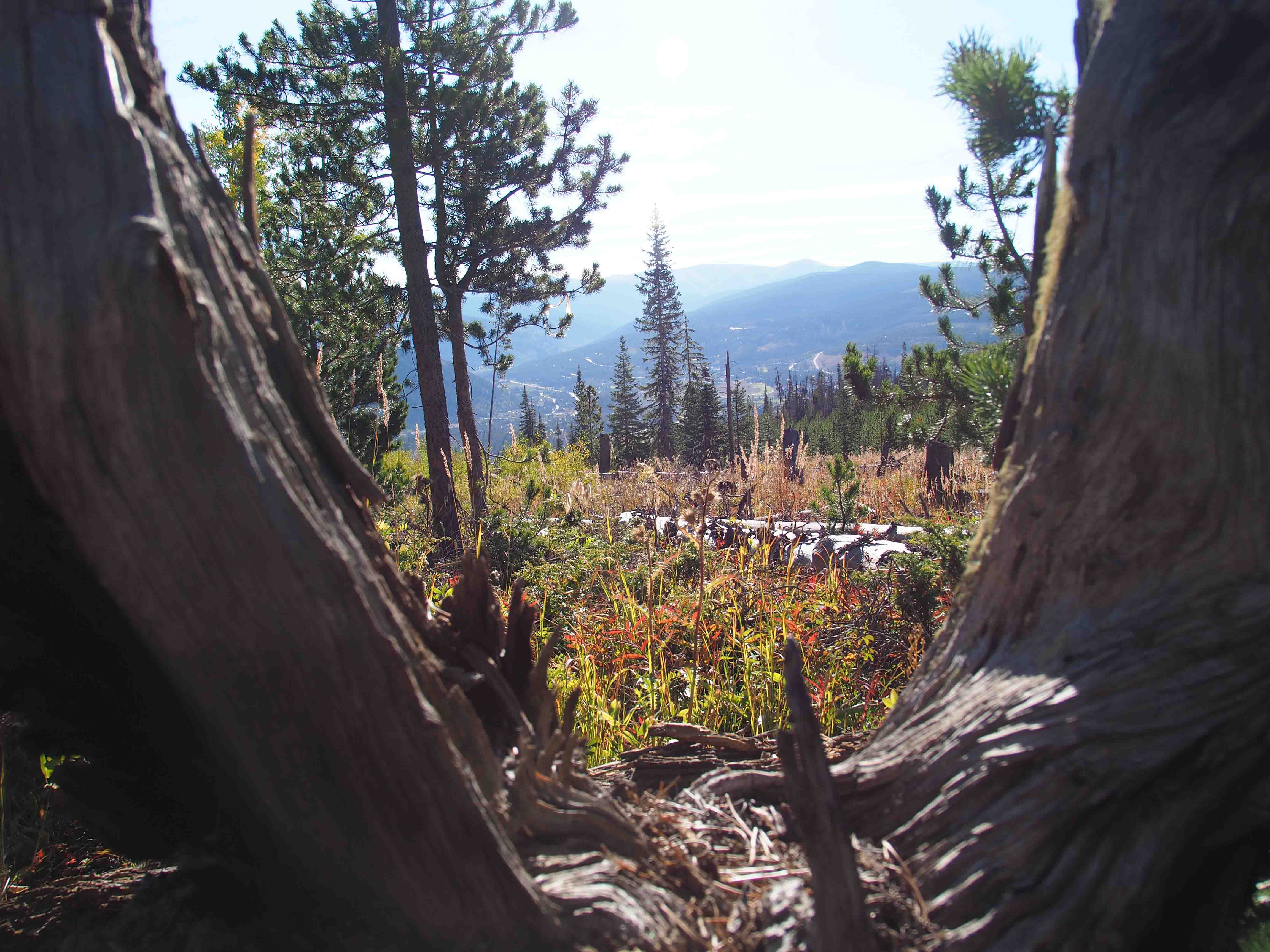
So we hustled back to our tent, tossed together our day packs and headed toward Glacier Grey around 2:30pm. Just near the turnoff to the trail, I read a sign “11K and 3.5 hours to the glacier”…hmmm. At a quick pace, we followed a light incline up an impressive valley through dead and stunted trees until we reached Los Patos Lagoon. Only 30 minutes into the hike, and we enjoying superb scenery which only got prettier as we climbed. Snow capped peaks towered over the Lago Grey which stretched the entire length of the trail. After about 1.5 hours of hiking, the glacier came into view. It looked magnificent in the nearly cloudless, sunny sky.

We stopped for a brief time to enjoy the grandeur before we continued toward the lookout point by the glacier. This is when we figured out the hike would take three hours at a steady clip as we were going beyond the lake and close to the base of the glacier. The sign and the staff were both right. We were the challenged ones! We had to hurry to finish as we had purchased dinner which ended at 9pm. At least we didn’t have to worry about the light given it doesn’t get dark until 10pm, and we had our headlamps anyway.

While we rushed toward the glacier through intermittent forest, I did not fail to take pictures. Flowers sprinkled the trail and waterfalls tumbled down the mountainside. Soon we reached Olguín bridge not too far from Refugio Grey, also operated by Vértice Patagonia. We passed by the refugio and through the campground to the final lookout point. We climbed out on the rocks, enjoyed a quick snack and view before racing back. Admittedly, I would have liked to enjoy a slower pace, but I also didn’t want to be the last one on the trail or miss our dinner. We capped our hike off by spotting six hares as we descended to our campground.

For David’s map and corresponding pictures, click here: map of our hike

Our cafeteria style dinner was good, though nothing spectacular. The burger patty, potatoes, corn soup, salad and peach tart beat cooking dried camp food. After dinner, we admired an absolutely fantastic sunset that lit up the rocky Cuernos del Paine! We couldn’t have asked for a better day, especially when the clouds blew in just after dark at 10:30 and the rain began at midnight. ETB

Other Articles About Patagonia You May Like

Shop

Check out the photographic note cards and key chains at my shop.  Each card has a travel story associated with it.  20% of proceeds are donated to charity.


photographic note card, belize sunset
SERENITY
Best Adventure Travel Blog

Navigating Puerto Natales, Chile

Our 5:30 bus came after 6 am. I guess that gave us a little more time for our breakfast that the hotel provided to us early. The company blamed the snowy weather. I could see why…we boarded a freezing cold bus with only one windshield wiper. Bundled in our puffy jackets and hats, we thought this will be a long ride to Puerto Natales. Just as we reached the outskirts of El Calafate, however, we met up with another bus and transferred. We gave up our front row seats for heat. I was OK with that trade!

Our bus took us past fields of snow that blended with a white sky. Sheep, guanaco (llama), rheas that look like ostrich, cows and horses peppered the fields that slowly turned green over our five hour drive. The sheep made me laugh because they ran away when the bus passed. They seemed so surprised, but they had to be used to it given all the scheduled bus transportation. On our way, we stopped at Hotel La Esperanza for our rest stop.

We arrived at the Argentinian border, got our passports stamped and then continued on to the Chilean border. In Chile we removed all our carry-ons from the bus, declared any food and passed through customs. The dog sniffed out fruit in our bags and helped agents search the bus baggage storage. The X-ray machine was somewhat useless because the agents only looked at the monitor half the time. We were ready to cross the border, but the bus driver didn’t have his papers! We were stranded 45 minutes away from Puerto Natales. What was funny, is this was the major piece of transportation I was most concerned about going as planned.

We waited a while because the driver said it would be 20 minutes. But after 45 minutes or so, we noticed a guide leading a tour group on our bus started looking for alternate transportation. When they ditched, David went in search of a new ride. A taxi had just pulled up to the border. $30 later, we were racing off the bus, crossing the border and jumping in a cab. It was pricey relative to the buses, but we needed to get cash, stop by the CONAF office, buy our camping food, get our bus tickets to Puntas Arenas upon our return from the W in Torres del Paine, find a park map, and come to find out buy another hat since I grabbed all of David’s stuff off the bus but managed to forget mine!

We checked into Kau Lodge around 1pm, got our room, and reimbursed our hotel $33 in cash for the Bus Gomez tickets to the park that they purchased for us in advance to guarantee us a space during the high season. As much as we would have liked to enjoy their awesome coffee shop, errands called our name. Once again, we had no problem getting cash, despite arriving on a Saturday, so I feel like the Fodor’s book is incorrect given we were visiting over the high season. The CONAF office posed more of a challenge. Our hotel staff guessed its location and was a few blocks off, but it didn’t matter as it is closed on Saturday (but of course it was open on Christmas). We needed to make reservations for some free campsites operated by the park, but it was required to make the reservations in person. We hoped we’d be able to make the reservations upon arrival in the park.

We checked the hours of the grocery store which remained open until 8, so we walked up the hill to the bus station where we purchased our bus tickets to the airport in Puntas Arenas for next week. We actually got to use a credit card for this bus! It seems Puerto Natales is far more equipped for credit cards than El Chaltén. We headed back down the hill for the grocery store. We spotted a few fellow bus mates who told us they were stuck at the border for another hour…not too bad, but aggravating none-the-less. We stocked up on cheese, sausage, pasta, and oatmeal. Outside the grocery store, we picked up some dried fruit and nuts from a street vendor. Next to him, we purchased a hat from a young girl, and then we went in search of a map.

It was just after 5, and we found many stores had closed. Fortunately, we happened upon a hostel that had what we needed. Not only did we find a map, we met an Aussie couple that had just returned from the W route. They said it dumped snow (2-4 feet), it was freezing, two of the routes were closed (Britanico and Torres del Paine), and that people were fleeing to the ferry to leave the park. YIKES…not what we wanted to hear…especially since we opted to leave our microspikes behind in Denver!

Oh, well. After five hours of wandering around town which was much larger than I expected, we returned to Kau Lodge for a coffee and a view of the lake and mountains across the street. We didn’t want to be out too late, so we chose a restaurant mentioned in Fodor’s called Kosten just a few blocks from our lodge. I wouldn’t recommend it. The king crab appetizer that we both wanted wasn’t available, and the service was extremely slow. Our entrees were tasty, though rather small in portion compared to the amounts of food we have been getting everywhere else. At least it had a nice view.

Back at the lodge, we packed up and got ready for our adventure in Torres del Paine with both excitement and nervousness. ETB

Shop

Check out the photographic note cards and key chains at my shop.  Each card has a travel story associated with it.  20% of proceeds are donated to charity.


photographic note card, longhorn
LONGHORN
Best Adventure Travel Blog

Strolling Around Santiago, Chile

After enjoying a wonderful Christmas party at my Mom’s Friday night, we set out for our Christmas vacation to Patagonia. Our flight Saturday departed 9:50pm. When we tried checking in at AA, they couldn’t check our bags to our final destination because we were supposedly “unconfirmed” on the LAN portion of our flights. So eventually we just checked our bags to our first stop in Santiago, Chile where we had a long layover.

In the meantime, we made sure we were confirmed on our LAN flights to Buenos Aires and El Calafate. We were. Oh well..worse case we’d wander around Santiago wearing our backpacks and best case we’d find a storage locker. Fortunately, upon arrival, we found a guarded baggage room where we could store two bags for 10,000 pesos or about $14.

After deciphering the Spanish ATM, we grabbed a cab which is metered to Plaza de Armas.  Following a combination of a few walking tours from GPSmycity.com, we soaked in the highlights.  At the plaza we admired the Christmas tree art made from scraps and stopped in the nearby Santiago Municipal Cathedral. The cathedral, built in the mid to late 1700s, is one of the largest in Chile.

From the church, we passed through a pedestrian shopping area and a variety of markets. Our taxi driver pointed out the fish market, so we meandered through the building. Inside, restaurants offered a plethora of seafood plates. We enjoyed lunch at Galeon.

Moving on at a leisurely pace, we passed by a beautiful arts complex and walked through a fantastic park called Santa Lucia Hill. We got a little practice in for our hiking trip as we took quite a few old stairs up to the tower atop the hill. The tower provided a panoramic view of the city that was surrounded by mountains. We also enjoyed the fountains and relaxed in the shade on a park bench. https://en.wikipedia.org/wiki/Santa_Luc%C3%ADa_Hill

From the park, we walked to the municipal theater who’s inaugural show, Ernani, played in 1857. Our final stop was La Mondeda Museum.  The cultural center is located under Citizenry Square.  It houses a small film center, craft rooms, a photography show as well as a museum displaying Samurai pieces.  It was a neat place though relatively quiet and empty.

In fact, for a Sunday, we felt the historical downtown area was somewhat quiet, though after a long red-eye flight it was perfect for us. Perhaps everyone was shopping for Christmas in Bella Vista. TripAdvisor recommended visiting this neighborhood, but we didn’t want to rush around. Perhaps we will come back, as the European vibe and friendly people appealed to us. We particularly got a kick out of the traffic signals. When the light was about the change, the walk sign turned into a person running! For now, however, we returned to the airport to make our way to El Chalten via Buenos Aires and El Calafate. ETB

Would you like to take this blog post with you? Click here to download it on the GPSMyCity Travel App:
Strolling Around Santiago,Chile

SHOP

For notecards and key chains, visit My Shop on this website.

Enchanted Keychain thumbnail

Great Fun at Great Sand Dunes National Park!

Great Sand Dunes National Park was a site listed in my Reader’s Digest 120 Scenic Drives Book that I used to make my drive around the USA four years ago. Unfortunately, I had to skip this National Park due to required maintenance on VANilla. I was very excited that I finally got to visit the park with David, Heather and Jaz this past weekend.

We made the estimated 4 hour drive in about 6 hours on Friday evening. Rush hour traffic held us up for about an hour, and we had to stop for gas and dinner. Without much light on the road it was difficult to see the turn for the Zapata Falls Campground. After one U-turn, we ventured up the 3 mile dirt road and found one of the last campsites around 10pm. None of us felt like setting up our tents, so the girls slept in the car while David and slept in sleeping bags under the stars. The clear night provided an amazing view of the Milky Way.

The next morning David and I awoke early and drove 24 miles to Mosca Pit-Stop for gas. For anyone who travels to this area, I recommend filling up at the last gas station passed on the way because the area near the park is desolate. Upon return to the campsite, we stopped to admire a small herd of elk along the roadside.

From the parking area by the campground, there is a short trail to Zapata Falls. The trail requires a creek crossing and a little rock scaling, but the jaunt isn’t that hard and the 25 foot falls that careens down the crevasse is certainly worth the visit! What an enjoyable first stop of the day!

Our next stop was deep in the Great Sand Dunes National Park and only accessible by small, high clearance four-wheel drive vehicles. Spots like these is why David keeps his truck around. We passed “The Point of No Return” and followed Medano Pass Primitive Road for 11 miles to Medano Pass. The 11 mile drive through deep sand, a shallow creek (which is deep in the spring and many times non-existent this time of year), and on a rocky road took about 1.5 hours.

Just before the trail to Medano Lake, we found a campsite. There are several campsites along the road which are free of charge and include a bear box for food. Most of the campsites were taken up by hunters, some who erected canvas tents and a small corral for their mules. Rifle season for deer and elk had just begun.

While I would have preferred to have hiked beneath the aspens adorned in golden leaves without gunshots in the distance, the leaf littered trail was still beautiful. We began the hike at 9,600 feet and gained about 1,900 feet over 3 to 4 miles in order to reach Medano Lake. Most of the first two miles followed a relatively easy grade which turned into a steep ascent toward the end. The calm afternoon offered a tranquil lake setting. For anyone with a small, four-wheel drive vehicle who enjoys fall colors, this is the place to visit in late September!

We arrived back at camp after our 7-8 mile hike just before sunset to set up our tents. The nice part about “car camping” is that dinner of ribs, veggie dogs, baked beans, and mashed potatoes is far more gourmet than the typical dehydrated meals we use for backpacking. We topped off our tasty meal with S’mores!

The quiet night turned violently windy around 11:15 am. We could hear the leaves shimmering in the distance a few seconds before the wind whipped through our camp. The fly on our tent shook while the straps held down by our stakes snapped back and forth. David did an excellent job staking the tent down in the hard ground because the corners remained secure. Our fly and mesh tent, however, didn’t keep dirt from raining on us! The sleeping bag was covered in a layer of fine grit! After 3 hours of crazy wind, we could scoop up dirt from the middle of the tent the next morning. But of course, the sand dunes were created by predominant winds and storm winds flowing against each other, so I suppose we shouldn’t have been surprised.

After breakfast, we returned along the primitive road all the way back to Zapata Falls Campground to secure a site for our final night. This was certainly more driving that needed to take place if we were just visiting the park to slide down the dunes, but the park is very diverse with lots of options. Also, David had to leave us this evening, and I didn’t feel like I had the skills to take over the four-wheel driving. Zapata Falls Campground, though not as private as a camp site in the woods, is quite a good deal despite no water nearby. It’s only $11 a night and half price with a National Parks Card.

After securing our campsite, we stopped just outside the park at the Oasis to rent sandboards and sleds. The sandboards and sleds are $21 per person (more on this later). We returned to the park to attack the dunes. Some of the dunes are over 700 feet high. We inquired where to go with the ranger at the entrance station and he said with our truck, we should go back to Medano Pass Road to Castle Creek because a 300 foot dune stands just feet from the parking lot. It only required us to climb up. I can’t believe how long it takes to climb up 300 feet in sand. It was hard!

David, Heather and Jaz all rented sandboards which are wood with foot straps similar to a snowboard. The sandboard was smaller and narrower than a snowboard or the sled that I rented. The sandboard required going barefoot or in socks. On the sled, shoes were optional, but given I had to brake with my feet, I elected to wear shoes. All the boards we rented needed wax. My first recommendation is to climb the dunes without shoes no matter what…much easier! Second, hold the top of the board and shove the bottom of the board in the sand to use it as a post while climbing up…this was a big help.

After probably 40 minutes of climbing beneath a black sky, we finally reached the top for lovely views. The attempts at boarding and sledding down the dune was simply hysterical. I think we had more fun laughing at each other than actually sliding down. Being rookies, we made a variety of mistakes. First, we needed more wax on the boards. David, Jaz, and Heather had a hard time getting them to slide. Second, we probably should have all rented sleds. They go faster and are more fun. Third, we probably should have only rented two sleds and taken turns as after our one attempt, we were exhausted. No one wanted to climb up the dune again! Fourth, in order to get two runs in, we should have gone in the late morning, eaten a packed lunch, and then made another run as the afternoon was nice and cool. Regardless, we had a fun and finished just before sprinkles fell.

We relaxed at the campground in the late afternoon. Jaz built a fire. Heather played the guitar. David and I read. Soon dinner time came around and we made Frito Pie and S’mores! Time to work out again.

The wind overnight was relentless again. It continued through the morning. The girls and I planned to go to the northwest portion of the park to look for elk in the grasslands, but we didn’t realize we’d end up on another unpaved road for several miles. After seeing a Buddhist Retreat Center along the way which was interesting enough, we pulled the plug on driving further and headed home. ETB

Shop

Check out the photographic note cards and key chains at my shop.  Each card has a travel story associated with it.  20% of proceeds are donated to charity.


photographic note card, snowy waterfall in oregon
SNOWY FALLS
Best Adventure Travel Blog

Salida, Mt. Shavano and Tabeguache Peak

The girls went camping with their mom this weekend, so David and I took a quick jaunt down to Salida, about 2.5 to 3 hours southwest of Denver. Saturday we piddled around the town and followed Spiral Drive for a view of the city. Sunday we climbed two 14ers, Mt. Shavano and Tabeguache Peak.

We learned the hard way to never try to tackle two 14ers, 11.25 miles, and 5,600 feet of elevation gain on three hours of sleep while not feeling up to par. We didn’t go out the prior evening. In fact, I think we were in bed by 9pm, so we could get up by 4:30am, make the 45 minute drive to the trailhead and start hiking by 6am. Unfortunately, we couldn’t fall asleep! Our best laid plans got us started at 6:30am just before sunrise.

The first mile of our hike which starts on the Colorado Trail through an aspen grove and soon turns left to begin the steep climb was simply lovely. We watched the sunrise creating a pink glow in distance while the aspens’ yellow leaves shimmered in the brightening sky. The climb took us over a rocky and root covered path until we reached the second mile.

The second mile, though the flattest and easiest with a few trailside campsites, was quite ugly. The pine forest has suffered much devastation from the beetle. Many fallen trees lined both sides of the path and even provided us a few obstacles to cross. With the record high temperatures of September and little rain of late, the creek was dry. Amazingly, there were still a few wildflowers clinging to life which may have been the only pretty part of the second mile with the exception of intermittent views of the golden valley below.

With every 14er, soon we ascended above treeline and entered the tundra. The treeless area offered spectacular views beneath the deep blue sky. While the views were nice, we contended with a strong headwind as we climbed toward a flat area before we had to boulder up to the peak of Mt. Shavano. Fellow hikers commented on the wind’s brutality.

Only three miles into the trail, I was already feeling weak and hungry, and we had eight miles to go. Now with a strong crosswind, we followed the trail to the right across a saddle. As I stepped, I lightly stubbed my toe on a rock. I reached my foot slightly farther than normal to the right to catch my balance and the wind blew clear off the trail! I landed very ungracefully in a patch of rocks. Pain shot through my bruised knee. My hip likely survived as it was protected by my shattered cell phone. David came to my aid and suggested that maybe we should turn around. That was probably an excellent suggestion, and I probably should have agreed, but those who know me know that is not part of my MO.

I told him that I was not going to quit, so he walked slightly ahead to my left while holding my left arm to block the wind. Upon reaching the boulder field, we found intermittent relief from the wind and opted to stop and eat in the cover of some rocks before we even reached the first peak! After refueling, I felt much better and we summited Mt. Shavano (14,229′) around noon. The panoramic views were stunning.

With it being October, there wasn’t any danger of inclement, summer thunderstorms, so we had plenty of time to maneuver across the boulder field, up and down 500 feet to Tabeguache Peak. Since I tend to get altitude sickness or a severe migraine (I haven’t figured out which since a headache and nausea are symptoms of both), I certainly wanted to knock out both peaks at once versus coming back to climb Tabeguache Peak on its own.

The one mile to Tabeguache Peak (14,155′) took us about an hour. The path came and went as climbed along the rocks. We hardly spent any time on Tabeguache Peak. We only signed the log and congratulated a few fellow hikers who had also made it to the small summit before we turned around. It felt easier on the return to Mt. Shavano, but by this time my headache was really kicking in, and we had a solid four plus miles to go.

Once we got below treeline, I just started crying. My head was pounding, and I was extremely tired and nauseated. I felt like I needed to eat for some energy, but I could hardly get a handful of nuts down. My Gatorade wasn’t much help either. I was burning up. I torched my lips as I failed to smear sunblock on them, and it was certainly too windy to wear a visor. All I wanted to do was lay down and rest. In the meantime, David’s knee locked up so while he was trying to help me, he was peg-legging down the mountain for the last mile and a half. We were so slow! It took us almost 12 hours to hike 11.25 miles.

While we had headlamps, fortunately we made it back to the aspen grove just before dark as the sun set. I’d like to say we stopped and admired the beauty, but a few quickly snapped photos is all I could muster as I was desperate to sit down. I’ve never been so excited to reach the car! These two peaks mark my 11th and 12th 14er since I started climbing them two years ago. While I don’t want to scare anyone since they were only Class 2, at the time it felt like the hardest thing I have ever done…harder than my marathon or triathlon. Personally, I believe it was simply the circumstance of starting the task on an empty tank, and that they probably weren’t that much harder than the other ten I have completed. I never felt in danger, but I sure felt exhausted and learned my lesson to ditch hiking a 14er unless I’ve gotten a full night’s sleep. As that is what my body needs! Despite the beating, I think we both feel accomplished and happy we finished. ETB

Shop

Check out the photographic note cards and key chains at my shop.  Each card has a travel story associated with it.  20% of proceeds are donated to charity.


photographic note card, mountain goat in colorado
MOUNTAIN GOAT
Best Adventure Travel Blog

Closing Weekend at Estabrook

What a nice weather we got for closing weekend at Estabrook. We were so lucky! The forecast called for rain, but we enjoyed a weekend of sun. A thunder shower rolled in one night and it looked like things might turn ugly as we were leaving today.

Heather and I went for a hike Saturday morning while David fished and Jaz read. The afternoon took David four-wheeling along the logging roads while we chilled out. We tried out the new Italian place that was packed. I thought it was fair, though we may not have ordered appropriately as the pizza looked pretty tasty. We finished out the night with family games.

On Sunday, while the girls played chess, we tried fishing once more. Not too much luck. I caught some bait…a tiny rainbow in the Platte that was the size of a minnow! Sad we have to wait until next summer to enjoy the place again. ETB

SHOP

For notecards and key chains, visit My Shop on this website.

Enjoying the Fall Colors

David, Jaz, and I took a trip to Estabrook to enjoy a nice weekend with my mom and Bart. It was a very restful weekend with hardly any strenuous activity. On Saturday morning, we tested out David’s new Subaru on the logging roads around our property. We got into some narrow spots as we four-wheeled through the pine forests and aspen groves. For the afternoon, we tried out some fishing. I caught a baby brown trout and had a few more strikes, but then lost the fly the fish seemed to like! Margaritas, brisket and S’mores called our names for the evening.

Despite turning in early, 6 a.m. came too fast so we slept in and skipped hiking Evans. Instead we ventured up to Kenosha Pass to check out the aspens. Kenosha Pass is very well known for its beautiful colors. This year, some of the aspens were subject to mold from all the rain, so the leaves browned early, but we still found some lovely spots. We slipped in another hour of fishing to no avail, but still had fun taking it easy in the mountains. ETB

Shop

For notecards and key chains, visit My Shop on this website.


photographic note card, fall colors in connecticut
FALL COLORS
Best Adventure Travel Blog
colorado trail

Segment 7 of The Colorado Trail

With Segment 7 of the Colorado Trail complete this weekend, I have now finished Segments 1-10 (170.5 miles) over the past two summers. Only 315 miles more to go…I suppose I’ve made a small dent.

David and I visited Breckenridge Friday night which coincidentally coincided with Oktoberfest (in September) and were fortunate enough to meet Cat for dinner at Blue Stag. After a great meal, Cat was nice enough to shuttle a car with us to our pick-up point at Copper’s East Lot. Continue reading “Segment 7 of The Colorado Trail”

spring

Labor Day Weekend on The Colorado Trail – Segment 6

We waited until the end of school Friday to tackle segment 6 of the Colorado Trail over Labor Day weekend. Our first stop was Gold Hill to drop off the pick up car. Then we shuttled to Kenosha Pass. It was 6:45 pm before we were able to start our hike. We planned on getting 3 miles under our belts so that we only had to average 10 miles a day the rest of the weekend.

Hiking at Dusk

Our hike began in large aspen groves. We were about a week or two too early for the magnificent colors, but the leaves were beginning to turn yellow. After emerging from the aspen grove, we enjoyed a nice view of South Park at dusk before we clipped on our headlamps.

We passed two small creeks, and likely the ideal campground in the dark. A car camping group with bright lights and music were situated near the suggested camping spots, 3.1 miles into the segment, so we continued on into the valley and set up camp just as sprinkles fell. Continue reading “Labor Day Weekend on The Colorado Trail – Segment 6”

A Day at Sea

We are at sea today with sails fully trimmed. This morning I finally visited the bridge. I checked out a few monitors and spoke with the second officer. She clicked on the ships on the monitor to show the details of each vessel. That was kind of neat. I could also see the path we were taking around a shallow area and learned that the Baltic Sea is relatively shallow and warm, at least for whales and large sea life. I suppose I won’t be outside looking for Orcas today. Though I’m not sure how much time I will spend outside anyway. While the sun is out, there is a cool breeze! Continue reading “A Day at Sea”