view from legault mountain

Road Trip to the Rockies: Legault Mountain

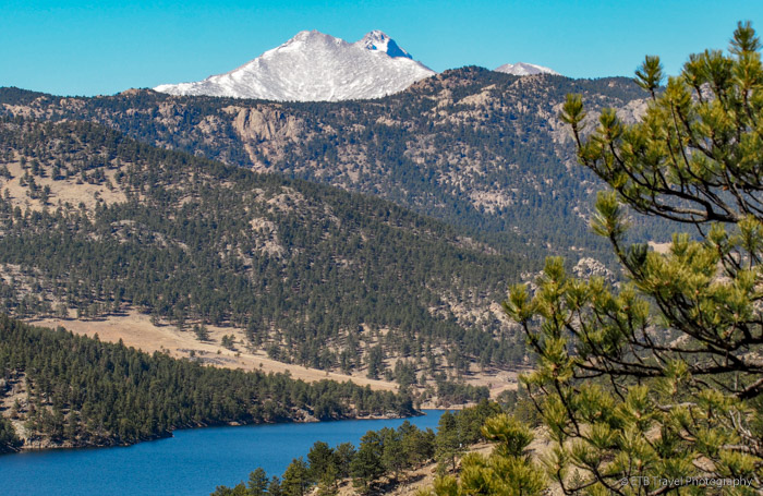
So the COVID crisis has kept me state side since the end of March.  That is a long time for me, especially while remaining in the same state the whole time.  Fortunately, I live in the beautiful state of ColoRADo, and there are lots of outdoor activities to keep residents busy.  Unfortunately, April and May tend to be “mud season” in the mountains, so the trails aren’t always inviting.
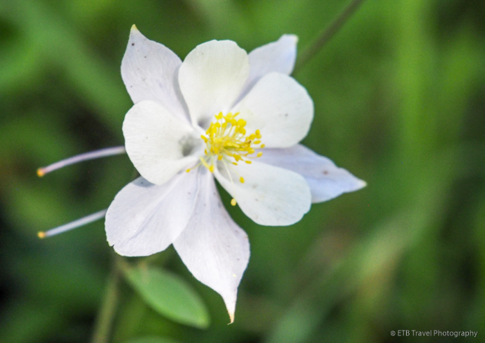
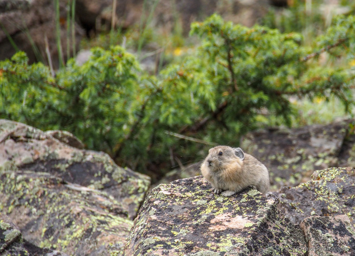
GO HIKING!

Road Trip to the Rockies: Button Rock Preserve

Button Rock Preserve

Trail(s): Sleepy Lion Trail
Location: Button Rock Preserve
Fees: Free
Distance: 4.7 miles
Dogs Allowed: Yes

I was pleasantly surprised by Button Rock Preserve, operated by the City of Longmont.  Many time, “Preserve” is synonymous with “No Dogs Allowed”, but this preserve had a leash, off-leash, and no dogs allowed area.

I got a late start this morning and I didn’t arrive to the trailhead until around noon.  I expected that many people would be finishing up their 4.7 mile hike, but the parking lot was full of families, hikers, climbers, and dogs on this sunny, yet crisp winter day.

The beginning of the trail follows a slightly graded dirt road.  Generally, hiking up a road with lots of people isn’t my favorite type of hike, but it passes by climbing cliffs, a dam, and the small Longmont Reservoir which just look like a wide, slow moving portion of the North St. Vrain Creek which is also skirted by the road all within 3/4 of a mile. Continue reading “Road Trip to the Rockies: Button Rock Preserve”

Road Trip to the Rockies: Two Days in Ouray!

Want to know what to do for two days in Ouray during winter? Here are a few ideas for the top things to do in Ouray.

WHERE TO STAY:

Stay at The China Clipper Inn. I scored a room for $100/night just a month before this busy weekend. This spectacular Bed & Breakfast is located in town just one block off Main Street. The China Clipper Inn is wonderfully decorated. It’s living room includes a fireplace which is very nice to enjoy during the winter months. It’s breakfast is great. It includes warm items like eggs, quiche, potatoes, ham and bacon, as well as mouth watering muffins and a lovely fruit salad. Of course it also includes coffee, tea ,juice, cereals and breads too. My room had its own fireplace! It is a really great, quaint place nearby everything. Continue reading “Road Trip to the Rockies: Two Days in Ouray!”

Roadtrip to the Rockies: From Crested Butte to Aspen!

I’ve been wanting to do the Aspen/Crested Butte hike for some time. It thrilled me when I saw a meetup group called “Bold Bettie’s” post this hike as it takes some coordinating and surprisingly, for this famous hike, the information is not that forth coming. I signed up to go even though I had just returned from Mongolia five days earlier and was still worn out and playing catch up.

Since I need time to acclimate to the altitude, I arrived in Crested Butte a day earlier than the planned outing, and hiked a simple 6.4 mile loop near town and then explored Downtown Crested Butte with one of the members of Bold Betties, Barb.

Lower Loop Trail

The hike began just from the edge of town on Lower Loop Trail. The signs as well as the description of the hike suggested to park in an area about 200 yards up Peanut Road on the right hand side.

If I had to do it over again I would have gone to the Woods Walk Trailhead, also located at the edge of town and hiked from there or driven 1.2 mile up Peanut Road to the Lower Loop Trailhead as walking up a road, all be it dirt, isn’t terribly appealing to me. Having said that, the parking up the road is limited so arriving early is crucial.

Though walking up the road gave me the chance to admire the Gronk, an old mining structure as well as the Peanut Lake with a lovely reflection of Gothic Mountain in its calm waters. Had I driven I would have missed two lovely bucks and the ducks, geese, and heron who hunted for food in the tranquil setting.

Upon reaching the actual trailhead, I continued on the lower loop which was very flat and a favorite trail among the locals who ran with their dogs off leash. Though I believe in following leash laws, I have to give credit to the dog owners. Not one dog ran up to me, jumped on me or anything. They just ran right by. Don’t get me wrong, I love dogs but they aren’t for everyone, and if they are out of sight or voice control they shouldn’t be off leash.

Anyway, the trail wound past a “commercialized area” for lack of a better word which included benches and interpretive signs about bugs. I don’t find these sections of trail terribly enjoyable, but I understand why they exist, so I hurried through the area to get to the less traveled section.

For a good while, the trail paralleled the river and led me through intermittent forest before I took a left at a junction called Gunsight Bridge. This section turned out to be a narrow, 4 wheel drive road that zig-zagged up the mountain. After only a few switchbacks, a sign the pointed up the road to Gunsight Pass and another that pointed left at a single track called Upper Lower Loop.

I took a left onto Upper Lower Loop and followed it until it connected back with Lower Loop. I would have liked to taken it farther toward Wood Walk Trail as it would have cut off most of the road walk, but it was under construction.

The Upper Lower Loop was flush with wildflowers which I really enjoyed. When I wasn’t admiring the wildflowers and losing my prescription sunglasses in the process (boo), I was delighting in the intermittent aspen groves. I really took pleasure in this part of the hike and finished it soon enough to keep from burning in the sun as I entered the exposed valley.

Upon returning to the parking area a mile down the road, the once empty lot with only my car was overflowing. It’s always nice to hit the trails early, simply for tranquility, much less the avoidance of heat and afternoon thunderstorms.

Camping in Crested Butte

I finished before lunch and met Barb about 3 miles down the dirt road which led to Oh Be Joyful Campground, not far from town. We needed campsites for twelve ladies, and Oh Be Joyful was full, so we resorted to River Flats just where I had propitiously parked. At first we weren’t too enthused about having to carry our stuff down to the sites from the road which provided limited parking for about six cars, but then we realized it would be tranquil.

We purchased four of the six sites for $5/night and had the space to ourselves until a family with kiddos and uncontrollable dogs showed up. Eventually all our group joined us and by 10pm all parties in the campground had turned in for the night.

Crested Butte / Aspen Shuttle

The shuttle was picking us up at the visitor center at 6:30am to take us to Scholfield Pass. As such we gave ourselves 30 mins to get ready and 30 mins to make it to town. We piled in the large van operated by Dolly’s which dropped us off around 7:30 after we bounced along the dirt road between the forested mountains. Our early departure provided many deer sightings and even two moose!

So the signs on the road were similar to the ones on the yesterday’s hike near town. They basically encouraged people to park well before necessary. In this case, the road appeared blocked and closed. Our drive swerved right around the signs and kept going! We finally stopped at the third roadblock where avalanche debris impeded the way.

From here we walked along the road and across a few patches of snow to Schofield Pass in the Maroon Bells Snowmass Wilderness. Across from the Schofield Pass sign where Rebecca added a Bold Betties sticker to the collection, we took the trail. Come to find out, we didn’t hike up the road two miles to Schofield Park Trailhead and mistakenly took Schofield Pass Trail. For the most part, it paralleled the Schofield Park Trail and eventually intersected it.

Anyway, I don’t think we missed much…maybe an old log cabin. Our trek took us up to a view, down through a meadow, and soon we found ourselves weaving our way through chest high wildflowers. After crossing a few creeks without bridges, we met up with Schofield Park Trail which connected at a junction to West Maroon Pass Trail where we prepared for our climb.

Prior to reaching the junction, the wildflowers on the open mountainside were absolutely spectacular. We were waist-high in Indian paint brush of all colors, blue columbine, kings crown and more. Red, blue, yellow, and white dotted the terrain for miles. It was fantastic!

Frigid Air Pass

From the junction sign tucked beneath the willows, we ascended a mile to the junction for Frigid Air Pass. Here, we settled down for an early lunch and fuel intake as we prepared for the 1,000 foot gain over West Maroon Pass. It was not as bad as I was expecting, though we were only carrying day packs! The backpackers completing the four pass loop were trudging at a snail’s pace.

The trail to the pass was steep enough, however, to separate us into two groups. The ‘fast’ group included eight girls and the ‘slow’ group included four. We sat at the pass marveling at the view of vast green meadows with patches of snow and a few alpine lakes while we chatted with a few hikers from The Aspen side before continuing.

The Aspen Side

The common question was, “Is it muddy on that side too?”

We thought it was somewhat muddy on the Crested Butte side until hikers from Aspen referenced swamp-like terrain…Ugh! What we were about to slog through?

We slid along some snow patches as we descended the pass until we reached the meadow blanketed in willows. Along with every willow patch came cavities of mud. No matter how hard we tried to stay to the side of the trail or completely detoured to keep from sinking in these mud pits, sooner or later we succumbed to the mire. The mud was slicker than the snow, and just about all of us ended up at least ankle deep in sludge as we struggled to keep our feet dry and remain partially clean.

I guess we were lucky our shoes stayed on. I nearly had a shoe sucked off while hiking to Lake Katherine, north of Steamboat Springs. There are many great hikes in Steamboat Springs by the way.

I don’t know if the conditions are always like this in the summer since willows tend to grow around water or if the trail was overly saturated from late snowmelt and recent rainfall. Speaking of rain, somehow, despite cloudy skies and a forecast calling for an 80% chance of rain, we had succeeded in staying dry with the exception of our mud soaked feet.

West Maroon Trail

The West Maroon Trail requires several creek crossings, none of which have bridges. Most of the time, we could hop from rock to rock and keep our feet out of the cold, mountain streams. One crossing, however, required wading in a strong, knee deep current. Knowing this in advance, most of us strapped on our river shoes and strided on moss covered rock through rushing water, though a few of the girls used the opportunity to clean their hiking boots and stepped right in the frigid creek.

Eventually, we met up with the masses near Crater and Maroon Lakes. These last three miles of aspen groves were pretty. I had considered hiking this trail again in the fall for the changing colors, but with aspens at only one end of a 11 mile day, I’m having second thoughts. I’ll have to do some more research because after today, we all felt we would have rather hiked from the Crested Butte to the pass and back as it was flush with wildflowers and much dryer.

Upon arrival at Maroon Lake we loaded in the Aspen shuttle that ran every 15 minutes until 5pm. Our bus driver was an aspiring singer who crooned a few John Denver tunes until we reached the ski mountain. Here, we exited this shuttle in order to board another shuttle that took us to town. We stayed on the bus until the last stop at the station that was centrally located to the restaurants in downtown. We asked Information for the best burger in town. She directed us to Justice Snow’s that only had inside seating available, so we ended up around the corner at Hops Culture. Encrusted in mud, bug spray (the mosquitoes were vicious at times) and sunscreen, we plopped ourselves down at two outside tables.

Fortunately, I’ve never found Aspen to be as pretentious as they claim, and both the servers and tourists were very friendly. Most visitors wanted to know what crazy adventure our motley crew had just completed. People’s eyes widened when they heard we hiked from Crested Butte. Of course, we walked as the crow flies, so the distance was short compared to the 173 mile drive.

The nice part about a long hike is it is easily justifiable to get the biggest, juicy burger around. Almost all of us went with the Royale with Cheese or the Bison chili and some not so good triple fried potatoes. We even finished the meal off with S’mores before we piled into Dolly’s shuttle for the three hour return trip to Crested Buttle. The shuttle cost a total of $80. $20 for the ride to the trailhead and $60 for the ride home.

Overall, we had a long, but very nice day! The wildflower hike in Crested Butte were some of the best I’ve seen. ETB

Shop

Check out the photographic note cards and key chains at my shop.  Each card has a travel story associated with it.  20% of proceeds are donated to charity.

photographic note card, lake in Yosemite
ENCHANTED
Best Adventure Travel Blog

Henderson Mine…Second Attempt

Well, I’m 0-2 in trying to reach Henderson Mine in the winter…bummer! I went last spring with David, but we never found it despite being above treeline and walking around. This time, Diana, Jim and I made an attempt. I really thought we’d be able to reach it this time.

We started up Butler Gulch trail on packed snow through a forest of evergreens whose branches were adorned in snow. The sun poked through fast moving clouds as we climbed a somewhat steep grade. We followed the swithbacks at a slow steady pace until we started to leave the treeline.

The wind picked up dramatically and snow whipped across the trail stinging our faces. Our hands instantly turned cold despite heavy gloves and mittens, so we broke out hand warmers. We continued in the open space for only a short while more as we suddenly began sinking to our knees.

At this point, none of us wanted to sit down to strap on our snow shoes as we knew we’d only get colder, especially our hands and feet. In addition, our camelback hoses were freezing up. If we didn’t drink water about every five minutes, we were working hard to get ice out of our bite piece. The final straw for me was, one of the many off-leash dogs on the trail jumped up on me while getting ice and snow all over my camera lens. I tried in vain to remove the ice enough for clear photos, but that turned out to be an excercise in futility. It was time to turn around!

In the summer-time, we rarely ever turn around. We feel like there isn’t much of an excuse not to reach our destination (unless it is lightning). In the winter, however, we don’t mind trying another time. It isn’t worth getting hypothermia! Covered in four layers of clothes, none of us were particularly warm, and it seemed like we’d only get colder with thick, gray clouds enveloping the surrounding peaks.

I’m glad we threw in the towel as by the end of the hike, we walked through light snow. At least we got outside in the beautiful mountains and got some exercise. Our four to five mile hike felt like eight, but overall it was a very pretty scene. ETB

SHOP

For notecards and key chains, visit My Shop on this website.

Mountain Goat Keychain thumbnail

From Turkey to Trails

Thanksgiving Week

What a lovely Thanksgiving Week. It was so nice! It started on Tuesday with pre-Thanksgiving at my sister Christian’s house. We sat outside by her firepit which kept us warm on a nippy night and enjoyed a fantastic dinner which included beef tenderloin, salad, potatoes, brussel sprouts and squash souffle. And who can forget the truffles. I wish I would have taken more pictures, but I did capture a few folks watching a funny Thanksgiving video from Jimmy Kimmel. Continue reading “From Turkey to Trails”