mount rainier

Day 267 – Magnificent Mount Rainier

Day 267 of a Year Long Road Trip Along America’s Scenic Byways

Mount Rainier

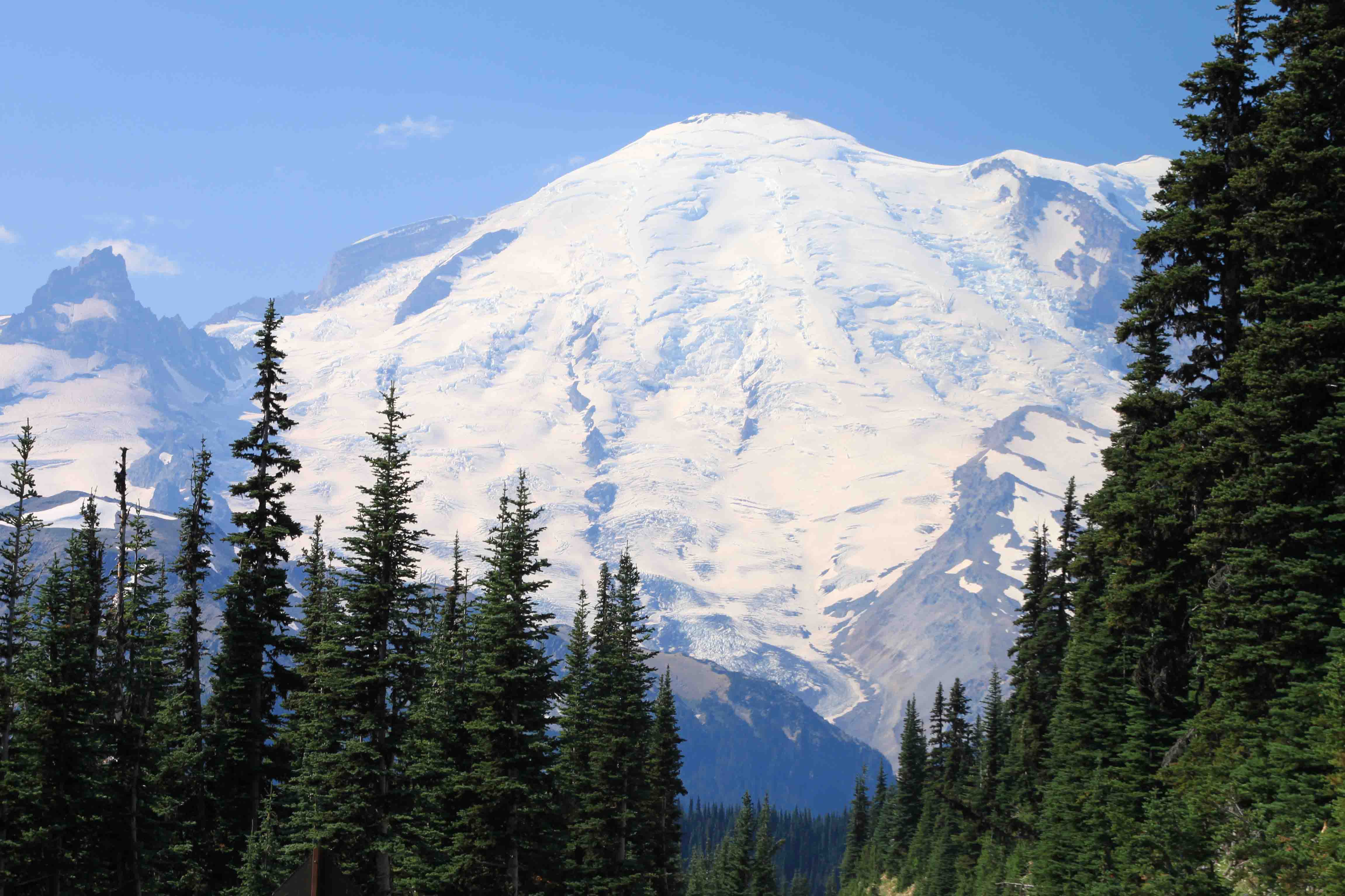
I think we drove close to seventy miles through farmland and along the Naches River which runs through the trail laced Mount Baker Snoqualmie National Forest before we climbed over Chinook Pass and rounded the bend for a magnificent view of Mount Rainier. The ice-capped Mount Rainier, a dormant volcano, stands at 14,411 feet and towers over everything around it; lakes, evergreens, meadows of wildflowers, and additional peaks.

ON THE ROAD AGAIN!
winthrop

Day 266 – North Cascades Loop

Day 266 of a Year Long Road Trip Along America’s Scenic Byways

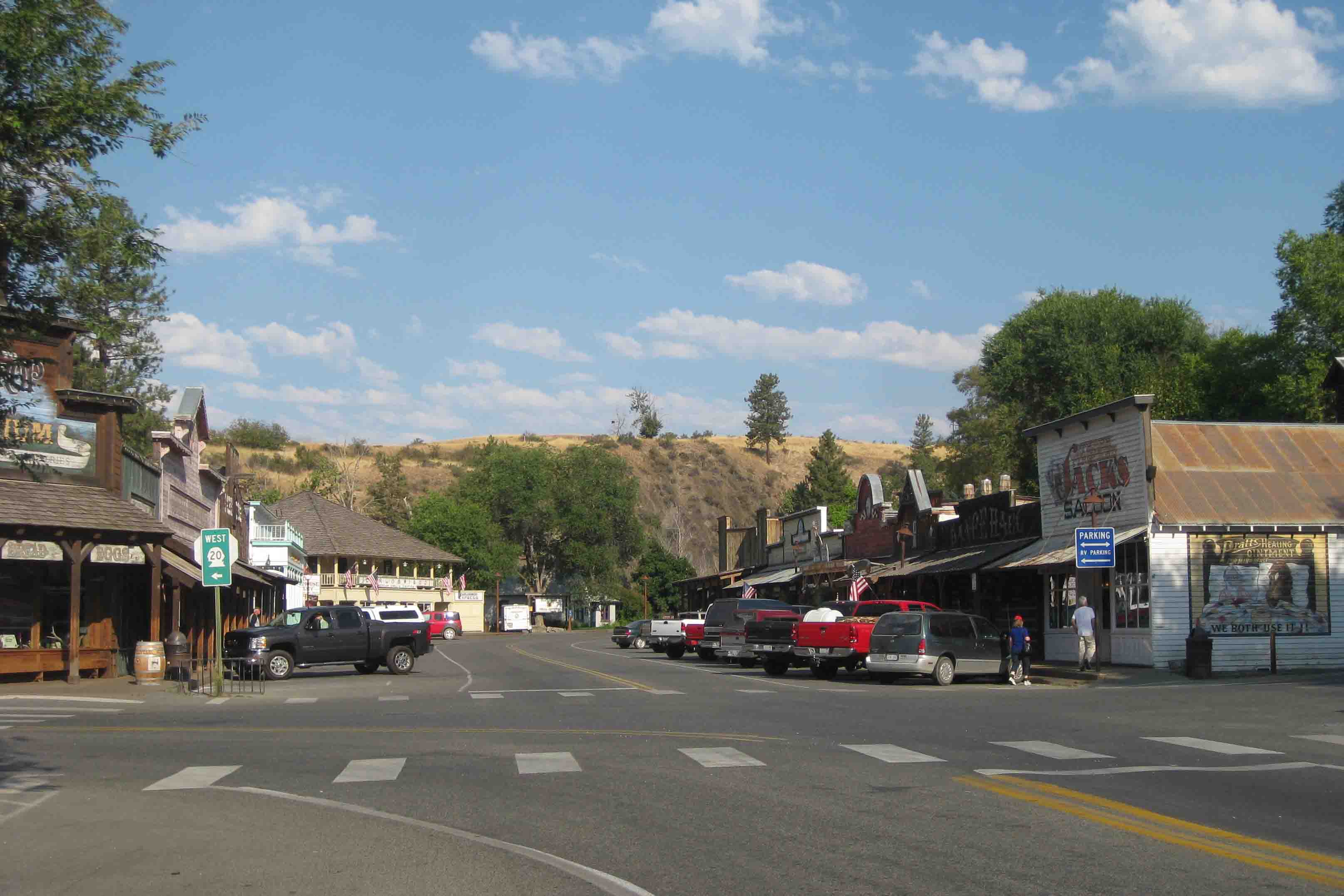
After tooling around the Town of Winthrop, which looked like it had been preserved since the late 1800s, though the old-fashioned facades were erected in 1972, we turned south to Cashmere to complete a loop drive.

ON THE ROAD AGAIN!
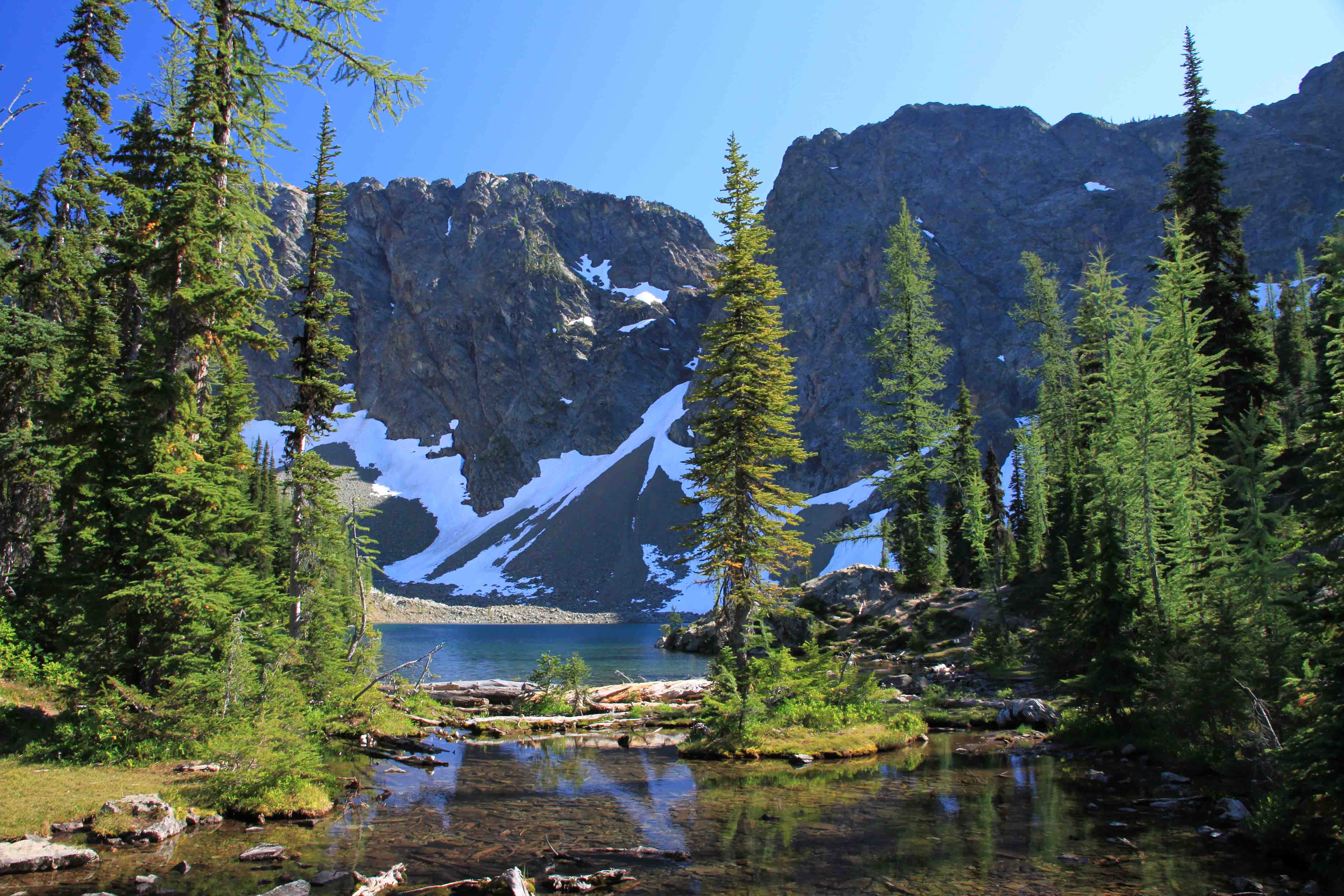
blue lake in the north cascades

Day 265 – North Cascades Loop (Part 4)

Day 265 of a Year Long Road Trip Along America’s Scenic Byways

Gorge Powerhouse

Our first stop of the morning was at the Gorge Powerhouse which was a pleasant surprise.  The powerhouse was originally completed in 1924 and expanded in 1949. The first surges of electric power sent to Seattle via the Skagit Hydroproject were from this powerhouse. 

With four turbines which require a dam and the river being diverted through a tunnel to generate enough pressure to operate them, the powerhouse provides enough electricity for over one million 100-watt light bulbs. The 1960 dam, 300 feet high and 670 feet long, replaced a 1923 rock-filled timber crib dam and a 1950 masonry dam.

ON THE ROAD AGAIN!
baker lake

Day 264 – North Cascades Loop (Part 3)

Day 264 of a Year Long Road Trip Along America’s Scenic Byways

I missed my turn back to the campground last night and forgot to mention the yard art I found. This house was complete with a tiger, bald eagle, moose and a zebra just to name a few.  There were so many, I can’t recall them all and they were big! Anyway, that was my evening entertainment before I turned in.

Gun Battery in Fort Ebey State Park

This morning I went on the greatest walk with Petey in tow.  We followed a ridge trail through Fort Ebey’s forested hills and looked out on the water with a mountainous background as ships sailed by.  Along the way to Partridge Point Beach, we stopped to explore the gun battery constructed in 1942. 

ON THE ROAD AGAIN!
view from langley on Whidbey Island

Day 263 – North Cascades Loop (Part 2)

Day 263 of a Year Long Road Trip Along America’s Scenic Byways

Well, I felt like I had an extremely busy day to write about, but now that I have skimmed through the pictures I didn’t go many places.  It must have been the holiday traffic and the wait for the ferry that took up a few hours of my afternoon.

Wallace Falls State Park

This morning I took about a 4.5 mile hike in Wallace Falls State Park.  It was cool out and VANilla had a shady parking spot, so Petey got to wait for me.  I normally take him on dog friendly trails, but I’ve been subject to dragging him midway through the second mile.  Thank goodness I left him to rest, the trail had quite a bit of elevation change. 

ON THE ROAD AGAIN!
deception falls

Day 262 – North Cascades Loop

Day 262 of a Year Long Road Trip Along America’s Scenic Byways

Petey and I went on the neatest hike this morning.  It was so unsual, interesting and scenic.  To get to the trailhead near Stevens Pass, VANilla took us through valleys of fruit orchards, followed alongside the Wenatchee River, and climbed a 4,000 foot pass before turning onto a gravel road which took us four miles to a parking area at the old town site of Wellington.

The trail runs along the old Great Northern Railway passage still marked with mile post numbers representing the distance from St. Paul, Minnesota.  We walked about 1.5 miles to mile marker 1712 where we found a cache to complete finding a cache in each of the lower 48 states.  Along the way we walked through a concrete snowshed that stretched nearly 2,000 feet and was somewhat eerie. 

ON THE ROAD AGAIN!
holland lake in flathead national forest

Day 259 – In Flathead Indian Country -Part 2

Day 259 of a Year Long Road Trip Along America’s Scenic Byways

Petey and I pulled into a campground at Seely Lake late last night and spent part of the morning chatting with the campground hosts who were from Huntsville, Texas.  They were staying through the Labor Day holiday weekend and then touring around the northwest before heading back to the hot south for the winter.

After catching up with my fellow Texans, Petey and I began our next scenic drive through Flathead National Forest along Route 83. We headed north on the Seeley Swan Scenic Drive to Holland Lake. Holland Lake covers 400 acres and includes several trails, a 41-site campground, and a day use area. The recreational area provides visitors a plethora of activities from hiking to waterskiing.

ON THE ROAD AGAIN!
sunset on the way of missoula

Day 257 – Salmon – Bitterroot Country

Day 257 of a Year Long Road Trip Along America’s Scenic Byways

Today ended up being a lot of driving and a lot of road construction.  I tried visiting Bonanza and Custer, two ghost towns from the mining days, but the road to the towns was closed for two hours at a time.  When the flagger heard me say, “Ok, I’ll skip it then”, he let out a sigh of relief!  Instead, I snapped a quick photo of a dam that was erected in 1910 and blown up in 1934 as it was prohibiting salmon from swimming upstream to spawn.

ON THE ROAD AGAIN!
little redfish lake with sawtooth mountains in the background

Day 256 – Sawtooth Sampler

Day 256 of a Year Long Road Trip Along America’s Scenic Byways

Ernest Hemingway’s Grave

On my way out of Ketchum and Sun Valley, I stopped at the local cemetery to pay respects to Ernest Hemingway.  He penned portions of For Whom the Bell Tolls while he stayed at the Sun Valley Lodge. His grave stone is like a wishing well…covered in coins.  Surrounding it are various empty bottles of wine and champagne.

ON THE ROAD AGAIN!
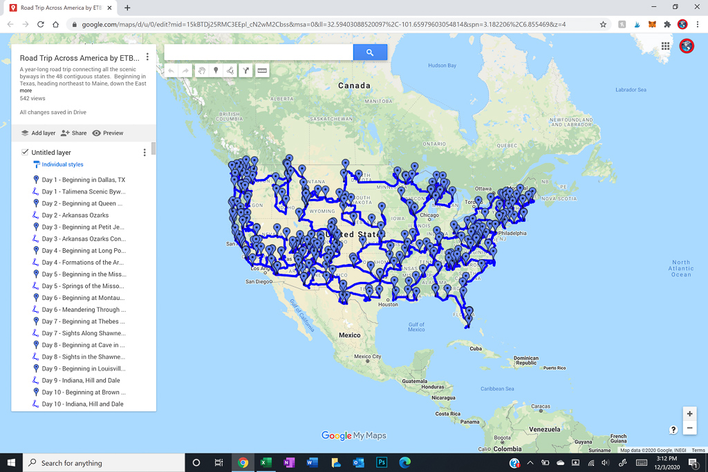
map of road trip along scenic byways across the USA

Day 255 – Idaho Heartland and Sawtooth Sampler

Day 255 of a Year Long Road Trip Along America’s Scenic Byways

After morning coffee with Sandy, I headed south to meet my friend, Kathryn.  An ex-colleague out of the Houston office turned doctor, that now lives in Boise.  We went for lunch at a local brewery and walked along the Boise River to the Boise Zoo. The giraffes were hiding.  I’m sad because I had my camera with me the whole time and forgot to take a picture!

After lunch I continued south to Shoshone Falls which were absolutely spectacular.  I was on information overload.  Each time I turned to look at a different portion, I noticed something new.  The Snake River tumbles 210 feet over numerous rock outcroppings.  I just loved it!

From the falls, I turned north up Highway 75 to end in Sun Valley for the night.  I got a great chicken stir fry at the Sun Valley Brewery which almost reminded me of Chef Wang’s at home.  An amber beer on tap and a little preseason football added to a relaxing evening.  ETB

Map of My Road Trip Across the USA

Learn more about my road trip across the USA, or click the link below for the interactive map.

Other Articles About Idaho You May Like

Best Adventure Travel Blog