World War II Sites on Peleliu, Palau

Today Bax picked us up at Carp Island “Resort”, and took us by boat to the Island of Peleliu to visit WWII sites and see leftover artifacts. On our way we spotted an ornate eagle ray. Jayden had never seen one and Bax had only seen one in the last five years. They were so excited over it!

We disembarked the boat and loaded into a small minivan, with the windows open to drum up a breeze. Our first stop on Peleliu was 1,000 Man Cave, part of the intricate cave system that the Japanese built and from which they defended the island. I mentioned in a previous post, the Japanese changed their defense tactics. Earlier in the war, they fought to protect the perimeter of the islands and soon as US forces landed on the beaches. In The Battle of Peleliu, they defended the island from its interior. The USA was unaware of this new strategy which resulted in significant casualties, but did educate the US forces for future battles in other areas.

Since the war, the 1,000 Man Cave was cleared of 582 explosive items of USA and Japanese origin including IEDs, mortars, grenades, anti personnel land mines, and projectiles. The cave was also cleared of human remains. We walked through a very small portion of it which is now home to whip spiders!

From 1,000 Man Cave, we moved on to visit a Sherman Tank which was located on private property. We followed a long drive way and short trail through the wooded area to find the tank on its side with the bottom blown out. The tank ran over a land mine after saving two navy airmen as it was returning to fire into the Japanese caves. Four men died…October 18, 1944.

After a short time walking around the tank and newly fallen tree from the typhoon in January, we went to the Imperial Japanese Navy’s Headquarters. Once an impressive, well fortified building, the remains of the two-story structure were crumbling. Bullet holes riddled the thick concrete walls and mangled rebar hung from the ceilings while the jungle has begun over taking the exterior.

Our next stop was to see a Japanese A tank, a smaller more maneuverable tank than the Sherman, but clearly not as safe. Then our driver then took us across the abandoned runway that was the biggest reason for fighting for control of Peleliu to see a Japanese Zero plane tucked in the jungle.

We continued on to what became known as Bloody Nose Ridge, where the deadliest part of the battle took place. The ridge, which was part of Umurbrogol Mountain and the highest part of the island, was well protected by Japanese cannons which made it difficult for the US LVT-A1s to penetrate. The Japanese retreated into their cave and tunnel system which included sliding steel doors and multiple entrances that were built on a slant to protect from grenades and flame throwers. One six-day battle in this area, resulted in the 1st Batalion, 1st Marines suffering 71% casualties. Captain Everett Pope and his company of 90 remaining men got trapped in the area, and had to fight with rock, knives, and empty ammunition boxes after they ran out of ammunition. They finally evacuated with 9 men.

The 5th and 7th Marines lost half their men as well over a month of battle. Army troops continued battling another month before the ridge was secured and the Japanese, posthumously declared Lieutenant General, Nakagawa committed suicide. We followed a mark path through the jungle toward the cave where he took his life. The sign by the path, instructed us to stay in the marked area, which was cleared of 4,822 explosive remnants, as the rest of the area had yet to be cleared. That’s one way to keep people from cutting the trail! The path was lined with old war relics…shovels, giant nails, cans and more.

After our walk, we stopped at the museum which was supposed to be open for us, but it was not. There was, however, a memorial outside the museum built by the Japanese. The granite slab used in the memorial was one of the tramway paving stones exposed to the atomic bomb blast in Hiroshima.

The plaque read: In our earnest hope for a new world order, we have had an image of a woman longing for eternal peace engraved on a total of 188 slabs collected from the streetcar track near Aioi Bridge, which was located 200 meters north of ground zero.

Learning lessons from the calamity we suffered and the sense of guilt we feel toward other nations concerned in World War II, we have pledged in our Constitution never again to conduct aggression toward foreign countries.

Also included in the memorial was a seven color cross which represented peace. Each individual color also had a meaning: Gold-mercy, Silver-peace, yellow-construction, black-solidity, red-love, white-purity, and blue-safety.

For lunch, we stopped at the Dolphin Bay Hotel, which was delightful! We all thought we should have stayed here last night instead of the Carp Island “Resort”, as we would have been treated to air-conditioning! We feasted on an enormous lunch including crab and vegetable tempura which was fantastic before we loaded into our minivan to head back to the dock.

On the way to meet Bax at the dock, we came across “Elvis’s” truck. We loaded onto the boat, and Bax took us on our last trip through the Rock Islands. We stopped at two snorkeling sites, IUS Cove and Belochel Bay to specifically see a Japanese Zero plane and to locate shrimpfish that swim upside down. Aside from those two sightings, there was nothing else to report of interest at these sites which was good since my camera broke!

From the snorkel sites, we toured through the bays of a few islands and stopped once more to see the banded sea snake rookery. This time we found one large female! Bax dropped Jayden and us at our starting point, Palau Pacific Resort, where we cleaned up and relaxed before going to our farewell dinner at the Taj for Indian food.

We enjoyed an awesome trip, in gorgeous country with fun people. Now I’m off to Asia for a few days before I head back to the states! ETB

Shop

Check out the photographic note cards and key chains at my shop.  Each card has a travel story associated with it.  20% of proceeds are donated to charity.


photographic note card, belize sunset
SERENITY
Best Adventure Travel Blog

Carp Island, Palau

The crew sent us on our way this morning. It was sad to say bye to them all, each with such a different personality, but all so nice. Wilter hardly said a word that many times he faded in the background, but he was a good fisherman and assistant chef. It was Hamilton’s first trip. He gave a great coconut show and could dive deep the one day he came snorkeling with us. Michael, was from Nigeria and always eager to help! Ludy was the head honcho and master chef. All of them seemed like masters of the ocean because they need fish to survive.

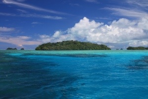
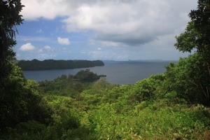
Bax took us by boat to two snorkel sites, Barnum Reef and Turtle Cove. A bunch of white tip reef sharks circled below, and we even spotted a few small black tips. I was blessed to see some squid which I haven’t seen in some time, so that was fun. We saw two more clown triggerfish which I really think are pretty, and a school of hundreds of goatfish. Of course, as the name of the reef suggests, several turtles hung around the reef…at least six! The green turtle had a prettier shell than the hawksbill.

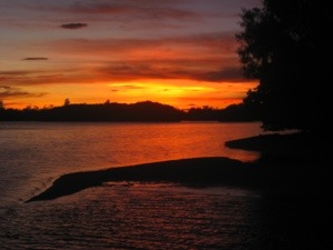
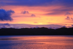
After our snorkel, we paddled to a small beach for lunch and then to Carp Island Resort where we rested for the afternoon. “Resort” was a bit liberal. Camp might be a better description with free-standing, unair-conditioned cabins with a connected bathroom accessible from an outside door. The open air lobby was like a sauna under the tin roof, so we ate our dinner at a covered picnic table while the sun set, which was quite pleasant, though I think we may have been better off camping after our expectations had been lifted to “Resort” level. I recognize many third world countries’ plumbing cannot accommodate toilet paper being flushed in the commode, but if resort is being used in the title then the ability to flush the TP should be a requirement! ETB

SHOP

For notecards and key chains, visit My Shop on this website.

Exploring the Rock Islands: Snorkeling the Best Dive Sites in the World

Boy did we ever have the storm of all storms last night! Rain, thunder, lightening…something rare for Palau. It did offer a nice breeze for the tents, which were relatively hot. Some people might say that relatively hot was an under statement as they were considering sleeping out on the beach or in a hammock like some of the crew. If I were assured I wouldn’t be eaten alive by ants and mosquitos, I may have slept under the stars as well, as they were magnificent. Interestingly, while Palau is in the Northern hemisphere, 4° above the equator, the North Star can’t be seen. Sailors navigate by the Southern Cross and moon. Since most of us had our tent flaps up, the crew came around at two in the morning during the monsoon and zipped us in. The crew is fantastic. They won’t let us carry anything…not even our day gear off the boat!

After our full breakfast of bacon, eggs, sausage, pancakes, fruit, juice and coffee, we set off for a full day of snorkeling, my dream and Ellen’s nightmare! Miraculously, the sun came out, a bright rainbow formed overhead and shortly thereafter we launched our boat. Three of us being divers were somewhat concerned about the wind and associated visibility or lack thereof because we were planning on snorkeling the number one dive site in the world! I was envious that I wasn’t diving it until I found out divers are attached into the reef with a grappling hook, so the current doesn’t sweep them away. I don’t know, I may still have to return to dive because some the snorkeling we did was superb, and all I could think of is what it would be like to be 40 feet lower!

20130502-101112.jpg

Our first stop was German Channel. We were hoping to see mantas, which wasn’t in the cards, but we saw a handful of large grey reef shark circle below schools of snapper and unicorn fish. We moved from the deep blue and sandy bottom area to the shallow reef and basked in the multitude of colorful fish. I spotted another pipefish which looks like a blend between a snake and a sea-horse. While I was busy snapping photos of moorish idol and a variety of butterfly fish that were somewhat cooperative for a change, I turned my head to the right for a second to glance at the channel and was surprised by a black tip reef shark six feet away. Once I got over my initial shock, I was excited that he hung around for a photo, passing in front of me, across the reef, and circling back to me again. Upon his third return; however, I thought, “Hmmm, I don’t know much about black tips…I dive in Nurse shark world…where are my snorkel mates?” He was harmless and probably just curious about my camera reflecting in the sun. It was fun to watch! Just before I got on the boat, I spotted a giant bump head wrasse that had to be 4 feet and weigh more than me and a turtle. I love the turtles…such a treat!

From the German Channel we motored over to German Wall. Here we saw puffers, goat fish, juvenile black and white snapper (another beautiful fish as a baby and ugly as an adult), a trumpetfish, and sweetlips. We saw these fish on multiple snorkels, but my photos came out the best at this location!

Our next stop was Big Drop Off named by Jacque Cousteau. None of the dive sites were very far apart. We could see if boats were at each location. Big Drop Off may have been my favorite snorkel of the whole trip so far. We started off on the shallow reef and immediately found the Clark’s anemonefish when we jumped off the boat. These aren’t in the Carribean, so it is a treat to see them. Throughout the dive there were more, and some were enormous for their species. We also spotted within the first minute a juvenile yellowtail coris…an inch long, red with big white dots. Jayden was excited to see this fish. He said he sees it once a year, and of course, the adult is not very pretty! Just a little bit further between the shallows of the reef and the sandy bottom, a moray wedged itself into its home. It stuck its head out about a foot to say hello every now and again. As we were crossing over to the “Big Drop Off”, which drops over 1,000 feet to the ocean floor, I spotted an octopus free-swimming! He passed by me and landed on a head of coral. He stayed on top of the coral until I waved Ellen and Gary over. Then he slid partially under the ledge, but never really camouflaged himself. He remained purple. Each time we backed away, he slowly inched up the coral ledge. It is such a treat to see the elusive octopus in the daytime!

Eventually, I made it to the drop off…sea fans and sponges grew on the wall while pyramid butterflyfish, a type we had yet to see, schooled around the reef’s edge. The pink tail triggerfish and clown triggerfish were also new to see (and favorites of mine). The yellow masked angelfish was gorgeous. The bi-color parrot fish feeding frenzy was crazy. The school of parrot fish were rapid swimming from coral to coral attacking it like a starving dog with raw meat. The quick, darting wrasse finally got caught by my camera lens!

We took a break after three snorkels and ate lunch on the boat at our next snorkel spot Fairyland. We could not land on the nearby beaches, as they were protected. The coral reefs at Fairyland were magnificent, with cuts in and out for divers to weave around. I was really wishing for a BC, tank, and regulator, and we hadn’t even made it to the world’s best dive site yet! We saw another enormous bumphead wrasse, though my picture makes it look much smaller than 300 pounds. These fish begin as colorful females and convert to green males as they mature. We saw some more butterflyfish, more Titan triggers, another clown trigger, and a conch. The arc-eye hawkeye seemed to catch my attention. He seemed lethargic, laying on the coral, and I thought he might not moved if I dove underwater to take his picture…I was correct!

I just realized anyone reading my blog today that isn’t interested in fish must be incredibly BORED! I am just loving the snorkeling here because most of my diving, aside from the Red Sea and Australia, has been in the Caribbean, so while we see the same types of fish, the colorful markings on many are very different.

We continued on to the number one dive site in the world, Blue Corner. Due to the depth, I’d say it’s a better dive site than snorkel spot because I couldn’t get very good pictures! Regardless, the variety of all the sites we’ve been to have been spectacular from the corals and sponges of the inner lagoons, to the colorful fish on the outer reefs, to the sharks and schools of big fish at Blue Corner. I snapped a photo of spade fish, sweetlips, and a turtle over the top of the reef before making my way to the corner which was about 75 feet deep. The white tips and grey reef sharks circled around 45 feet. I counted as many as six at once. The schools of snapper, trevally, and barracuda were much closer to the surface. The corner was a haven for the big fish, especially the shark, due to the current because it gives them a chance to sleep and fall to the bottom before the have to swim again.

Our final stop of the day was the Blue Hole/Blue Corner site which is basically the Blue Hole and the other side of Blue Corner from a different direction due to the currents. There are four holes. Three are in a row and connected by a tunnel 45 feet below the surface. Divers bubbles from their tanks were filtering up through the coral hours after they had been there. The first and second hole were connected by a 15 foot arch. Bruce, Jayden, and Hamilton free dove down through the tunnel. I wasn’t sure I could make it, especially given it was our sixth snorkel of the day, so I skipped out. We saw another turtle, a few white tips, a school of Titan triggers, a school of golden trevally that look silver in the daytime but gold at night, a school of sweetlips, and two palette surgeonfish (like Dori). It was the first time for Jayden to see palette surgeonfish at Blue Hole/Blue Corner. Many times it isn’t possible to snorkel Blue Hole because of the waves that crash over the reef, so we had a lucky day with the weather, visibility, and the currents. With the half-moon, we were dealing with slack tide which makes them switch around a bit, but they seemed to work in our favor to see fish today!

Bax took us back to our camp at Jackson’s Beach. We freshened up beneath our sun shower and enjoyed a drink on the beach while chatting. Bruce, from the Virginia area, owned a chain of laundromats which he sold over five years ago. He sold his string of Polo ponies too, so he could spend time traveling. He’s a strong paddler and swimmer, and has a high curiosity. Karen, a nurse from Florida, also loves traveling. She tracks the number of countries she has visited. She tells us there are 196 countries recognized by the UN. I think Palau was her 48th country. Just a layover in an airport doesn’t count, and all the islands that are territories of a larger nation like France or Denmark only count as those countries. Apparently, lots of people track this. I never have. Sonja is a German geneticist who lives in the New York area. Interestingly, she specializes in horse genetics and by looking at the confirmation of the horse, can predict a horse’s ability. It was a little weird to be in a group of six with three of having been or currently are heavily involved in horses. Sonja and I knew some of the same people in the hunter/jumper world!

After enjoying a drink on the beach and the sunset, we were called to dinner by the conch shell horn. Ludy and Wilter had prepared a Palaun BBQ for us! As usual it was a feast: corn, beef and pork stir fry, ribs, chicken, rice, peanut cabbage salad, and more. In addition, some of the boys went fishing for us and brought back fresh sushi! It was a fantastic send off dinner, as we will be waving “bye” to Ludy, Michael, Wilter, and Hamilton tomorrow when Jayden and Bax take us away in the boat. ETB

SHOP

For notecards and key chains, visit My Shop on this website.

Exploring the Rock Islands: Jellyfish Lake and Giant Clam Beach

This has been a game of careful what you wish for…no rain and LOTS OF SUN…it was a hot day, but also a fascinating day! We started out with a boat ride to Jellyfish Lake, one of the coolest places I’ve ever been. We hiked up some rocky stairs made for giants, over the top of a hill, and back down onto a dock where we jumped in for a snorkel. Depending on the direction of the sun, the jellyfish are usually concentrated on one side of the lake or the other. This morning they had already made their pulsating swim to the east. Jellyfish instinctively avoid shadows, and By migrating to the east with the sunrise, the jellyfish stop at the shadows extending across the lake before reaching the edge where white sea anemones await to feed on them, thus keeping them safe from their predators. By the dock, where we jumped in, there were hardly any. As we swam the half kilometer toward the weather station, used to monitor the conditions of the lake, the concentration increased. Soon, we were swarmed by millions, no exaggeration, of “non-stinging” Golden Jellyfish. It is estimated that there are over 5 million Golden Jellyfish in the lake whose population was completely destroyed in 1998 due to an El Niño weather event that increased the lake’s temperature by several degrees. The population, however, returned in 2001 and is back to its pre-1998 levels. Technically, the jellyfish do have stingers, but the sting is so light, it isn’t harmful to humans, and it is generally only felt in sensitive areas. We softly touched them and tried not to kick much because the fins cut them in half. We had to get used to their slimy touch at first, but after a few squirms and uncontrolled jerks, we just stopped in the midst of them, held them and watched them rotate counter-clockwise toward the surface seeking the sun.

The algae on the jellies converts sunlight into food which creates energy for both the algae and its host. In the afternoon, the jellies migrate to the west, again to meet the shadows before reaching the edge of the lake where the anemones lurk. At night-time, the jellies swim up and down reaching depths of 15-17 meters. At such depths, the lake is red with bacteria where the algae gets its nutrients. The jellies avoid the lake’s bottom layer which contains no oxygen and has high concentrations of hydrogen sulfide…highly poisonous to humans, fish, and jellyfish…thus no diving is allowed in the lake. This permanent stratification in the lake, between the oxygenated upper layer and anoxic lower layer is extremely rare. There are only 200 lakes in the world that have been identified with such characteristics and most of them are freshwater. There are, however, eleven permanently stratified lakes in Palau which require three conditions to keep the water from mixing vertically: rock walls and trees to block the wind, sources of water (rain and tidal flows through tunnels) to be at the surface, and the small seasonal temperature changes of the tropics. Jellyfish Lake is one of only two habitats in the world with “non-stinging” jellyfish. We were lucky to have the lake to ourselves for about thirty minutes before a mob of tourists came poring in.

20130501-212541.jpg

Jellyfish Lake Video: http://www.youtube.com/watch?v=i5o5IfMnfnw

After Jellyfish Lake, we paddled a short distance to see the Yap stone money, the largest currency in the world. They carved the money into a donut shape out of crystal calcite quarried from Palau and only stopped carving the money around 100 years ago. If a stone cracked while it was carved or transported, it was considered worthless and left behind. It wasn’t even used to carve smaller pieces of money from it, as it was considered bad luck. The stone money, while a fixed supply, is still in use today. The value of the stone is determined by its size, the loss of life associated with transporting the stone, the tools used to carve the piece (shells or newer metal), and if the stone was dedicated to a chief. The stone money is used to buy land, to tender apologies, and even to buy friends and wives, as well as everything else in between. Since the stone money is difficult to move, it stays where it currently resides (generally outside), and any shift in ownership is completed publicly in front of the chief and elders, so that community knows who owns each stone. These large pieces, despite sometimes being worth several hundred thousand dollars, are never stolen between villages as this is considered very bad. We were able to see the Yap stone money in Palau because it cracked and was left behind.

From the Yap stone money, we paddled between the Rock Islands and through the channels without much protection from the sun. As such, we ditched our planned lunch spot for the choice of closer beach which we name, Desperation Beach. Surprisingly, the sun wasn’t bothering me as much as it was bothering some of the other southerners, but perhaps I was just happy to be out of the Denver snow and the Palau rain! And the light highlighted one of my favorite things: the multi-shades of blues in the island lagoons…simply glorious!

After our lunch on the beach, Bax picked us up in the boat and took us to three snorkel sites…Rainbow Reef, Giant Clam Reef, and Wonder Channel. The fish at Rainbow Reef clearly used to be fed as the wrasse and needlefish would swim up to our masks and circle around us. I stuck my hand out, and a wrasse bit me! The Giant Clam Reef was aptly named. It was home to four feet long clams, weighing 300 hundred pounds. They can get as large as 800 pounds. All the snorkels were nice, but with the tide a little high, the water slightly choppy, and the coral damaged from the January typhoon, marine photography conditions were not the finest.

We loaded back on the boat and were transported to Pirates Cove, via Kingfisher Arch, where we paddled around the placid waters and limboed under another tunnel to Hidden Lake. Finally we made our way toward our new campsite, waving at the guy from Liberal, Kansas who moored his catamaran in the protection of the Rock Islands, before we paddled across the open water to Jackson’s Beach…another great spot for camp! ETB

SHOP

For notecards and key chains, visit My Shop on this website.

Exploring the Rock Islands: Milky Way and Einstein’s Gardens

The tents were spread out along the sweeping sandy beach that looked out onto calm, turquoise water protected by reef to the left which was home to WWII Japanese Zero airplane. A young 19 year old pilot safely landed it on the reef as opposed to crashing the plane Kamikaze style, as they were taught.

The staff had a nice tin roof shelter supported with Kelly green painted wood for cooking and storing our supplies. A few large picnic tables were scattered about the beach and the bathrooms were built up on large cement bases. The Survivor Island contestants were living right compared to our first camp.

Torrential rains blew in right at departure time so we waited a little while before leaving on our paddle. Once the rain slowed to a drizzle, we loaded our kayaks and paddled in “rougher” seas to a channel called the Milky Way. The bottom of the channel is almost a soft clay like substance that is used in beauty treatments. Jayden dove to the bottom multiple times and filled up a plastic pan with the mud so we could all rub it on our bodies. Not everyone in our group were willing participants, but Bruce now has a wrinkle free shin, Sonja and Karen have smoother faces, and I should have a youthful front-side!

We just beat the tourist boats to the Milky Way. As we paddled out the back side of the channel and across the open water, one boat was on its way in. I’m glad we had the place to ourselves. It was so tranquil. From the Milky Way we continued on to Einstein’s Gardens for a snorkel, but not before we stopped to check out a pitcher plant which eats insects by trapping its prey in a deep cavity filled with liquid. We snorkeled Einstein’s Coral Garden and Newton’s Wall. The tide was high and the water was a bit murky and cold in places where the marine lake water filtered in with the bay through the pores of the limestone. It was not the best for picture taking, though we did see some amazing coral and even a turtle.

After our snorkel, we paddled through the inner lagoons, between some Rock Islands and then rode some breakers into a small beach for lunch where we saw an old megapode nest. It looks like a large pile of leaves. There was also a small lagoon at this resting spot, though we didn’t do much venturing. We sat on our kayaks under the protection of a tree and tried to stay out of the rain which was relentless.

After lunch, we paddled back out across the waves for a brief minute before cutting between the Rock Islands into the protected coves, though we did contend with the wind quite frequently today. We were supposed to snorkel the other side of the reef we were on this morning, Darwin’s Coral Wall, but without the sunlight, the group made an executive decision to keep paddling toward camp; of course, not without detouring through another tunnel into another marine lake. This time we did the kayak limbo into Secret Lake. We paddled around, saw a few jellyfish…bigger than the ones in Disney Lake…dipped our hands in the water and determined it was way too cold to snorkel…and kayak limboed back out.

We had a pretty long paddle against the wind back to camp, and we were all ready to sit in the dining tent just to dry off. Everyone in the group cleaned up except me. I figured the sun shower couldn’t be too warm, since the sun hadn’t been out yet today, and if the sun did come out there was a chance we could go snorkeling again. I knew if I cleaned up like everyone else, I wouldn’t want to go.

Lucky for me, it cleared up, so Bax the boat captain took me and Jayden back to Einstein’s Gardens. This time we snorkeled Darwin’s Coral Wall and later we snorkeled Einstein’s Coral Garden and Newton’s Wall again. It was incredible! I’ve noticed the fish are very shy in certain areas because they are hunted by spear fishermen, rightfully so, as the Palauns live off the ocean. Having said that, other reefs are protected, but it is amazing to see the difference and how fast the fish swim away and hide. With just Jayden and I, it was much easier to see fish and get pictures. We saw all sorts of creatures…sea cucumbers feeding on a sponge, razor coral feeding on each other, sea squirts which are nearly translucent, pincushion starfish, brain coral of all colors. Some of the brain coral was colonizing so it was pushing a piece out. The piece falls off and starts growing a new colony. The juvenile spadefish with a fluorescent orange stripe leading from its mouth to dorsal fin was breathtaking. As an adult these are silver and black. The Clark’s Anemonefish guarded its home with gusto, always turning its head toward me ready to charge the camera if necessary. The lettuce coral was enormous, probably 500 years old. The Pajama Cardinalfish, yellow in the front and red polka a dot in the back with a black vertical stripe down its center were peppered everywhere in the stag horn coral. Measuring a few inches, they seemed to be bigger than the others we had seen too! The Pennant Bannerfish still alluded my camera…it is a challenge to snorkel and shoot. To really keep the blue shade of the water out of the shot, the fish has to be only a few feet from the camera and with only a 3x zoom that is a whipping while contending with current, choppy surface water, and fish darting around. And on sunny days, forget seeing the fish in the viewfinder, just point the camera toward its location and hope. I took underwater photography while diving for granted…it’s so much easier while floating in a BC! I couldn’t count how many pictures I’ve deleted. Thank goodness digital. The highlight of the snorkel may have been the octopus. They don’t usually come out during the daytime. It was crawling along the coral and sucked itself underneath the ledge and changed from purple to white as it tried to camouflage itself like the sandy bottom. Each time we backed away, it would slowly poke its head out. Jayden would dive down for a photo and about half-way there, the octopus would tuck back under the ledge. I was entertained because I wasn’t bothering with diving down thirty feet for picture! It was turning dusk, and Jayden suggested we swim back to the boat via the middle of the lagoon, not the edges because the crocs come out at night…that got my heart beating fast. The saying, “You only have to run faster than one hiker when you see a bear” was not going to work for me. I was definitely the slowest swimmer between Jayden and me, and would be a tasty dinner to the croc!

Obviously, I’m here to report we made it safely back to camp for, of course, another outstanding meal. Each meal includes a seafood, chicken, and a meat along with rice and a vegetable and a dessert. Of course, we try everything. Despite all this exercise, I bet I’m gaining weight. I’ve been eating like a horse! ETB

SHOP

For notecards and key chains, visit My Shop on this website.

Exploring the Rock Islands: Long Lake and Honeymoon Beach

After another full breakfast (there is no shortage of food), the crew of Michael, Wilter, and Hamilton, loaded our kayaks onto the boat, and Bax transported us to our paddling disembarkation at Long Lake. Long Lake is the longest lake in Palau, a mile long. It was a very rainy start to our morning, and the rain drops which were quite cooling required most of us to wear a rain coat simply for warmth.

We paddled the mangroves of Long Lake, weaving through narrow areas and then coming out into open expanses. We tried to spot some eagle rays, but we were unsuccessful. We did see a lovely fish poisoning tree flower. Lazy fisherman can smash the seed of the flower with a volcanic rock and drop it into the water. It takes away the oxygen from the nearby fish.

After a few hours of paddling, definitely not at blazing speed, we retraced our path and stopped at a small beach for lunch. The locals sometimes use this beach, so it was equipped with a water tank, shelter, and a BBQ pit. Jayden and Bruce started a fire.

There was not a dry part on our body and our hands were shriveled like we’d been in the bathtub for hours. Fortunately, the rain stopped in time for us to nibble on our sandwiches and scour the sandbar for shells. We aren’t allowed to take the shells with us, and I’m not much of a shell person anyway, but it gave me something to do while we were resting and there was quite a variety.

Bax picked us up and took us to two snorkeling spots, Fantasy Island and Honeymoon Beach. From the boat we saw a turtle, and under water was another delight. The reefs changed so much in such a small area. In some places, the coral was dead from the recent typhoon and from the crown of thorns starfish the locals pick off the reefs and kill in order to save the coral. It’s too bad the crown of thorns starfish are so damaging because they are pretty…a variety of color and designs with “thorns” protruding out. I also saw a pipefish, regal angelfish, a bi-color angel for the first time, a giant lobster, a giant puffer, lots of chromis, grouper and the list goes on.

Box waited for us with the boat and took us back to “Survivor Island” camp or Margie’s Beach. I walked to beach and checked out the American Dive Bomber from WWII and found a fresh piece of coral that had broken off a barrel. It was multi-color blue and green…so pretty. We enjoyed an absolutely magnificent sunset that changed an array of colors…oranges, pinks, purples. The sky reflected orange in the tranquil waters and everyone ran to get their cameras…definitely a picturesque moment. A little bit later…another gourmet dinner was served! ETB

Exploring the Rock Islands: Risong Bay Area

It was a warm night of camping, and I think most of us were awake before the sun even rose. Ludy called us to breakfast with a conch shell. It sounded like a fog horn. We feasted on sunny side up eggs, bacon, sausage, bagels, and fruit.

Our first activity of the day was snorkeling Ngel Channel. The tide and wind were high and going in opposite directions, so it ended up being a bit choppy and not our most favorite one, though of course there were many colorful fish and a few more species I had never seen having done most diving In the Caribbean. The large Pacific Blue Starfish that dotted the reef were magnificent.

We took the boat back to the beach and went on an amazing paddling excursion through the choppy exposed waters by our camp until we rounded the corner into a placid, beryl bay. We cut between islands and weaved between mangroves until we reached the sapphire waters of Black Tip Lake which is a nursery for black tip reef sharks in July. We didn’t spot any today, but instead paddled into a cave and later the adventurous squeezed under a limestone tunnel again. This time, the adventurous included only me, as there was a way around the tunnel and the last tunnel had several things dangling about half an inch away from our face which was not appealing. This time there was a little more space!

After our paddle, Karen (one of the guests – a nurse from Florida), Jayden our guide, and I took a snorkel just off the beach from our campsite at Blue Devil Garden. It was a much better swim. We saw two large lionfish, some beautiful giant sea cucumbers, shells, and tons of juveniles.

Upon return to camp, lunch was served and afterward we enjoyed a coconut show. Hamilton climbed a palm tree picked eight coconuts, and husked them on a stake he sharpened with a machete. Ellen and I tried husking one, and it was hard! Hamilton made it look easy. It was not a task to try in the Amazing Race.

The tide goes out until around three in the afternoon. It was time for us to paddle again. We followed the shade of the shoreline in search of sea snakes and other critters as we admired the ferns hanging overhead until we reached Shipwreck Bay. The center of the bay was very brown in color from the tannin from decomposing leaves that gets trapped in the area due to the low current. It was the first bay we’ve seen with brown water. The bay was named for a Japanese Lifter Ship that was sunk during WWII. Another lifter ship, which commonly carries medical supplies, didn’t even make into the bay before it was sunk.

In addition to seeing the ship, we saw upside down jellyfish. This is their actual name. They lie on the floor of the sandy bottom acting like an anemone and await their prey. As we paddled out of the bay, we passed by an oyster rock that was home to a few chiton that create the scallop formations in the limestone. Along with the tides, these prehistoric looking animals help erode the limestone, creating the large undercuts in the islands.

We followed the scalloped rock ledges of the Rock Islands, of which there are 300, into the turquoise waters of Kingfisher Bay and finally ended our paddle in Mandarin Fish Bay to see a “salt-water waterfall”, according to the brochure. It was more like a babbling brook. A marine lake drains into the bay and vice versa depending on which way the tide is flowing.

I expected the “salt-water waterfall” to be the highlight, but the best part about Mandarin Fish Bay was the snorkeling. It was fantastic! The turquoise oasis didn’t have a surface ripple in the water and was home to the endemic Mandarin fish that reminded me of a harlequin clown with its pattern and colors…a dark red body with blue and green swirls. The Mandarin Fish was the size of my pinky and hid in coral. Jayden pointed out the first two to me before I figured out how to spot them. I ended up being the only person in our group to see them. In addition to the Mandarin Fish, we were blessed to see several Pajama Cardinalfish which have now become my favorite. I love that half the fish is polka-dot…I love the black stripe that cuts its body in half…and I love its size and shape! Another pleasant surprise were seeing the yellow gobies on the sandy bottom guarding their hole dug by their blind, companion shrimp that was busy coming in and out of its home. I could go on and on about the fish here, but those were the highlights.

After our snorkel we paddled back to camp, enjoyed dinner, and prepared to move camps for the next two days. Apparently we will be camping where The Survivor Palau tribal council was held. Until tomorrow…ETB

SHOP

For notecards and key chains, visit My Shop on this website.

Exploring the Rock Islands: Nikko Bay

We enjoyed another amazing breakfast buffet at the hotel. It’s amazing how excited we got over seeing what would be offered…vegetable of the day, a soup, beans, hashbrowns, pancakes, a variety of breads, eggs, noodles to order…the list goes on. Today’s breakfast was of Korean influence!

From the hotel we were shuttled by van to our kayaks, where we began our expedition in Nikko Bay. We launched our kayaks into the teal waters and followed the edges of the tree covered islands for as much shade as the emerald beauties offered in the early morning as the sun shined above.

It wasn’t long before a short shower, only a few minutes, sprayed us with welcomed cold drops. Jayden, our guide, suggested we might hide out in the cave where we inspected booger algae, aptly named, but we happily paddled around the small bay, beneath the over hanging trees, and admired the national flower of Palau, the Rur flower from the Rock Islands, before the shower abruptly ended just as quickly as it visited.

We continued following the contours of the Rock Islands in and out of small inlets and bays while we peered into the crystal clear water spotting a carriage and firing pin from a WWII Japanese cannon and seeked out caves, one where the President of Palau hid during the war.

After an hour or two in the kayak, we geared up for our first snorkel. Donned in our mask, fins, and snorkel we scoured Lettuce Coral Wall for all kinds of critters. We were blessed to see beautiful coral, a variety of butterfly fish including the 8 banded, the Pajama Cardinalfish, and of course multiple clams. Ellen, who doesn’t particularly care for snorkeling, wondered what I was diving down to take a picture of so many times. It was the Pajama Cardinalfish. I had never seen one, and it was so cool…yellow head, a black stripe down its middle, and a red polka-dot tail. The way the sun was reflecting in my view finder; however, I never could see what I was taking a picture of once I took a deep breath and dove. Needless, to say the pictures were not spectacular. In the meantime, Ellen noticed something blue and wanted to know what it was. I replied, “it’s a clam…watch…if you move your hand above them they will close up.” That turned out to be her game for the rest of the snorkeling session.

After snorkeling, we kayaked across the bay to our lunch spot at a Japanese Pill Box Island. We used a wooden ladder to get from the water to the land and then climbed a razor-sharp, rocky and slippery trail to a water cistern and bunker. Sonja, who was German and as a small child had to hide in bunkers during WWII, didn’t find the bunker too fascinating. It was, however, shocking to learn how much the Rock Islands of Palau were used in the war. The Japanese fortified the island to protect a nearby ship harbor from the Americans, though the Americans never came through this channel. The men manning the island were also armed with an ammunition bunker, fuel tanks, and beer bottles for Molotov cocktails. The bottles, marked with different lettering, depending on the year it was made, were littered all over the area. Amazingly, from the water, despite knowing the location of the walls and concrete bunker, all I could spot at the top of the island were trees!!

After lunch, we kayaked beneath the shelf ledges to Disney Bay where we performed the kayak limbo through a limestone tunnel into Disney Lake. The edges of the lake were lined in coral while the middle was somewhat murky for Palau standards. This was due to damaged coral that had fallen to the middle of the forty-foot deep lake caused by a typhoon in January. We snorkeled the edges of the marine lagoon while Regal Angel Fish and a variety of other fish flitted between the corals. Ellen opted to sit this snorkel out and her game for the afternoon was to stir the pot for the moon jellyfish, which only deliver a light sting, that floated on the surface near the center of the lake.

Our final stop before returning to camp was Cathedral Cave. What a gorgeous place. Just before the entrance, the water barely covers a reef and then drops to a deep Cobalt blue as the cave opens up with stalactites and bats hanging above. The locals seemed to enjoy this cave too, as they were cooking up their fresh catch on their boat just outside the entrance.

We took a circuitous route back to camp so we could see a B24 wing. At high tide it was submerged underwater, but at low tide it was out for us to see. The tide differential here is quite dramatic. The sites we see, many times are dependent on the tide. We could hardly get into Disney Lake earlier today, but when we left, we had plenty of room to fit in the tunnel…though it still required being able to limbo.

20130501-111011.jpg

The camp was at Lee Marvin Beach. The kitchen and bathroom structures were permanent, made of wood and palm leaves. The toilet had a cement floor with a wood box and toilet seat mounted on top…primitive, but I’ve camped more primitively in the states for sure! We each had our own tent and the dining tent was large enough to seat ten! Ludy made us a fabulous meal which included fish, beef, chicken, rice, and a bean salad. The crew, Hamilton, Michael, Bax (the boat captain), and Wilter all come around and serve us off platters. For dessert, we had chocolate cake for my birthday and everyone associated with the trip signed a birthday card! It was a great ending to an amazing day exploring portions of the Rock Islands. ETB

SHOP

For notecards and key chains, visit My Shop on this website.

Boating Around Ulong Island, Palau

We started our day with another amazing breakfast buffet. The Asian food was a more Korean flare….noodles in sauce and dim sai. Of course, I also had to try the Sausab Fruit. It was the consistency of a banana and a pine-apple with a sour taste.

Our guide, Jayden,with Bax the boat captain and Hamilton took us on a cruise through Tarzan Bay. We saw so many interesting sites. Our first stop was a WWII canon. Who knew the Rock Islands of Palau were a strategic battling ground in the war? I didn’t…but then again I’m not much of a history buff. The Japanese, after they gained control of them from Germany as a result of WWI in 1914, were given a League of Nations Class C mandate. As such, Koror became a mini Tokyo to the Japanese as they pushed economic development and built schools and hospitals. Japanese immigrated to the islands, outnumbering the locals two to one in the 1920’s. In the 1930’s, Japan began fortifying the islands with bunkers, intricate cave systems, and airstrips, viewing them as unsinkable aircraft carriers.

20130501-094128.jpg

During the Pacific War and WWII, Palau (in particular the island of Peleliu) became a battle ground between the USA and Japan. As part General MacArthur’s strategy to take over the Philippines, invade Okinawa, and ultimately the mainland of Japan, it was determined the USA needed to control Peleliu and its airstrip. It was thought it would only take four days to takeover Peleliu; however, due to a change in defense tactics by the Japanese the battle took two months in the fall of 1944 for the USA to win. It was the deadliest battle in the Pacific…the USA suffered 9,800 casualties while the Japanese lost 13,000. The battle was also highly controversial after the island wasn’t ultimately needed to support later attacks on Japan.

Not far from the canon, was a banded sea snake rookery. Technically, it is not a sea snake, and is sometimes called a krait, because it leaves the water to nest. We only found one small male resting on the rocks, all the rest were out fishing as we were approaching a new moon. Normally, the nesting area is so populated with snakes, that we couldn’t have disembarked the boat like we did. I would have been bummed not to see one, so I’m glad we did, but as Jayden pointed out we will get a chance to see them in the water! The snakes are extremely poisonous (deadly), and there is no anti-venom, so hopefully I won’t swim into one, though they seem shy.

20130501-094553.jpg

From the rookery we glided across the aqua waters past some WWII bunkers to our first snorkeling spot at Fish Bowl Reef. Here we saw countless butterfly fish, moorish idol, clown fish, wrasse and a swimming sea snake! The krait was on the surface, and then it dove down to the sandy bottom…so cool.

After our snorkel, we weaved throughout the shallow bays of the Rock Islands looking for salt water crocs, admiring the White Tail Tropic Bird, Collared Kingfisher, and sea turtles before swinging by Ulong Arch and finally landing on Activity Beach on Ulong Island for lunch. We enjoyed a traditional Palaun lunch basket loaded with food…crab, chicken, spinach patties, sliced taro, sliced sweet potato, almond nuts, coconut candies and more while we learned about the first settlers of Palau.

It is thought Palau was settled by the Austronesian (western Malayo-Polynesian) speaking groups from the Philippines. The winds and currents near the equator in the Pacific pushed their boats to the Rock Islands of Palau by chance. They then migrated to larger of island of Babeldaob. After our brief history lesson, we took a short walk to the lower part of a terraced ancient village and looked at old pottery and shell remnants used for water and spears respectively.

We were surprised by a few unexpected rats….gross…but we also saw the endemic Megapode, a chicken-like bird. The megapode builds its nest, a large mound of sand and compost on the ground and buries its eggs in the mound. It regulates the heat of the mound by removing or adding debris in order to incubate its eggs, as it does not use its own body heat like other birds. They are shy creatures, and scatter as soon as anyone comes nearby (thus no picture).

Before leaving the island, another short walk along the beach took us past the wing of a Japanese Jake plane to a monument built for Wilson, an English sailor who shipwrecked on Ulong in 1783. He was the first to make friendly contact with the natives, and eventually took the King of Palau’s son, Prince Lee Boo, to England. He is credited with naming the archipelago, the Pelew Islands.

After lunch we trolled past some rock pictographs and the famous Natural Arch of Palau. We also visited a small Rock Island where a piece of the limestone had recently calved. Yes, it happens to rock too, not just ice. Limestone is porous and tree roots grow through the rock in search for water. Eventually the rock breaks off into the water.

Our final stop before returning back to the resort for the day was Soft Coral Arch. We swam with the current back and forth beneath the arch to admire all the colorful soft corals.

We ended the day with a nice dinner, including native dancing entertainment and cheese ice cream, at the resort with our group. We are looking forward to our camping and kayaking expedition tomorrow! ETB

SHOP

For notecards and key chains, visit My Shop on this website.