mackinac island historic downtown

Day 222 – The Scenic Sunrise Shore

Day 222 of Year Long Road Trip Along America’s Scenic Byways

This morning Petey and I began our tour along Michigan’s Sunrise Shore. Our day started in Mackinaw City where we boarded the 8:30 ferry to Mackinac (Mak-in-aw) Island.  The double-decker catamaran whisked us across Lake Huron in 18 minutes or less on a calm, clear day. 

Mackinac Island

We disembarked into a land of pedestrians, cyclists, and horse drawn carriages…no cars are allowed.  Even the island’s garbage truck is a giant wood cart pulled by horses.  For a brief moment I thought what a nice way to live…no noise, no exhaust fumes, and naturally exercising to get around.  Then I thought of the snow, the rain, and running late. I wander what the islanders do, especially in the winter.  Perhaps snow mobiles are allowed.

ON THE ROAD AGAIN!
mackinaw bridge

Day 221 – Upper Peninsula Drive – Part 3

Day 221 of Year Long Road Trip Along America’s Scenic Byways

Tahquamenon Falls State Park

Well, I thought I did a lot today, but looking back at my pictures I don’t have much to show for my activities, at least in quantity.  We started the morning visiting the Upper Falls in Tahquamenon Falls State Park. The Upper Falls are in a different area of the park from the campgrounds and may be reached by hiking a long trail or by taking a lift from VANilla. 

The roundtrip walk was a bit long for my old mutt, Petey, so I steered VANilla to the Upper Falls parking lot where we took a more reasonable stroll to the falls along a paved pathway and down 94 grated, metal stairs that Petey hated!  He had his choice, wait in VANilla or maneuver the stairs. He hates being left alone more.

The Upper Falls is often called the little Niagara as 50,000 gallons of water per second rush over a sandstone ledge in a copper-hued arc.  The volume of water that tumbles over the falls is second to Niagara Falls in the eastern United States.  While the falls were beautiful, I couldn’t help but think how magnificent they’d look in the autumn with the changing leaves. In fact, I’ve entertained that thought quite a bit while being on the north shore of Minnesota and in Michigan’s Upper Peninsula over the last week. I may have to revisit this area in the future!

Soo Locks

After visiting the falls, we turned north to Sault Ste. Marie, Michigan’s oldest city, to see the Soo Locks where freighters squeeze through one of the longest, busiest canal locks in the world.  I watched a Canadian ship go through, but my view was poor at best.  Given I had an excellent view of this procedure in New York last September, I didn’t snap any photos as it would have just looked like a freighter in the water.

The Gangplank in St. Ignace

Instead of driving one more mile north to Canada, I remained in Michigan’s Upper Penninsula, turned south, and headed toward St. Ignace. Intermittent showers gave VANilla a few washes while I took the afternoon to rest and blog.  I’m not sure why I was so wiped out.  Perhaps it was due to a week’s worth of sleepless eighty degree nights. 

In St. Ignace, I went to dinner at The Gangplank, where  I ordered fried cheese curds and whitefish tacos at the counter window before plopping down at the picnic table with a view of Lake Huron.  Nick and Nikki, the couple I met in Wisconsin, suggested I try fried cheese curds, and they didn’t steer me wrong. They were great!  As were the fish tacos topped with vinegar coleslaw and pico de gallo.

Mackinaw Bridge

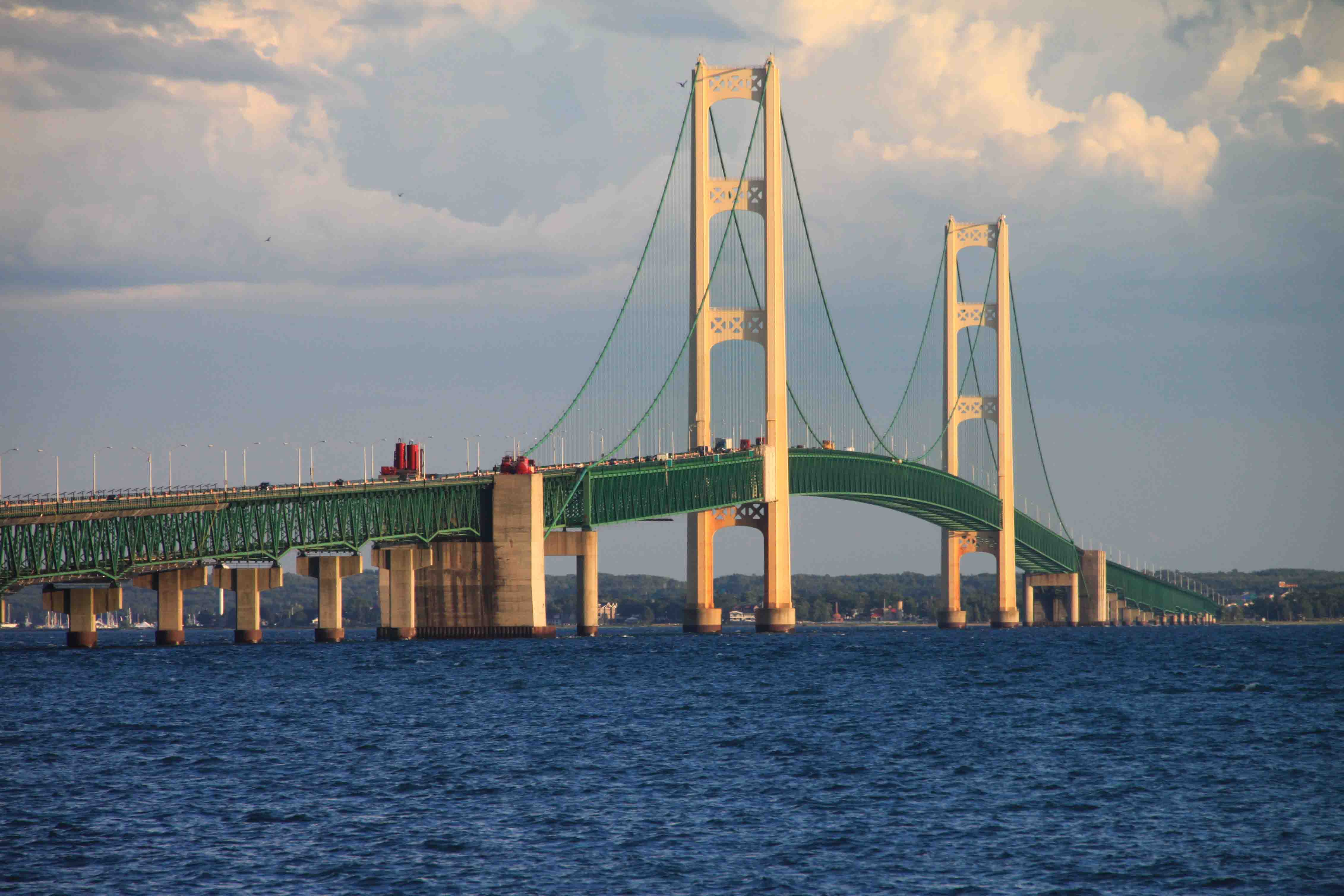
After dinner I stopped at the viewing area on the north side of Mackinaw Bridge just as the sky behind me was filling with dark, storm clouds.  Some almost looked like roll clouds.  I snapped a handful of photos from the north side of the bridge, paid the $3.50 toll, and raced across the metal grated, middle lane to Mackinaw City in order to capture the bridge with the clouds to its west side.

By the time I parked and walked to Lake Huron’s shore on the east side of the bridge, the clouds had almost reached the shore of Lake Michigan on the west side of the bridge. The storm was coming in fast as the sun set and the waves churned in the two Great Lakes.

While I wondered if I should prepare for a tornado, many pedestrians seemed oblivious to the approaching weather and went about exploring the lighthouse and Lake Huron’s shores in the city park.  Once a few big rain drops landed on target, I hopped in VANilla and headed for the Walmart in Cheboygan for the night.  I loved to say that word…Cheboygan.  Perhaps I should have stuck around a bit longer…the view from my side-view mirror of the peppermint colored clouds was fantastic!  ETB

Map of My Road Trip Across the USA

Learn more about my road trip across the USA, or click the link below for the interactive map.

map of road trip along scenic byways across the USA

Interactive Map of Road Trip Across the USA

Other Articles on Michigan You May Like

Best Adventure Travel Blog

tahquanmenon lower falls

Day 220 – Upper Peninsula Drive – Part 2

Day 220 of Year Long Road Trip Along America’s Scenic Byways

This morning I investigated another portion of Pictured Rocks National Seashore in Michigan’s Upper Peninsula.  Since Petey wasn’t allowed on the trails, I did a quick hike through the hardwoods to Chapel Lake and Chapel Falls.  The Chapel Lake Overlook is a bit of a misnomer. My only view was a splash of water through the trees. 

The falls was relatively protected by trees as well, but with a little work I was able to snap a photo of the water streaming down the cliff. Overall, I wasn’t as enthusiastic about this hike as my book led me to believe I would be.  Perhaps I needed to make the six mile roundtrip to Chapel Rock.

ON THE ROAD AGAIN!
painted rocks national lakesshore on Michigan's upper peninsula

Day 219 – Upper Peninsula Drive

Day 219 of Year Long Road Trip Along America’s Scenic Byways

With a little bit of a late morning start (lost an hour in Michigan), VANilla, Petey, and I motored up Highway 2, through Hiawatha National Forest and toward Fayette Historic State Park on Michigan’s Upper Peninsula.  To get to the park, we turned south at Garden Corners, followed a road along Big Bay De Noc, and passed by an old house, covered in peeling white paint with “FREE STUFF ->” spray painted in large, black freehand. 

Next to it, a smaller phrase in black spray paint demanded, “Don’t put anything here without my permission”.  I’ve passed a handful of quirky signs over my last 48,000 miles of travel, but many times I forget to mention them.  Glad I remembered this one on our Upper Peninsula Drive.

ON THE ROAD AGAIN!
lac du flambeau

Day 218 – Wisconsin North Woods (Part 2)

Day 218 of Year Long Road Trip Along America’s Scenic Byways

Wow…I think I have had two “do-over” days in one week!  The second half of my Wisconsin North Woods drive, from the Apostle Islands to Lac de Flambeau, I believe was more suited for kayakers or canoers.  It certainly wasn’t a bad day, but there are ways I could have enjoyed it better.

Madeline Island

As usual I started my morning with a cup of coffee.  I have to say the local coffee shop sold awesome raspberry scones.  This prompted me to buy a container, twice the size of what is customary, of local raspberries at the small grocery store for three bucks or so…a bargain and good!  I wanted to have some food on hand for a morning at Madeline Island, the only inhabited island in the Apostle Islands and the only island which is not part of the National Park. 

The rest of the Apostle Islands, remnants of sedimentary rocks deposited in the Lake Superior Basin over 600 million years ago that have survived the crushing action of four glaciers over the past 100,000 years, are a National Park and a popular kayaker destination.  Getting to those islands was an all day excursion and less than accommodating to Petey which is why I ended up choosing Madeline Island.

ON THE ROAD AGAIN!
twin falls at tettegouche state park

Day 216 – North Shore Drive – Part 2

Day 216 of Year Long Road Trip Along America’s Scenic Byways

Last night’s storm was so incredible that when the lightning and thunder hit at once, VANilla shook!  It has been so hot, that I forgot I left the small roof hatch tilted up to release the stagnant air overnight. Consequently, I awoke to a soaked dog bed this morning.  Oh well, it could be worse. The bed could have been wet and dirty instead of wet and clean.  I should have known it would rain.  That’s what happens after laundry day. Upon cleaning up the mess, we set out for another day on Minnesota’s North Shore.

ON THE ROAD AGAIN!
lake in chippewa national forest

Day 214 – Northern Minnesota Circle

Day 214 of Year Long Road Trip Along America’s Scenic Byways

I began with a great start to my morning.  My coffee from the shop was served in a paper cup with the question, “What keeps you awake?” printed on the side with a variety of answers from local patrons. My personal favorites were “Extra innings and overtime” and “When I hear my three-year old ask, ‘Mommy, what letter does “s” start with?’”

After my morning Joe, things went south.  This may qualify as a do over day.  I headed northwest out of Grand Rapids on Highway 2 and was supposed to turn north on 48. I unknowingly missed the exit and didn’t notice for a while. As a result,  I backtracked to Deer River and eventually reached Avenue of the Pines Scenic Byway which cuts through Chippewa National Forest.

ON THE ROAD AGAIN!
longhorn

Day 211 – North Dakota Sampler

Day 211 of a Year Long Road Trip Along America’s Scenic Byways

Theodore Roosevelt National Park

I survived a wicked thunderstorm last night.  Thunder roared as lightning flashed and rain washed VANilla for over two hours. VANilla is a closer shade of white now that the red Utah clay has been washed away.  I had planned to complete several short hikes this morning in the south end of the Theodore Roosevelt National Park, but after 2 inches of mud caked to my trail shoes over a hundred yard walk to the bathroom in the campground and knowing the forecast called for out of the ordinary 97 degree temperatures, I thought better of it.

ON THE ROAD AGAIN!