Day 211 of a Year Long Road Trip Along America’s Scenic Byways
Theodore Roosevelt National Park
I survived a wicked thunderstorm last night. Thunder roared as lightning flashed and rain washed VANilla for over two hours. VANilla is a closer shade of white now that the red Utah clay has been washed away. I had planned to complete several short hikes this morning in the south end of the Theodore Roosevelt National Park, but after 2 inches of mud caked to my trail shoes over a hundred yard walk to the bathroom in the campground and knowing the forecast called for out of the ordinary 97 degree temperatures, I thought better of it.
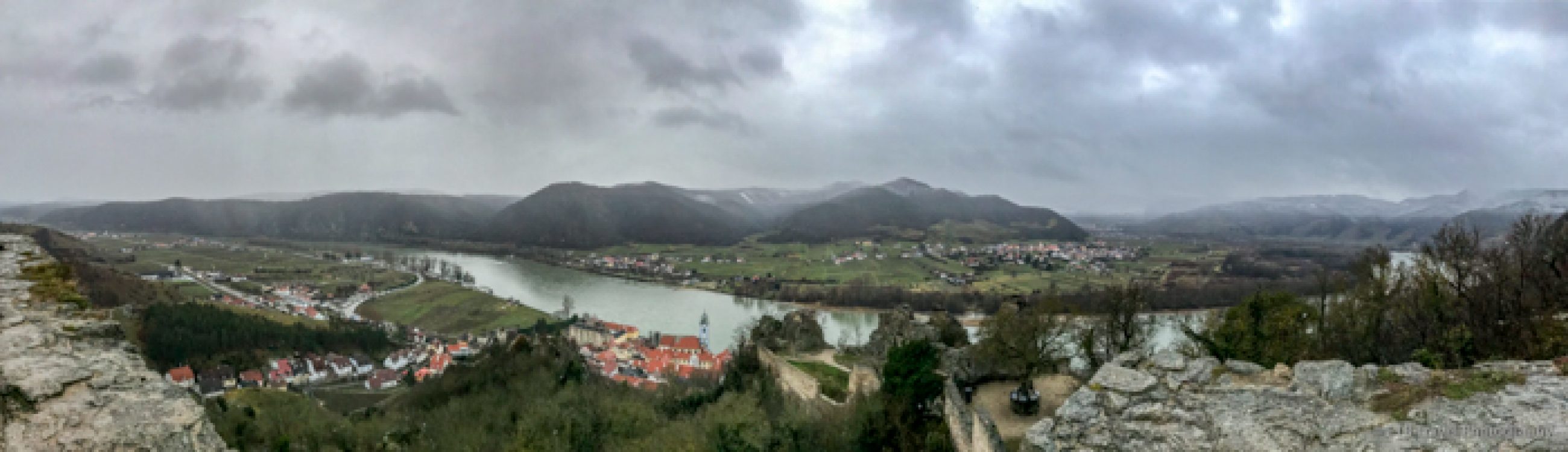
Beef Corral Bottom
Instead, we took the 36 mile scenic loop drive through a prairie dog town, to a handful of pullouts overlooking the North Dakota badlands and to the Beef Corral Bottom. Along the way, we spotted some wild horses that live in the park.


The Beef Corral Bottom used to be a large corral constructed in 1883. During the open range cattle industry, ranchers would work together in the spring and fall to round up their cattle. The Beef Corral Bottom was one of the areas where cattle were held for transportation to the slaughterhouse. The disturbed land provides an ideal location for a prairie dog town.


Northern Section of Theodore Roosevelt National Park
I was unsuccessful in spotting the bison in the southern end of the park, so I headed for the northern section. Despite only being home to approximately 100 bison, 1/3 of the population of the southern section, I located just about all of them. A portion of the herd with calves rested on the hillside close to the road while another portion camped out atop the ridge.


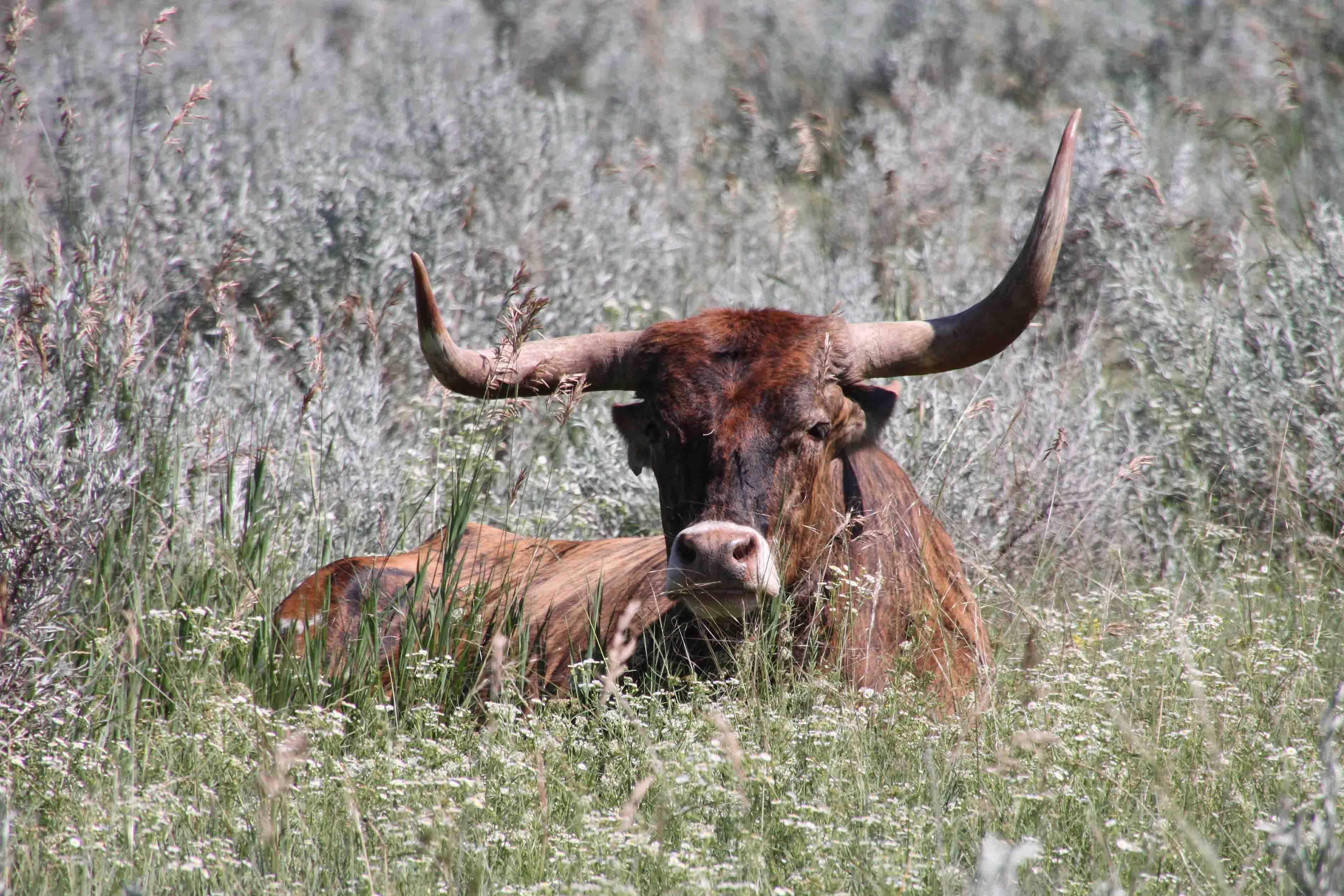
I was also lucky to find nine of the eleven longhorns known to live in the park! In addition to the wildlife I enjoyed the vast fields of wildflowers and a variety of geological structures including slump formation, Bentonitic Clay, and Cannon Ball Concretions. Slump formations are tilted mounds that were once part of higher cliffs. Over time, the stream cutting against their base over-stressed the cliffs which slid downhill yet still maintained their layered pattern.


The blue-black popcorn-like soil that caps some of the plateaus is known as Bentonitic Clay. The clay flows when it is wet and can be traced for miles up and down the river. Cannon Ball Concretions are large spherical boulders. They may have any shape, but most are round. Concretions are formed within rocks (shale, clay, sandstone) by the deposition of mineral around a core.


Fort Union Trading Post National Historic Site
After visiting the Theodore Roosevelt National Park, I continued to the north to the Fort Union Trading Post National Historic Site where a partial reconstruction of the fort stands today.

Fort Buford State Historical Site
Just down the road, I visited Fort Buford State Historical Site. The field officer’s quarters, constructed in 1871, is the location where Hunkpapa leader Sitting Bull surrendered in 1881 which helped end warfare on the northern plains. Sitting Bull told his young son Crow Foot to hand over his Winchester to Major Brotherton and is recorded as saying, “I surrender this rifle to you through my young son, who I now desire to teach in this manner, now that he has become a friend of the American people. I wish to teach him the habits of the whites and to have him educated as their sons are educated. I wish it to be remembered that I was the last man in my tribe to surrender my rifle.”

I finished the day camping in Lewis and Clark State Park. It was absolutely packed. Every campsite was taken. They let me stay in a parking lot where walk-in tent campers park. At first I just thought it was due to a Friday night at the lake; then I realized several of the campers were decorated with Christmas lights for a Christmas in July celebration. Too bad I missed the festivities! ETB
Map of My Road Trip Across the USA
Learn more about my road trip across the USA, or click the link below for the interactive map.

Interactive Map of Road Trip Across the USA
Other Articles About North Dakota You May Like

thanks for all the info…….we got much needed rain here….had great time in Estabrook…..but no wild animals…wild turkeys was all that we saw…….love the fact that there is NO tv.