Petey and I hung out at the Desert Rose RV Park for a while this morning to take advantage of electricity, the internet, and laundry. We finally hit the road around 10 am and made our first stop in Fallon to collect our next stamp for our Loneliest Road in America adventure. We didn’t stay long in the town, but instead followed Stillwater Road to Stillwater Wildlife Management Area and Refuge.
Stillwater Wildlife Management Area and Refuge
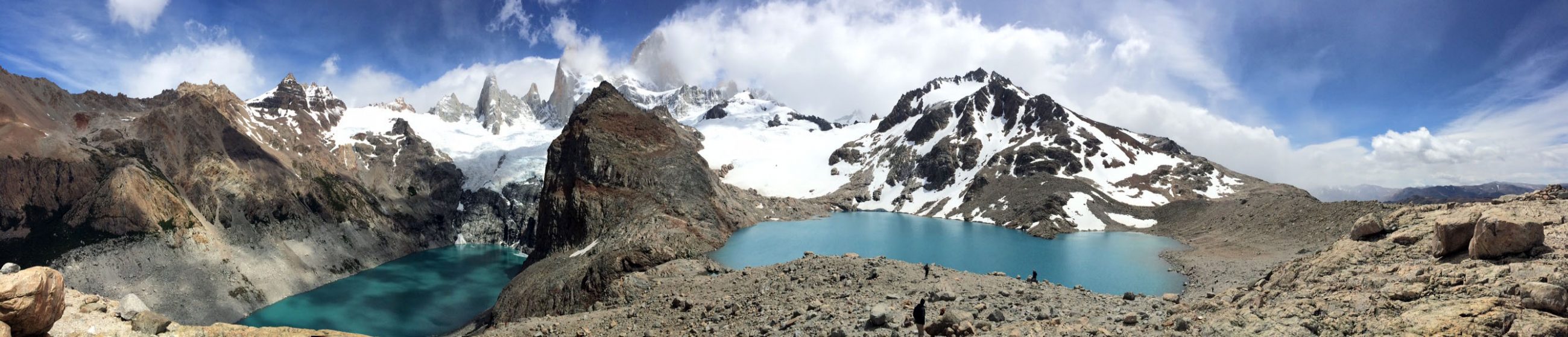
We passed by several farms until we arrived at a series of shallow lakes that once made up Lake Lahontan. 12,500 years ago Lake Lahontan covered 8,600 square miles, 4.5 times the size of Grand Canyon National Park. The Stillwater Wildlife Management Area and Refuge would have been under 700 feet of water. The lake began to dry up 4,000 years ago which resulted in the area marshes here today.
I only explored a tiny portion of the 224,000 acre park as I took the Auto Loop Tour around one of the small lakes. I spotted a variety of birds and even a snake before VANilla hauled us along the gravel road to the exit.


Grimes Point Archaelogical Area
Here we turned east toward Grimes Point Archaeological Area, home to countless petrogplyphs and a hidden cave. The cave requires a guided tour. I happened to arrive to area while the local school was on a field trip. A late-arriving parent suggested I join the group.
As I delined and turned toward VANilla, he said, “Oh, I saw you around town. You’re from Texas. You were just at Stillwater.”
Yep, VANilla sure can stand out, I thought. He told me all about the events in Fallon…the Spring Wingfest this weekend to watch the migrating birds, the rodeo, and the Canteloupe Festival held in September. The area is world famous for its canteloups. As he ran up the hill to join the school group, I ventured to the other part of Grimes Point to walk Petey. We strolled past Indian rock art on the trail as pilots from Top Gun practiced maneuvers overhead.


Sand Mountain Recreation Area
Our next stop on the Loneliest Road in America was at Sand Mountain Recreation Area. Sand Mountain is a large sand dune that looms above the flatlands. Sand from 40 miles away is blown to this area and dumped here as the wind can’t carry it over the mountains. Many visitors come here to ride ATV’s and to sandboard (like snowboarding, but in sand). Given I had neither an ATV or a sandboard and I had just showered, washed all my clothes, and cleaned VANilla, I simply admired Sand Mountain from the road, though I mistakenly missed the ruins of the Pony Express station at its base…bummer!

The Old Shoe Tree
About 16 miles east of Sand Mountain, we came across the Old Shoe Tree, a giant cottonwood filled with hanging shoes. The tradition is said to have started following an argument between newlyweds during which one tossed the other’s shoes into the tree. Upon reconciling, the other reciprocated and folks have been adding footwear to the tree ever since.

Austin, Nevada
We continued past the dry bed of ancient sea, some of which was decorated by rock artists. Instead of finding graffiti sprayed on cliffs, drivers will find small rocks place near the roadside spelling names or claiming love for a significant other. Soon we began climbing the road from the salt flats to the mountains where we visited another old, silver mining town, Austin nestled in the mountains. Just outside of town lies Stokes Castle, a three story rock tower, built in 1897 by one of the town’s mining barons.

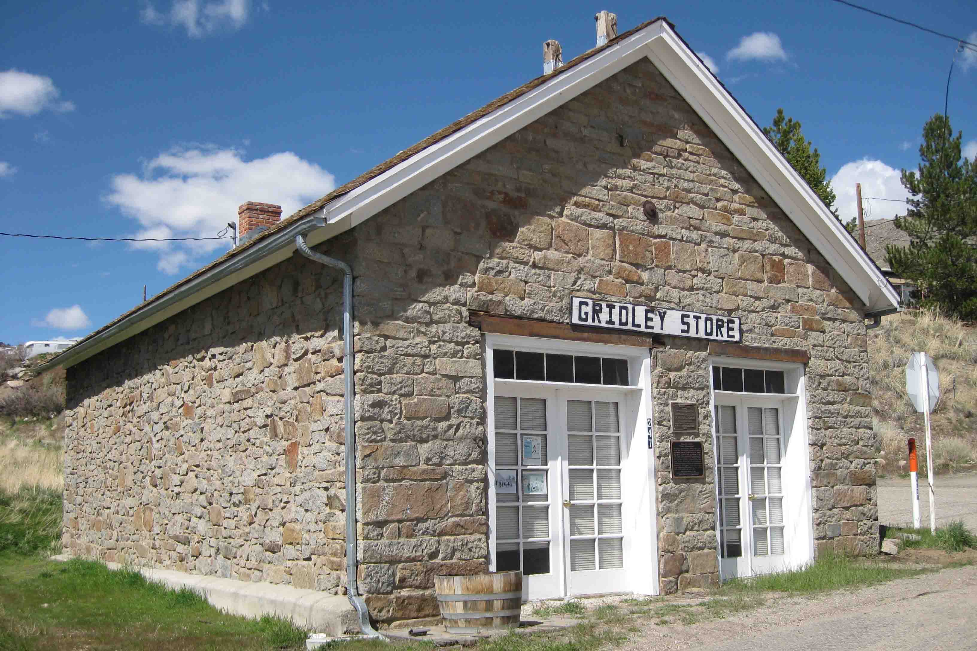
Within the town, visitors can find three old churches, an old courthouse and the Gridley Store. First, I stepped into the courthouse in search of my third stamp for the Lonelist Road in America drive…success! I have to give Nevada credit for turning Life magazine’s statement that there is nothing to see on Highway 50 into a tourist attraction! I could think of some other roads that could benefit from a marketing campaign with a little history and a simple goal. After visiting the courthouse and snapping a photo of one of the churches which was under renovation, I pulled up to the Gridley Store.

The Gridley Store
The Gridley Store was constructed by Reuel Gridley in 1863. He is remembered for losing an election bet. Gridley bet on his democratic party winning the election; however, the republican party won. As a result, the loser he had to carry a 50 pound sack of flour to Clifton a mile away. Upon honoring the bet, he auctioned the sack of flour to raise money for the Sanitary Fund, forerunner of the Red Cross. The bag of flour was auctioned so many times that it raised $175,000 by the end of the Civil War.

Eureka County Opera House
VANilla chugged over Austin summit, wound along the mountain road as Antelope Peak and Summit Mountain towered above, and eventually arrived at Eureka, around 70 miles to the east. Here I chose the Opera House to stamp my “Nevada Passport”. The Opera House, constructed in 1879, is fully restored and is still operational. A gallery downstairs showcases local artists’ mixed media and paintings while the opera hall is used for performances and conventions. The ladies at the Opera House were fantastic.
They asked, “How have you enjoyed the drive so far? Do you have the CD? Are you going to the museum?”
“I’ve love the drive so far. Other states should take some cues from Nevada. I didn’t know there was a CD. And yes, I plan on walking around a town a bit.”
As I explored the Opera House, they called over to the museum and found a CD for me! The CD explains the history of the towns and the mining activities along the Pony Express route. While I was snapping a photo of the opera stage, a man who was setting up the stage said, “Let me put the backdrop down for you. It’s really great.”

A painted backdrop operates as the curtains. As I waited, I noticed a program to A Broadway Extravaganza being presented by the Eureka High School Band and Choir tonight. I thought to myself, I should stay, but I kind of wanted to press on to Ely and spend the night there.
Eureka Sentinel Museum
From the Opera House, I crossed 50 and walked a block to a side street where the museum was located in the Eureka Sentinel Building. The building, constructed in 1879 for $10,000, was designed by C.M. Bennett. The Eureka Sentinel was published in this building until 1960. The printing press still sat in the back room whose walls were covered in old newspaper headlines.

The upstairs housed a variety of antiques including an old stove, old typewriters, and furniture. I chatted with the museum curator briefly about my trip, camping around town and Ely, my next destination. After our chat, instead of continuing on, feeling slightly under the weather, I kept VANilla in her current parking spot, enjoyed the High School performance of a variety of Broadway songs, and slept on the streets of Eureka. A good choice! ETB.
Map of My Road Trip Across the USA
For a summary about my road trip across the USA, click HERE. For the interactive map, see the below link.

Other Articles About Nevada You May Like
- Day 164 – Loneliest Road in America
- Day 166 – Loneliest Road in America – Part 3
- Day 167- Nevada 93
- Day 168 – Nevada 93 – Part 2
- Day 169 – Hoover Dam and Bridge
Like It? Pin It!

Sounds like a good choice.