
Day 242 of a Year Long Road Trip Along America’s Scenic Byways
Another great day in South Dakota! I have been pleasantly surprised. I expected mostly flatland and prairie like Nebraska and North Dakota, but the Black Hills resemble the foot hills in Colorado. We climbed through the pines to a towering granite outcropping carved with four presidential faces…Mount Rushmore!
Mount Rushmore
The national memorial pays tribute to Washington, Jefferson, Lincoln, and Roosevelt. Each face is sixty feet tall from brow to chin and the each eye is eleven feet wide. It took 400 workers 14 years to carve the monument with dynamite and jackhammers, and it cost just under one million dollars to complete.
The sculptor, Gutzon Borglum, envisioned carving the presidents to their waist. But with his death in 1941 and our nations involvement in World War II, his son who had accompanied him on the project declared it finished.


Carving Mount Rushmore
To carve the monument workers, mostly unemployed miners, climbed 700 stairs to the top of the mountain. Winch men used 3/8-inch steel cables to lower the workers over the front of the 500 foot face. The workers referenced large plaster masks, produced by the sculptor, that hung from cables on the mountain.
Over 450,000 tons of rock were removed from Mount Rushmore. Dynamite was used to remove 90% of it, but jackhammers and facing bits were used for the rest. Air compressors at the bottom of the mountain provided the power to operate the jackhammers. An 1,800 foot, 3-inch pipeline followed the stairway up the mountain to
carry the air for the jackhammers. During the winter months, a liquid gas was injected in the pipeline to prevent freezing.
In 1936, Julian Spotts, a National Parks Service engineer checked the system for leaks. He discovered a blacksmith had tapped into the line to blow air on himself while
he worked. Spotts provided a fan! In addition, he noticed that Rushmore suffered a power loss every Monday morning. It turned out that almost every woman in Keystone washed clothes on Monday with an electric washer. He encouraged the Mount Rushmore Commission to invest in a gasoline-powered auxiliary compressor….no more power problems. In 1939, Black Hills Power and Light completed a powerline to Rushmore which provided electricity to the project for the last two years of carving.


Visionaries of Mount Rushmore
In addition to the presidential faces, Borglum wanted the site to include a Hall of Records which would include a history of the United States, busts of famous people, and a list of U.S. contributions to the world. A seventy foot tunnel was blasted out of the mountain behind the faces. The government ultimately did not approve funding for this portion, so the Hall of Records was never completed; however, in 1998, Borglum’s daughter was part of a team that inserted 16 porcelain panels into the floor at the entrance of the tunnel. The panels include words of the Declaration of Independence, the U.S. Constitution, and the Bill of Rights. In addition, the panels contain the biographies of the presidents and information about how and why Mount Rushmore was carved.
The visionaries that brought Mount Rushmore to fruition were Doane Robinson, Peter Norbeck, William Williamson, and John Boland. Norbeck and Williamson were South Dakota Senators who pushed through the legislation that secured $500,000 of federal funds to turn Robinson’s idea into reality. Boland, a Rapid City business leader, raised additional funds when necessary and managed day-to-day funds of the project at times.
In addition to the presidential faces, the national memorial includes an entry way with each state’s flag and a column with an inscription noting the date each state was admitted to the union and its associated number, 1-50. Also, a half-mile pathway with information signs on each president leads to closer and unique views.

Sculptor’s Studio and Views from the Highway
I liked the Sculptor’s Studio the best where the plaster mask and original design were on display. If I had a complaint, it would be that my National Parks Pass didn’t
work at the National Memorial?!? Everyone simply had to pay a private company eleven bucks to park! And really, if it weren’t for the Sculptor’s Studio, I think I would have been content to snap a picture from countless opportunities provided on the highway. I have the profile shot, shots through tunnels and shots through trees.


Custer State Park
In fact, these views were created intentionally by highway engineers when they were charged to make the section of the road leading to Custer State Park one of the most visually pleasing in the state. In my opinion, they succeeded. Three different, low cut, single lane tunnels frame the president’s faces. The road twists and turns over wooden, corkscrew bridges like a roller coaster. The highest point on the route, Norbeck Overlook, provides magnificent views of the Black Hills, including 7,242-foot Harney Peak, the loftiest mountain between the Rockies and the French Alps!
Descending from the overlook the roads leads into Custer State Park which sells a seven day pass that allows travelers to pass through the park to the Town of Custer (almost like a toll). Three different state highways run approximately 20 miles each through the enormous park. A particular treat was to twist and wind along Needles Highway through more narrow tunnels and past fingerlike spires that line the Black Hill’s steep road.


Sylvan Lake
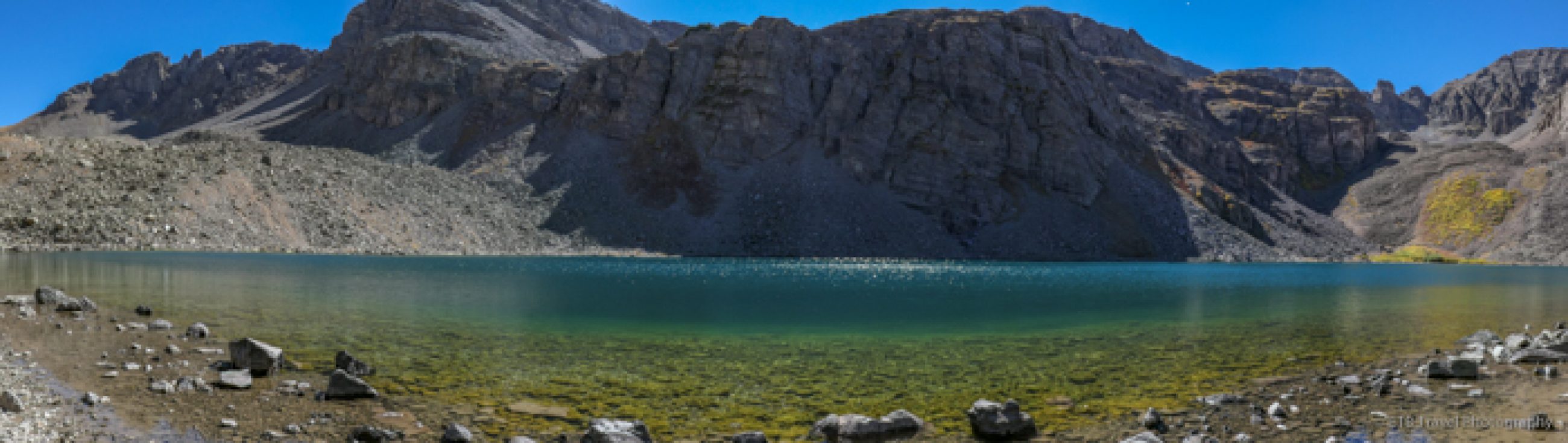
Near the summit lies idyllic Sylvan Lake which offers a variety of activities including canoeing, swimming, fishing, and hiking. Large granite boulders are the backdrop to the dark blue waters. Petey and I enjoyed a lovely walk along a mostly groomed trail beneath the shade of pines.


In addition to the Needles Highway, the park includes an 18 mile wildlife loop. The road leads through grasslands and provides the best chance to view its herd of 1,500
buffalo, one of the largest in the nation. I was sort of “buffaloed” and “prairied out” so I skipped the 18 mile loop yet still saw buffalo three different times; two singles and a herd. VANilla played chicken with one of the singles. He moved to the opposite lane.


Wind Cave National Park
Leaving Custer State Park, we passed through prairie land, spotted a few pronghorn and a deer, and crossed yet another bridge before eventually arriving at Wind Cave National Park. As the name suggests, its main attraction is Wind Cave. The cave may have been known to local Indians for centuries, but it wasn’t discovered by white settlers until 1881 when brothers Jesse and Tom Bingham were lured by a strange whistling sound to a small hole. The whistling sound was created by wind, which can reach up to 70 mph blowing from the cave. The cave either blows air out of the hole or sucks it in depending on the outside air pressure, and thus the cave is known as a breathing cave.


Neither the brothers nor the Indians entered the small, natural entrance to the cave, but a sixteen year old boy by the name of Alvin did. He had to be one skinny, six foot kid to fit through that passage. He spent four years exploring the cave and trying to find its end before he died from pneaumonia. To this day, based on the wind velocity it is believed that only 5% of the cave has been discovered. Explorers have mapped 136 miles of passageways in 1 square mile. The passageways go in every direction and are on top of one another.


The cave was formed by fractures, water and carbon dioxide. Water seeped through the fractures and created carbonic acid when it came into touch with the carbon dioxide. The carbonic acid dissolves limestone. What is left is several passageways with mostly box work formations. Box work formations are made of calcite which formed between the fractures and is not dissolved by carbonic acid. The box work formations look like spider webs. 95% of box work formations in the world are found in this cave. While I didn’t find it to be as pretty as some of the other caves I’ve visited, I certainly appreciated its uniqueness as well as the 53 degree temperature!
Moon View from the Park Campgrounds
After the cave tour, I found a campsite in the park and called it a great day! It is here where I met Don and Joan who were also on the cave tour and from Missouri. They are visiting all the National Parks and have already visited every presidential library except two. They are headed the same direction I am, so we may cross paths again.
Just before a storm blew through, I noticed the moon glowing a vivid orange. It was so pretty. I snapped a few photos and then took cover as lightning that had already started a fire earlier in the day flashed all around as thunder pounded above. ETB

Map of My Road Trip Across the USA
For a summary about my road trip across the USA, click HERE. For the interactive map, see the below link.

Other Articles About South Dakota You May Like
Like It? Pin It!


A really wonderful post. I loved all the details regarding Mount Rushmore, facts I did not know. I think you are lucky to be missing some of the terrible weather in parts of the U.S.
I can’t wait to read your next entry. I love seeing Petey in his special posts.
hi, ty you for sunflower photos…..and ty for all the information about Mt. Rushmore…..It is going to be 107 Tues. this is going to be a HOT week in Tuc have a great day
Hi,
I was wondering if I could use your photo of the monuments original plan? I want to crop t-shirts onto them and add the picture to a social media post for my work.
I can be reached at the email entered below.
Thanks
Ryan Keenen
Sure…please credit blog in social media post. thanks!