
Day 286 of a Year Long Road Trip Along America’s Scenic Byways
I made a quick stop at Oregon’s largest Ponderosa Pine in LaPine Recreation Area. It is approximately 500 years old and stands 162 feet high with a diameter of 8.6 feet. From here, I headed south to Crater Lake.

Crater Lake
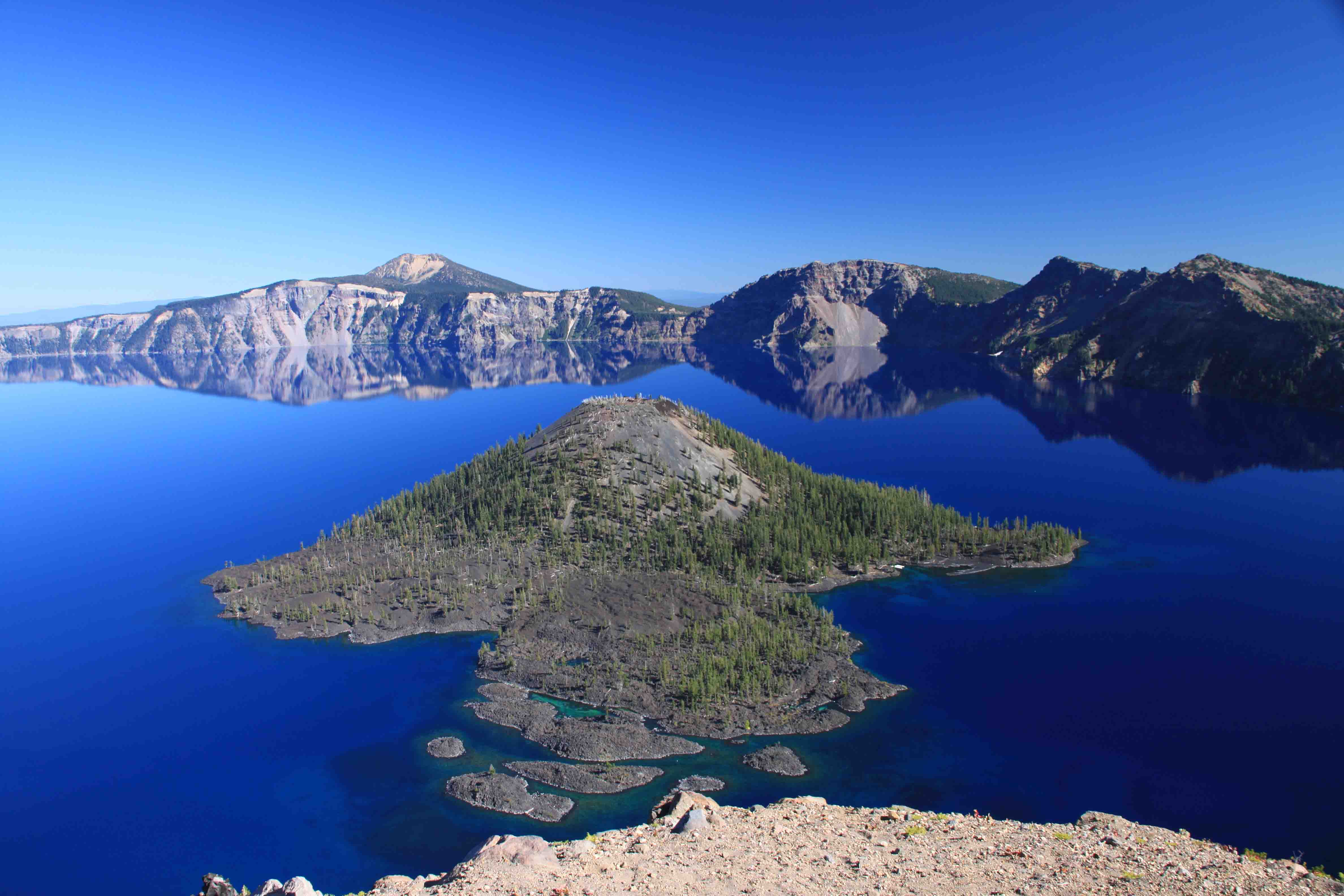
Back in May when I drove the Rogue-Umpqua Scenic Byway, the snow was falling and several feet of snow lined the roadway. The two lane road to Crater Lake was only snow plowed the width of one and a half lanes, so I decided to visit the park upon my return home. This time the weather was glorious: not a cloud in the sky, temperatures in the high sixties, and a light breeze that had no effect on the Crater Lake’s glassy surface.
Mt. Mazama erupted 7,700 years ago and after its discharge of pumice and ash, the mountain collapsed forming a caldera which filled with water over time. The result is Crater Lake, six miles wide and more than 1,900 feet deep. The intense, sapphire blue lake lies encircled by green forests. Even a few patches of snow remained near its surface.
The lake is considered sacred by the Klamath Indians who refused to acknowledge its existence to outsiders. Not surprisingly, many Indian legends are associated with the lake including gazing at the waters was thought to be fatal. An outsider searching for gold, John Wesley Hillman, finally discovered the lake in 1853 and named it “deep blue lake”. Over the years, the name changed, but the 1869 name, Crater Lake, stuck and in 1902, Crater Lake became the nation’s sixth national park.
I sort of wish I made it to the lake when the cliffs were covered in snow to compare the difference. Today, it was hard to believe there could be any snow. I stopped at countless overlooks and each view seemed more beautiful than the last. The crater walls reflected on the lake’s mirrored surface as I chatted with a couple from New Jersey. They were traveling for ten weeks and had visited Glacier as well as Oregon’s coast around the same time. They suggested that I visit Mount St. Helen’s National Monument. I missed it this trip, but thinking about it, I bet it is very interesting given the eruption was so recent.


Redding
After driving the circle around the lake, I turned southeast toward Redding, CA. The last time I stayed in Redding, I awoke to the circus coming to town near the convention center where I was parked. This time, I parked at the Wal-Mart despite the posted signs “No RV Parking”, and I found several fellow campers. I asked a long
haired, blond man whose dog ran across the parking lot if he had camped here before, as I didn’t want to get set up just to be chased out.
He replied, “Oh, yes ma’am. It’s pretty quiet.” As he pointed off to the right, he said, “that guy lives here.”
I felt like I was joining a small little community. I would have been more social, but my head was pounding while I was trying to adjust from 25 degrees this morning to 90 degrees this early evening. Tomorrow, I plan on visiting Lassen National Park which was completely closed in May due to snow. Being from Texas, it’s hard for me to think of May as winter and September as summer. But that is what it is like here…ETB
Map of My Road Trip Across the USA
Learn more about my road trip across the USA, or click the link below for the interactive map.


You didn’t say how high you were… I mean what altitude you were in! It’s a good thing you don’t get altitude sickness with all the mountainous driving you have done.
What a breathtakingly beautiful lake! Definitely not the sort of lake one sees in Texas!
I hope your head feels better!
xo’s M
WOW