The Sneffels Traverse – Day 4

Morning Coffee

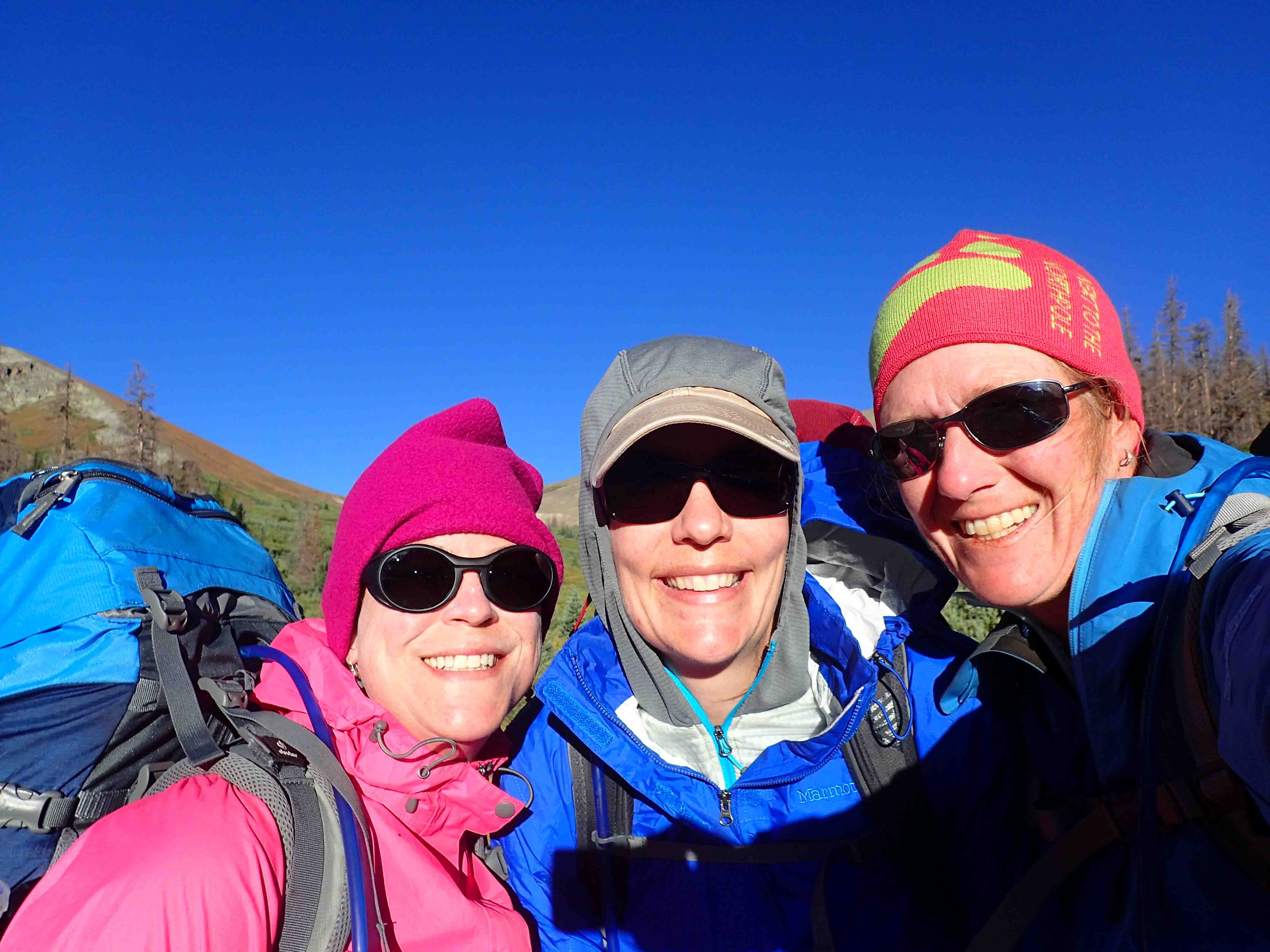
Our fourth and final day on the Sneffels Traverse took us 8.1 miles from the Ridgway Hut to Ouray.  We skipped staying at Burn Hut for an additional night as it was only 4.1 miles away.  With the final hike being mostly downhill and not too long, we voted for a later start…8:30 am.

As usual, Tina was the first one up.  She turned on the propane and got the water boiling.  Normally, we would have left the propane on overnight, but there was a leak outside the cabin. Given a leak can cause an explosion and even emit carbon monoxide in certain instances, I, being the worry wart, turned it off.

Happy Hiking!
blue columbine with blue lake in background

The Sneffels Traverse – Day 3

Wake Up Call

For our third day on the Sneffels Traverse, we planned a 6.6 mile side hike to Blue Lakes before trekking 5 miles to Ridgway Hut.  Due to speculative weather, we planned an early departure.  Tanya’s phone alarm rang at 5:15 am.  She was in such a deep sleep, she couldn’t even find it! 

I wish I could say the same.  I was up before my alarm.  Though it was kind of funny, when Tanya commented, “I’m used to Karla’s 14er hikes, when a chorus of phone alarms chime.” I know!  Fortunately, Tanya’s alarm worked for the whole cabin, and we began quietly preparing our day packs while waiting on the pot of water to boil for our much-needed tea and coffee.

Happy Hiking!

The Sneffels Traverse – Day 2

Pre-Hike Departure

On our second day of the 29.4 mile Sneffels Traverse, a deer made a brief visit to the meadow by our hut as Tina, the first to rise, got the water boiling. Half the group poured their coffee and tea and walked out to the beaver ponds to watch the sunrise while the other half the group packed up and ate breakfast.

Happy Hiking!

The Sneffels Traverse – Day 1

Planning the Sneffels Traverse

I’ve always been interested in a summer hut trip but wasn’t familiar with the hut system process in Colorado which can range from entering a lottery to simply making a reservation depending on the ownership and operation of the hut.

In June of last year, I stumbled across the Sneffels Traverse in 5280 Magazine.  The Sneffels Traverse is a 29.4-mile trek which begins at Last Dollar Pass near Telluride and ends near the quaint town of Ouray.  Along the way are four backcountry cabins operated by the San Juan Huts System

Since 5280 mapped out the traverse and included all the necessary information about the traverse, I thought this is a trip I could do.  A few months later, I mentioned it to my friend Tanya while spending a weekend in Aspen hiking through fall foliage.

HAPPY HIKING!

The Colorado Trail – Segment 14

Another segment of the Colorado Trail is marked off the list…Segment 14 (20.4 miles) with a 3-mile side hike to Browns Creek Falls that is definitely worth the detour!

Just about every weekend I am in town this summer is dedicated to finishing up the 484.6 mile trail.  Thus far I have completed 292.7 miles over the past few years.

HAPPY HIKING!

The Colorado Trail: Segments 18-20

Day 1: Segment 18 Mile 0-12.4

I think we may have backpacked the easiest segment of the Colorado Trail yet (segment 18). We finished over 12 miles in about five hours and with the exception of one steep climb, it was mostly a stroll with many stops for pictures, snacks and adjustments.

Our trip began Thursday night with a road trip from Denver to Saguache where got a hotel room with three double beds for $120…not bad. The room was peppered with signs. My favorite was, “Hold toilet handle down until all material passes through. Then lift handle up. Thank you.” Continue reading “The Colorado Trail: Segments 18-20”

Soloed Segments 11-13 on the Colorado Trail

Day 1 – Segment 11 (Miles 0-2.1)

Tonight I started my first solo backpacking trip. I did a practice run with some of my new stuff and the help of David the prior weekend at Conundrum Hot Springs. I felt good about everything except for the possibility of getting lost and hanging my food bag in a tree and away from bears.

The trail is well marked in these sections, and it is also well traveled, so getting lost likely wouldn’t have been an issue, but it always feels better to know there are backups in place. David gave me a short lesson on his GPS, and I had the Colorado Trail app on my phone with a battery that required regular charging. I decided to purchase an Ursack to protect my food, so I was good to go, as I had already arranged a shuttle to the trailhead.

ON THE CT!

Aspen and Conundrum Hot Springs

For David’s birthday weekend, we visited Aspen and backpacked to Conundrum Hot Springs. I left earlier than he did so I could wander the streets of the quaint mountain town. I took the longer scenic drive from Denver which took me over Independence Pass. I made my first stop here. I parked the car in the lot at the pass and followed a trail to the edge to view the lovely surrounding mountains. The cool breeze sent me back to the car relatively quickly where I continued on to Aspen.

I stopped at a sandwich shop, Grateful Deli, for lunch. I thought I might be able to find something for a reasonable price. The meal deal which included a turkey sandwich, chips and a drink was $13…Ha! That sounds about right for Aspen. The shops were nice as well, Van Cleef and Arpel, Ralph Lauren, Rag and Bone among other fancy retailers.

David and I got a great hotel for the night. Hotel Durant was a few blocks from downtown and the ski mountain…easy walking distance to both. The room was spacious with a nice view. We were able to squeeze into the bar after a short wait for a nice dinner at Wild Fig. From there we tried out the brewery before turning in for the evening.

IMG_4715

Conundrum Hot Springs is a popular destination. The hike in from the parking lot is about 8.5 miles. We slept in until 7:30 and grabbed a quick free breakfast at the hotel before we made our way toward the trailhead. We knew with our late start, the parking would likely be a challenge. Of course the small lot was full, so we dumped our packs by the start and then drove a mile back to the main road where we parked on the shoulder.

So our day started by adding a mile to our hike. At least it was without a backpack. The next 8.5 miles led us mostly uphill over a rocky path. We passed through beautiful aspen groves, intermittent forests, and fields of wildflowers beneath a sunny sky. Fortunately, there was a light breeze that kept us cool in the unseasonably warm weather.

The wildflowers were nice though the dry, warm weather seemed to take a toll on them just as the biting flies took a toll on us. I’m not sure why I felt like this hike was so hard. It was my first time to carry a full backpack for the season, and it was steep in places, but it didn’t seem like I should have been struggling so much.

I will say I didn’t find walking across a boulder field or balancing on a log in the beaver pond to be too exciting. The variety on the trail, however, did provide nice changes of scenery which was quite enjoyable. About half a mile from the hot springs, we set up camp around several others. This area is so popular privacy is tough to come by and campfires aren’t allowed.

We hiked the rest of the way carrying a small day pack which included our swim suits, towel, sunscreen, off and the like. There were two hot springs, one larger than the other. Ten or so people sat in one that was a touch warmer than the smaller one which fit 4-6 people comfortably. Both springs were very muddy.

OLYMPUS DIGITAL CAMERA

David could have sat there all day. I, on the other hand, tried to sit there for a whole hour. Once I had shriveled up, I was ready to go. Actually, probably before that, but it was his birthday! We hiked back down to camp to cook dinner and have a nap. He mentioned he might head back up there in the morning. The morning came around 2am for him. He hiked up in the dark and sat in the pool with a few others who didn’t bring a tent so they just slept in the springs! He stayed until the sun came up and then some!

Once 7am rolled around, I figured I should check to see if he was alive. I hiked up to the springs and probably ruined his fun when I reminded him we had to cook breakfast, pack up, hike down, and drive four hours home. Though I think he enjoyed a night under the stars.

The hike down wasn’t too bad though with all our ailments between the two of us, we realized our backpacking days might be replaced with easier activities in the next five years. Upon reaching the parking lot, we wished we didn’t have to walk the extra mile to our car. Fortunately, a couple of guys picked us up.

After treating ourselves to a deserving lunch at the White House Tavern, we took a slight detour to Glenwood Springs before heading back to Denver. I wanted to see the historic Colorado Hotel where my mom used to stay as a kid. It is neat. I will have to stay there one day. Of course, the metering at the Eisenhower tunnel was in force, so the drive home took a while, but it was a nice getaway to the mountains. Aspen is a beautiful place! ETB

SHOP

For notecards and key chains, visit My Shop on this website.

Mountain Goat Keychain thumbnail

Hiking to Mirador Torres del Paine in Parque Nacional Torres del Paine

After a very good egg breakfast, we left Los Cuernos just before 8 with our box lunch in hand. The park map suggested it would take about 7.5 hours to Campamento Torres by taking the “short cut” and not hiking by the hotel in the valley. As such we prepared ourselves for a long day of backpacking.

We climbed up and down the undulating, rocky path and wondered why it wasn’t cut closer to the lake’s shore that seemed much more level than the track we were traversing. We passed through some intermittent trees, but mostly followed the shoreline of the lake for a few hours under a partly cloudy sky. Along the way we spotted a few hares and listened to chirping song birds.

As we cut across the valley of rolling hills and wild flowers, the sun became more intense. We crossed many streams and tried not to kill ourselves on the primitive bridges and in mud pits. Soon we began a steep climb. From speaking with the group we met last night at dinner, I thought we had only just begun the climb to the intersecting trail from the hotel. I planned on refueling over lunch at the trail intersection to tackle the rest of the incline. We snacked on our pork tenderloin sandwich for energy and continued.

Little did I know, though winded, we had plowed through the hardest part relatively quickly. We reached a look out over the valley and saw a Refugio below. I thought this must be Refugios Torre Norte and Torre Central. From these we would continue the steep climb. As we rounded a tight turn, a young man commented, “You are almost there”.

David quipped, “Yeah, right”.

The young Asian replied, “No really! That building down there is Chileno.”

David and I looked at each other in dismay. We couldn’t believe we had reached El Chileno Refugio, operated by Fantástic Sur, so soon. We weren’t staying at Chileno, but we knew it was only 1.5 hours from Campamento Torres, and that we had just ascended the steepest part of the trail! About a mile earlier, we were discussing Chileno’s advertisement “Feeling tired, stop in to reserve a horse ride down the mountain”. Given we met 30 years ago riding horses, we thought it might be fun. By the same token, the weather was nice and we didn’t want to waste any time in the offices. Furthermore, we wanted the freedom to chose our schedule in the morning so with a bounce in our step, we strode forward.

As we hiked past the Refugio and through the camp grounds along the powder blue river with the Torres in sight, signs displayed 1 km to Campamento Torres. I was trying so hard to contain my excitement and hike slowly, but I don’t think I was succeeding. Anytime I have ever seen a photo that made my jaw drop, and I looked to see where the photo was taken, it was always the Torres in Patagonia. I have wanted to come here for years. With each step, I just kept hoping the clouds would cooperate!

The path led us across several bridges, many only supporting two people at a time, some only one, as we climbed up and down the steep terrain through a beautiful forest. As much as we enjoyed the forest, this elevation change was slightly unexpected based on our review of the map and our conversation with the group we met at dinner last night.

Soon we reached a sign for the camp. We were amped! We had reached the camp in 5 hours instead of 7.5 hours. With smiles spread across our faces and an energized laugh, we began looking around for the check in building. It wasn’t in sight! Confused, we wondered if we should have split off the path somewhere. It wasn’t long before some fellow trekkers hiking the opposite direction came along.

We asked, “How far is it to the campgrounds.”

The European gentleman replied, “45 minutes with your luggage.”

We must have looked at him in bewilderment because he quickly pointed to his partner and exclaimed, “Her English is better!”

With the language barrier, David asked with hand gestures, “Did you see an area with tents where you can sleep?”

She confirmed that the campground was 45 minutes away and there we signs pointing down to the camp and up to the Torres.

Ugh…a few more Kilometers! We probably would have enjoyed the lush vegetation much more had we not been so demoralized! We prodded on and reached camp in six hours instead of the 7.5 hour projection. I suppose we still should have been proud of ourselves, but by this time we were ready to dump our heavy packs, set up camp, and hike the last hour to the Torres lookout.

We presented the ranger with our reservation slip that took me a little while to find given the countless bus tickets, food tickets, and reservations slips I carried in my travel purse. We immediately headed to the back of the campground, found a flat spot beneath low hanging trees, and set up our tent. We threw our packs inside, planned on laying our sleeping out later, and stashed some snacks, water, and layers in our day packs. We were ready to tackle the final kilometer.

I couldn’t contain myself as I zoomed up the path. David remarked, “You know how sometimes you say I get crazed over good meals?”

I replied, “Yes, I know. I’m crazed over this photo!”

We criss-crossed a small stream on ladder-like bridges as we maneuvered over boulders, stairs of rocks and loose scree. The terrain was slightly similar to the top of a 14er though at a much lower altitude. Coming from 5,280 feet was a blessing for us, as it made the climbs somewhat easy.

With the Torres in sight, we rounded the bend and soon found the grey lake with the granite columns towering above. It was spectacular! And much to our surprise, there were far less people there than we expected. With a limited hiking area, we were able to scramble over some boulders to an area that allowed us to snap photos without anyone else in the pictures!

Loaded with many snacks, we hung out for probably three hours as we watched the cloud formations swirl around the north torre and many times change directions. Of course, I could never decide when the sky seemed the clearest, so I just snapped one photo after the next. I had to capture the waterfalls, the surrounding peaks, the valley behind us, and of course the Torres poking through the clouds. What a way to spend New Year’s Eve! We celebrated back in the tent with ricotta and spinach ravioli drenched in red sauce with a sprinkle of cheese, a bottle of red wine that David lugged all the way from Los Cuernos, Godiva Chocolate that I got for Christmas.

We hardly made it to 9pm, much less midnight, but we planned on waking at 3:45am to go up for sunrise as long as we could see the stars when we woke up. Today was all that I could have hoped and more! We had such good weather for the whole trip, I was worried our luck might run out. Fortunately, luck was on our side, and the landscape met my high expectations (which doesn’t always happen). ETB

For David’s map and corresponding pictures, click here: map of our hike

Other Articles About Patagonia You May Like

Shop

Check out the photographic note cards and key chains at my shop.  Each card has a travel story associated with it.  20% of proceeds are donated to charity.


photographic note card, old house in antarctica
WEATHERED THE STORM
Best Adventure Travel Blog