Beautiful Hike to Upper Cataract Lake

Surprise Trailhead
Fees: None
Website: http://www.protrails.com/trail/450/summit-county-eagle-county-clear-creek-county-upper-cataract-lake-and-cat-lake
Elevation: 8,605-10,744 feet (below treeline)
Distance: 10.9 miles
Hours: Any…Careful for hunting season

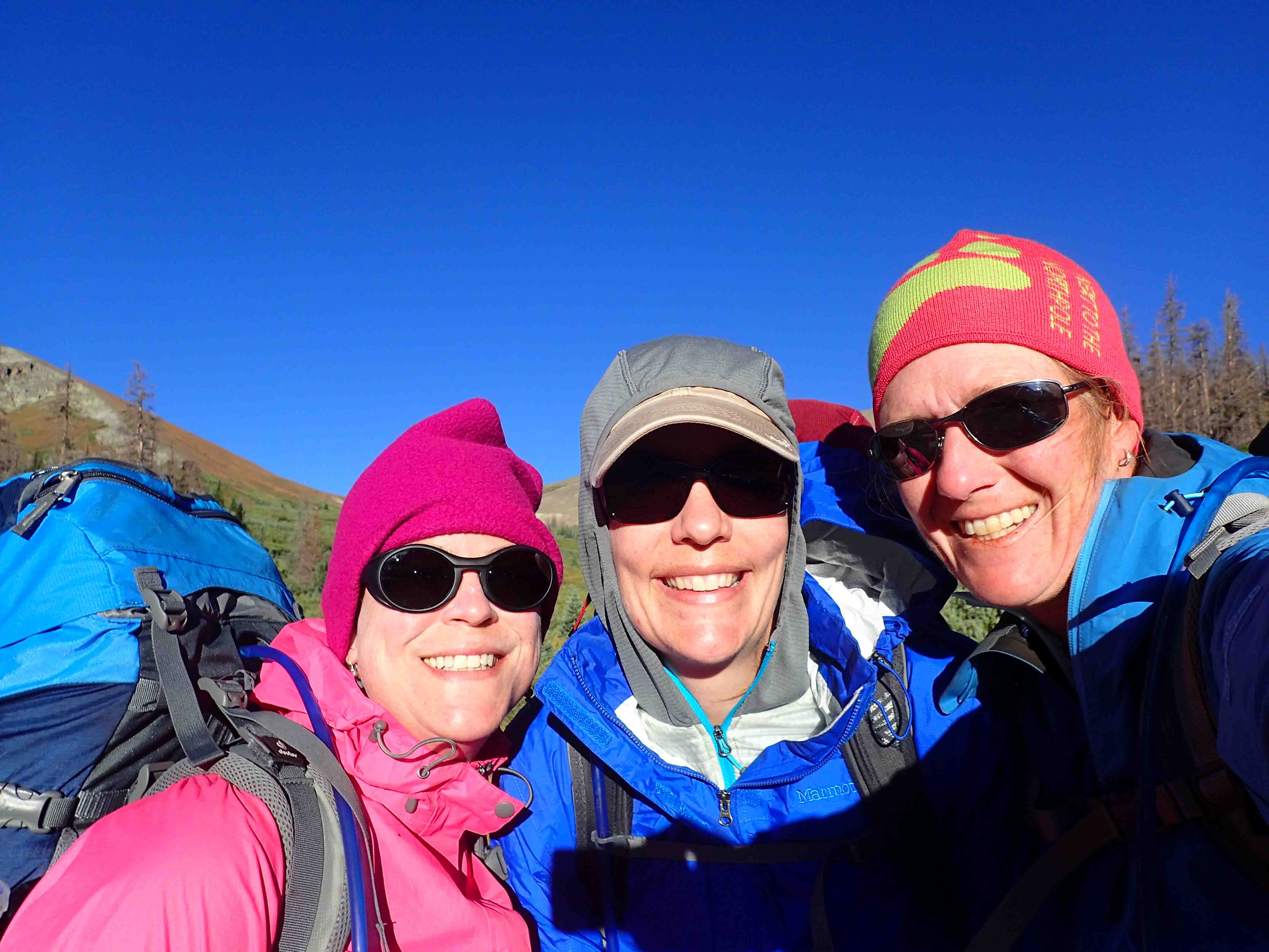
I had such a great weekend! On Saturday, I went up to Schussbaumer, a ski chalet in Breckenridge, for a work party. There was hardly any work to do, so I just got to enjoy a relaxing day in the mountains and got to catch up with my friend Cat. I love that its just a short roadtrip for me to enjoy the Rocky Mountains…no flying across the USA.

I stayed the night at the chalet, and met up with Cat the next morning. We started out with a great breakfast at Clint’s. We were good and got eggs, but the muffins and cinnamon rolls sure looked delicious!! It was probably better to load up on protein since we planned on a 10.9 mile hike to Upper Cataract Lake.

Uniquely, just a month ago, a few of my fellow hikers and I aimed to hike Lower Cataract Lake, but accidentally ended up on the Upper Cataract trail (Surprise Trailhead), but we were limited on time and weren’t able to get to any of the lakes on the route. The last time I hiked the trail, we stopped at the trail intersection at mile 2.7 for a 5.4 mile jaunt as we admired the colorful aspens. This time, we climbed up the steep trail peppered with aspen leaves as they had already fallen. Then we entered the conifer forest laden with fallen trees.

The sun was out and the sky was clear on this 65 degree day. We worked up a sweat as we tackled the sharp grade. At the trail intersection, we turned right and continued climbing, though the terrain began to level out. As we were walking along, it was about time for a bathroom break. We scanned to our left and were surprised to see a lake concealed by thick timber! The name of the lake was appropriate…Surprise Lake.

We didn’t expect to reach it so soon, nor did the landscape seem to suggest we’d stumble across a lake here. Lily covered, it was quite different than the alpine lakes we generally strive to reach. We stopped for a short while, but the sweat on our backs coupled with the cool breeze encouraged us to continue.

It wasn’t long before my stomach started to grumble. Of course, we wanted to reach a lake but we stopped for a snack. We originally thought Surprise Lake was just a random pond, so we thought we would be at another body of water within the hour. Not so. We kept going and going while crossing a few streams. We even descended over the ridge toward a talus field.

On this side of the ridge, the wind was relentless. We gave into the elements and stopped for our hat, gloves, and puffy jacket. We also decided on a snack because we weren’t certain when we’d see the lake. Then Cat pointed to the right as she looked through the trees below and questioned, “Wait, is that a lake?”

Sure enough, it was! We threw our packs on and headed down the trail as we admired Eagles Nest Peak lightly dusted in snow. Soon we turned the corner and enjoyed a remarkable view of Cat Lake. At the time, we thought this was Upper Cataract Lake, but when we reached another trail junction, the sign suggested otherwise.

We were pretty cold at this time and weren’t willing to hike much farther, so we figured we’d actually read the description of the trail that we had on our phones! We warmed up a bit at the trail junction as we stood in the sun with some protection from the wind. This new warmth coupled with the good news that Upper Cataract Lake was only a tenth of a mile up the trail rejuvenated our spirits.

First we found a small pond and then a large lake tucked beneath the towering mountains. As much as we would have liked to sit by the lake for lunch, the wind was brutal! We climbed over a small, rocky ridge to find shelter and enjoyed a lovely view while we soaked in the sun. It’s amazing how cold 65 can feel with 40 mile per hour winds!

On our way back, we opted not to explore Cat Lake though the shore sure looked beautiful. We climbed back up the trail past the talus field and soon descended to the other side where we began shedding layers and enjoyed a pleasant walk back to the parking lot. It was a great day and gorgeous hike. We were pleasantly surprised by all the lakes! I’d highly recommend this trail especially during the fall color change. ETB

Shop

Check out the photographic note cards and key chains at my shop.  Each card has a travel story associated with it.  20% of proceeds are donated to charity.


photographic note card, fall colors in connecticut
FALL COLORS
Best Adventure Travel Blog

Meridian Trail, Kenosha Pass, Ben Tyler Trail, and Estabrook

What a great week I had with friends and fall colors! On Thursday, Belinda, Tanya, and I hiked the Meridian Trail. Normally, I wouldn’t find this trail too exciting as it is an out and back path that climbs to a saddle with little view, no lake, and not much of a stream to speak of (all things I prefer on a hike), but for the fall this hike was a treat.

The trail is lined in several golden aspen groves. Occasionally we were treated to some orangy red aspens too. When we weren’t enjoying the intermittent groves that we walked through, we were admiring views along the way of green hillsides peppered with yellow and red. It was a lovely six mile hike on a gorgeous day.

On Friday, Tanya and I visited Kenosha Pass, known for its fall beauty and it didn’t disappoint. The golden hillsides were simply spectacular! I’m not sure my words or pictures could do it justice. Golden leaves floated to the soft ground in the strong wind while we stayed bundled up in the cool temperatures.

Our view from lunch on the ridge was magnificent. We hiked far enough in (a few miles) that we got to enjoy the solitude. For a Friday, the pass was quite crowded with cars parked along 285. I’m glad we made it there before the weekend!

Saturday, Erin, Brian, Mario and I hiked the Ben Tyler Trail, also known for its fall colors. This is another trail I wouldn’t normally find too exciting as it starts immediately with switchbacks up the mountain next to highway noise. But then, it weaves it way back through several aspen groves with views of a nearby hillside blanketed in fall colors.

What made the 2,500 foot climb over four miles even better was the dusting of snow near 10,500 feet. The fallen leaves in the snow was an added bonus to the lovely views. We felt lucky to hike when we did, as the aspen were already succombing to the winter weather that blew in overnight.

The cold weather also made Estabrook a little nippy! We hung out by the fire and had an awesome night…tacos and margaritas! Our final hike of the week was to the Bear’s Cave. I do it just about every time I go to Estabrook. It’s such a serene place to me! I had so much fun with my friends! ETB

Shop

Check out the photographic note cards and key chains at my shop.  Each card has a travel story associated with it.  20% of proceeds are donated to charity.


photographic note card, windmill in Texas
WINDMILL
Best Adventure Travel Blog

Surprise Lake…Sort Of!

Tanya, Ann, and I set out to enjoy the fall colors today. We had some time restrictions, so we thought we would just take a short 2.25 mile hike to Lower Cataract Lake and then grab lunch somewhere in Silverthorne.

Lower Cataract Lake Trailhead and Surprise Lake Trailhead are both off the same dirt road and probably only 100 yards apart. Unfortunately, we weren’t sure of this at the time we arrived at Surprise Lake Trailhead that also leads to Upper Cataract Lake. Tanya’s book was more official than my directions so we ended up stopping slightly short of Lower Cataract Lake Trailhead. Usually, the lower and upper lakes with the same name are on the same trailhead which is what caused the confusion.

In the end, it didn’t matter, except we never made it to a lake because Surprise Lake was too far to hike with our time limitation. Our goal, however, was to see fall colors and we were rewarded with lovely yellows, reds, and greens along the path and on our drive out to the hike. In addition, we got some extra exercise…always a plus for the long drive from Denver. We logged 5.5 miles instead of 2.25 while making our destination a junction at two trails.

Lunch was quickly kicked out of the equation as we took a leisurely stroll through the aspen groves and pine forests. There was a bit of an incline as well, so the hike turned out to be a bit harder than we expected, but nothing too bad. The wind was cool, the air crisp, and the sun warm; so needless to say, we seemed to layer and unlayer regularly over the 3 hours on the trail.

I love the fall and am looking forward to more leaf peeping over the next week! ETB

Shop

Check out the photographic note cards and key chains at my shop.  Each card has a travel story associated with it.  20% of proceeds are donated to charity.


photographic note card, fall colors in connecticut
FALL COLORS
Best Adventure Travel Blog

The Colorado Trail: Segments 18-20

Day 1: Segment 18 Mile 0-12.4

I think we may have backpacked the easiest segment of the Colorado Trail yet (segment 18). We finished over 12 miles in about five hours and with the exception of one steep climb, it was mostly a stroll with many stops for pictures, snacks and adjustments.

Our trip began Thursday night with a road trip from Denver to Saguache where got a hotel room with three double beds for $120…not bad. The room was peppered with signs. My favorite was, “Hold toilet handle down until all material passes through. Then lift handle up. Thank you.” Continue reading “The Colorado Trail: Segments 18-20”

Lovely Fancy Pass Loop

Well, I have to say, hikes to alpine lakes in Colorado are just spectacular. This was my third hike in the last ten days to an alpine lake and each one has been awesome. Today David and I decided to tackle the Fancy Pass and Missouri Pass Loop. We left the house at 6:30am to make the 2.5 hour drive to the trailhead. It was a bit disconcerting when we ran into sprinkles before we even reached Bakersville. We hoped that once we made it over Vail Pass the weather would change to the forecast…cloudy, with a high of 67.

At first it seemed like the drive was a bit long and wished we stayed the night or weekend in or around Vail. But the beauty of this hike more than made up for the five hours of driving. In fact, the beauty started soon after we exited Highway 24. Neither of us had driven through Minturn which was a cute little town. And the 8.5 mile drive on Homestake Road #703, a dirt road that passed through meadows and several camping areas was lovely.

Eventually we reached Fancy Creek Trailhead. Several cars lined the road. We expected the trail to be busy, but we actually enjoyed a quiet beginning as we followed the path though the conifer forest. We gained about 500 feet in elevation the first mile and probably 800 feet the second mile as we climbed the switchbacks. The dirt path turned to a flat rocky terrain as the creek cascaded through a narrow gorge.

Soon we made it to Fancy Lake, though we were traveling at a somewhat slow pace. What a picturesque lake tucked beneath the granite crags. Utani, the dog we are caring for, David and I stopped for a quick snack by the placid water before it began sprinkling. The cool weather encouraged us to continue on to keep warm. Upon reaching the trail junction we turned left up the rocky pass. We gained 1,200 feet over the next mile while marmots and pikas chirped and scampered around their nearby homes. The rain picked up and by the time we reached 12,400 feet it turned to sleet.

Despite the wet weather and low clouds, the view of Cross Creek Valley dotted in wildflowers and lakes on the other side of Fancy Pass was incredible. We maneuvered down the wet rocks and followed the path nearest the closest lake, Treasure Vault and admired Blodgett Lake in the distance. Here, the trail turned up Missouri Lakes pass, far less steep than Fancy Pass. Remnants of mining equipment peppered the surrounding peaks.

The view from Missouri Pass didn’t disappoint. We passed by a small patch of snow before we headed down to the largest of the lakes surrounded by patches of trees where we snacked again as the rain and sleet stopped momentarily. We sat there until the thunder boomed. This was our sign to mosey.

We passed by several more lakes of all sizes. The Missouri Lakes basin was quite a treat. And it didn’t stop there. The path crossed the creek down the mountain. We stopped several times to admire the tumbling cascades. The rain started again toward the end of our hike, but amazingly for walking through the rain or sleet for probably 3-4 miles of the 8.1 mile hike, we weren’t that wet.

On our way home, we detoured to Red Cliff and stopped for dinner. It was surprisingly good. Then, we decided to take the ten mile drive over Shrine Pass back to I-70. The dirt road was watered down and the surrounding peaks were enveloped in fog. I suspect we may take a weekend trip out this way again sometime. There was so much to explore in this alluring part of the state. ETB

Shop

Check out the photographic note cards and key chains at my shop.  Each card has a travel story associated with it.  20% of proceeds are donated to charity.


photographic note card, cowboy boots on fence
BOOTS
Best Adventure Travel Blog

Fantastic Forest Lakes!

Wow…we are two for two for picking good hikes on Thursdays recently. Last week, Mohawk Lakes was amazing, and this week Forest Lakes was a pleasure!

Diana, Tanya, and I made it to the trailhead of Forest Lakes shortly have 9:30am. For some reason it seemed like forever to get to the East Portal of Moffat Tunnel. We went through a short construction zone, drove behind a hay truck, and finally reached the long dirt road at Rollinsville which led to our destination.

It was slightly nippy in the parking lot, so we added a few layers before we started up the trail. The path took us through an aspen grove, past an old house, and across a creek at during the first minutes of our hike. In about a mile, we reached a junction where we could turn right to go to Forest Lakes or go straight to Crater Lakes.

After shedding a layer and indulging in a few wild raspberries, we took the right turn up the mountain. We gradually gained altitude as we criss-crossed log bridges over beautiful waterfalls. A few purple and yellows wildflowers dotted the green, lush forest. The mushrooms were profuse. We worked up a sweat as we continued climbing through the evergreens draped in moss on this humid day. We were surprised to reach the lower Forest Lake so quickly. I suppose we hiked 30 minute miles which is normal, but last week we took so many detours it took forever to reach the lake. This time, 1.5 hours later, we were enjoying the reflections of the mountain peaks in the placid waters, as a nearby fisherman cast his line in search of a hungry trout.

From the lower lake, we hiked another 0.75 miles to the upper lake. We were admiring the contrast of the green forest, blue sky, and gray boulders when we suddenly noticed the upper lake. It was so big, it was kind of funny we didn’t even see it at first, but now we know why they are called Forest Lakes. The lakes were really tucked in beneath the pines and camouflaged by the greenery.

After stopping for a few pictures, we climbed up on an awesome boulder with a lovely view of the lake for lunch. The only downside to our lunch spot was having to watch the only other hikers at the lake fly a drone over their friend who was fishing. I don’t know if they were trying to spot fish or to just capture the action, but the constant buzz was a bit disappointing. We had just discussed how tranquil it was on this hike. It was far less crowded than Mohawk Lakes…in fact we had most of the trail to ourselves.

Fortunately, they only made a few passes with the drone, but in the short time we snacked, the clouds rolled in and socked down. While it was amazing to watch the surrounding peaks disappear in minutes, we also knew we shouldn’t admire the change of weather for long. We were already chilled from the sweat on our backs, the overcast skies, and cool 50 degree temperatures. I found myself in a puffy jacked, wool hat and gloves as I finished up lunch!

Soon, a sprinkle started, which turned into a steady drizzle. The tree cover didn’t seem to keep us clear of the rain, but we stayed dry enough with our raingear. It’s funny because the only other times Tanya and I have ever hiked in this area, it was cold and damp too. We wondered if this location attracted more moisture. Despite the early rain, we enjoyed another great hike. ETB

Shop

Check out the photographic note cards and key chains at my shop.  Each card has a travel story associated with it.  20% of proceeds are donated to charity.


photographic note card, moose in wyoming
MOOSE
Best Adventure Travel Blog

Mohawk Lakes is a Must See!

Mohawk Lakes
Fees: Free
Website: http://www.protrails.com/trail/368/summit-county-eagle-county-clear-creek-county-mohawk-lake-and-lower-mohawk-lake
Elevation: 10,390-12,073
Distance: 6.7 miles roundtrip

The trail to Mohawk Lakes is a must see! We had the best hike today. We started out on Spruce Creek Trail which I can’t say is too pretty. In fact, I felt slightly disappointed. Many trees had fallen to the beetle kill, thus the forest wasn’t the best. But after about 1.5 to 2 miles, things changed in a hurry. We reached another parking area which I recommend driving to if your car allows and starting the hike at this point. That way most of the ugly part of the trail can be skipped.

We checked out the diversion mechanism at the creek before we crossed it just after leaving the parking area. Over the 3.35 miles to reach Upper Mohawk Lake at 12,073 feet, we had to gain just under 1,700 feet from the trailhead mostly over a gradual incline. We quickly reached the junction for Wheeler Trail, where we stopped to look for a moose in the pond. While we didn’t find any wildlife, we certainly enjoyed the magnificent reflection on the still water.

From the pond we carried on until we detoured to Mayflower Lake, another lovely stop. We were only just beginning with these side trips. In this area there were remnants of old cabins which we explored. After returning to the trail intersection, we faced our first steep climb. It wasn’t too bad and at the top we were rewarded with an awesome view of Lower Continental Falls and another cabin relatively in tact with a roof and make shift stove.

From here, we started another steep climb near the waterfall. There were two ways up the mountain at this point, straight up via an old mining cable or along some switchbacks. We opted for the cable route because it was so unique and not very hard. I highly recommend this way. It was so much fun to pull ourselves up the cable to the cog.

From the cog, we gradually ascended out of the forest and followed the switchbacks just above treeline to Lower Mohawk Lake. This lake was truly gorgeous. It had to be the shallowest alpine lake I have ever seen. Rocks popped through the water’s surface and the water was so clear we could see the rocky bottom. The surrounding landscape with another cabin and greenery as opposed to just rocks at most alpine lakes was breathtaking as well. Unfortunately, the sky appeared ominous, so we only stopped briefly to admire the lower lake before heading to the upper lake where black clouds loomed overhead. The storms were coming early today…it was only 11:00.

We sort of wondered if we wasted too much time exploring all the side trails and cabins given it took us at least two hours to go 3.3 miles and now we found ourselves racing over the final 0.4 miles to the upper lake in a light sprinkle. The upper lake, despite being lined by rocky peaks, was hardly protected from the wind, so our stop here was short at best. We decided it would be better to enjoy our snack at the lower lake which we thought was more picturesque and protected from the wind. We rested on the rocky shore until larger raindrops began falling which encouraged a quick departure.

For the next mile or so, zipped up in our rain jackets, we carefully maneuvered over the slick rocks at a quick pace. We wanted to get to tree cover for relief from the steady drizzle. While many storms blow over in twenty minutes in Colorado, this one seemed like it would last. Fortunately, we ended our hike during a dry pocket. While it took us three hours to ascend, it only took us one to make it back to the car! Before heading all the way back to Denver, we treated ourselves to a decadent cookie at Mary’s Mountain Cookies in Breckenridge.

It was such a fun hike and what made our outing even better was heading up to Breckenridge the night before and staying at the Schussbaumer Ski Club. We got to enjoy a nice dinner and relax for the evening before our hike in the morning which made it feel like a mini vacation! The only thing I would have changed about the day, is I would have driven up the rocky road to skip the first part of the trail to add additional mileage after Upper Mohawk Lake, as I read the are several other lakes beyond. With the rain threatening, we had to skip exploring them. I might have to repeat this hike though to give myself more time to enjoy it…this would be a rarity for me as there are so many trails in Colorado to hike. ETB

Shop

Check out the photographic note cards and key chains at my shop.  Each card has a travel story associated with it.  20% of proceeds are donated to charity.


photographic note card, fall colors in connecticut
FALL COLORS
Best Adventure Travel Blog

Genesee Park: Great Place to Hike Near Denver

So Belinda and I set out to hike at Genesee Park off I-70. The 2,300 acre park was Denver’s first mountain park (1912) and is just a short jaunt along the highway west of the city. For the limited amount of time we had on Saturday, it was a perfect spot to explore. I had planned on connecting the Chavez Trail and Beaver Creek Trail to make a 3-4 mile loop. Unfortunately, I didn’t bring the map with me and just typing Genesee Park into Google Maps didn’t get us to the correct location.

Upon exiting the highway, the sign pointed us to the left or the south side of I-70. I turned to Belinda and said, “That’s funny. I always thought the park was on the north side of the highway.” We later found out the trail we were searching for was on the other side of the highway, so we will have to try that out another time.

On the south side of the highway, however, we followed Genesee Mountain road that gradually wound around the mountain to a parking lot, picnic tables, bathrooms, and shelter. Several trails left from this area, none of which showed on the map we found online. In addition, we didn’t find a sign nearby with any description of the trails. It’s no wonder there was hardly so soul there on a Saturday morning, despite a lovely forest so close to downtown Denver.

We started at the Genesee Mountain Trailhead and then others split off from it. We had a choice to climb up to Genesee Peak or to keep following the Genesee Mountain Trail. We stuck with the Genesee Mountain Trail because it seemed like it was going to be flatter, and we were just out for a nice stroll with her dog Deacon in the beautiful weather.

Soon we reached the American Bison Trail. This time we followed it. We left the forest and ended up on a dirt road before we eventually reached a fenced area with the bison. I’ve seen them from a distance on I-70 in the past, but it was nice to get a good look up close. This park was home to the first buffalo and elk herds reestablished in 1914.

From the secured area, we turned up hill onto Genesee Mountain Trail again, and wandered through the woods once more. We ended up walking for about three hours, but if I had to guess we were slower than our usual 30 minute mile pace. We probably meandered five miles before returning to Denver.

I was pleasantly surprised by this area, because it was one of the few parks near the city that really made me feel like I was in the mountains. We hardly ever saw a view of buildings. It was all evergreens and pine needles. I vowed to come home and do more research on these trails. I still haven’t found a map for them. I’d like to know the distances because if I ever want to go for a short hike near Denver, I think I’d pick here! ETB

SHOP

For notecards and key chains, visit My Shop on this website.

purple sky keychain closeup

St. Mary’s Glacier

I finally made it to St. Mary’s Glacier! I’ve been wanting to do this hike for some time as I have heard such nice things about it. The hike, however, is short, so driving there and back actually takes longer than the actual activity, so I suppose that is one reason why I haven’t been. While the hike can be extended to James Peak, a 13,000 foot mountain, it becomes extremely long, so I just hadn’t made the time. Ideally, I think it would be nice for a leisurely morning and lunch in Idaho Springs.

I joined Scott and Belinda’s family who were visiting from the east coast on our short trek. The paid parking is easy to reach and has a decent amount of spots. From the lot, we walked up the road and found the trail on the left. I can’t say the beginning of the hike was that picturesque. We followed several other hikers up a wide, rocky path or road before it eventually turned into a single track.

It is only three-quarters of a mile to the lake that sits below the glacier. We stopped here briefly to watch a few people jump off the cliffs across the way. Then we weaved through a variety of trails to the glacier. The summer flowers were lovely as was the view, but our failure to remember bug spray kept us from remaining idle too long. Those mosquitoes were relentless.

Anyway, it was a nice, somewhat steep walk that I finally got to enjoy! ETB

Shop

Check out the photographic note cards and key chains at my shop.  Each card has a travel story associated with it.  20% of proceeds are donated to charity.


photographic note card, mountain goat in colorado
MOUNTAIN GOAT
Best Adventure Travel Blog

Great Hike Around Walker Ranch Loop

Walker Ranch Loop
Fees: Free
Website: http://www.bouldercounty.org/os/parks/pages/walkerranch.aspx
Elevation: 6,500-7,800 feet (we walked downhill)
Distance: 7.8 miles for loop, 1 mile on connector trail
Hours: daylight

The Walker Ranch was once one of the largest cattle ranches in the region. The original 160 acre homestead grew to 6,000 acres between 1882 and 1959 when the Walker Family sold its property. After a succession of owners, the county began purchasing the land in 1976. Now it is a part of the Boulder County Parks & Open Space.

Tanya, Diana and I set out to hike the 7.8 mile Walker Loop Trail. After about an hour drive from Denver, we arrived at Ethel Harrold Trailhead, a new access point into the park. What we didn’t know, is this added a mile to our journey, so our total distance traveled turned into 8.8 miles in just over four hours.

The trail started by descending through the evergreen forest. Our first thought was that we would be finishing going up hill. It didn’t take long, however, to get distracted by all the wildflowers. Several varieties lined the trail and sometimes blanketed the hillside. This trail will be gorgeous in a few weeks.

We dropped 300 feet in the first mile of our trek where we crossed a narrow creek. Over the next 2.5 miles we climbed 900 feet. Some of the ascent included rock and log stairs overlooking the now raging creek. We passed a fisherman and asked if he caught anything. He replied, “No, they must be letting water out from the dam. The water is murky, and it is running twice as fast as normal.”

Little did we know there was a dam nearby, but we ended up spotting it after we rounded the lush, green hillsides and admired the snowcapped mountains from afar. The Gross Reservoir was completed in 1954 and receives water through the Moffat Tunnel.

By this point in our hike, we had descended another 700 feet in 1.5 miles and climbed 500 over the next mile. Being so close to Denver, I thought the trail would be undulating through the foothills. Instead it was somewhat steep. I suppose it was good warm-up for hiking the part of the Colorado Trail this summer.

With at least half the hike complete, we stopped for lunch in the limited shade. We continued down through the forest to the creek again before we reconnected with the Ethel Harrold Trail to finish the last half mile. The loop provided lovely views, both rocky and smooth terrain, open space and forest for a dynamic hike on a super, sunny day. ETB

SHOP

For notecards and key chains, visit My Shop on this website.