Salida, Mt. Shavano and Tabeguache Peak

The girls went camping with their mom this weekend, so David and I took a quick jaunt down to Salida, about 2.5 to 3 hours southwest of Denver. Saturday we piddled around the town and followed Spiral Drive for a view of the city. Sunday we climbed two 14ers, Mt. Shavano and Tabeguache Peak.

We learned the hard way to never try to tackle two 14ers, 11.25 miles, and 5,600 feet of elevation gain on three hours of sleep while not feeling up to par. We didn’t go out the prior evening. In fact, I think we were in bed by 9pm, so we could get up by 4:30am, make the 45 minute drive to the trailhead and start hiking by 6am. Unfortunately, we couldn’t fall asleep! Our best laid plans got us started at 6:30am just before sunrise.

The first mile of our hike which starts on the Colorado Trail through an aspen grove and soon turns left to begin the steep climb was simply lovely. We watched the sunrise creating a pink glow in distance while the aspens’ yellow leaves shimmered in the brightening sky. The climb took us over a rocky and root covered path until we reached the second mile.

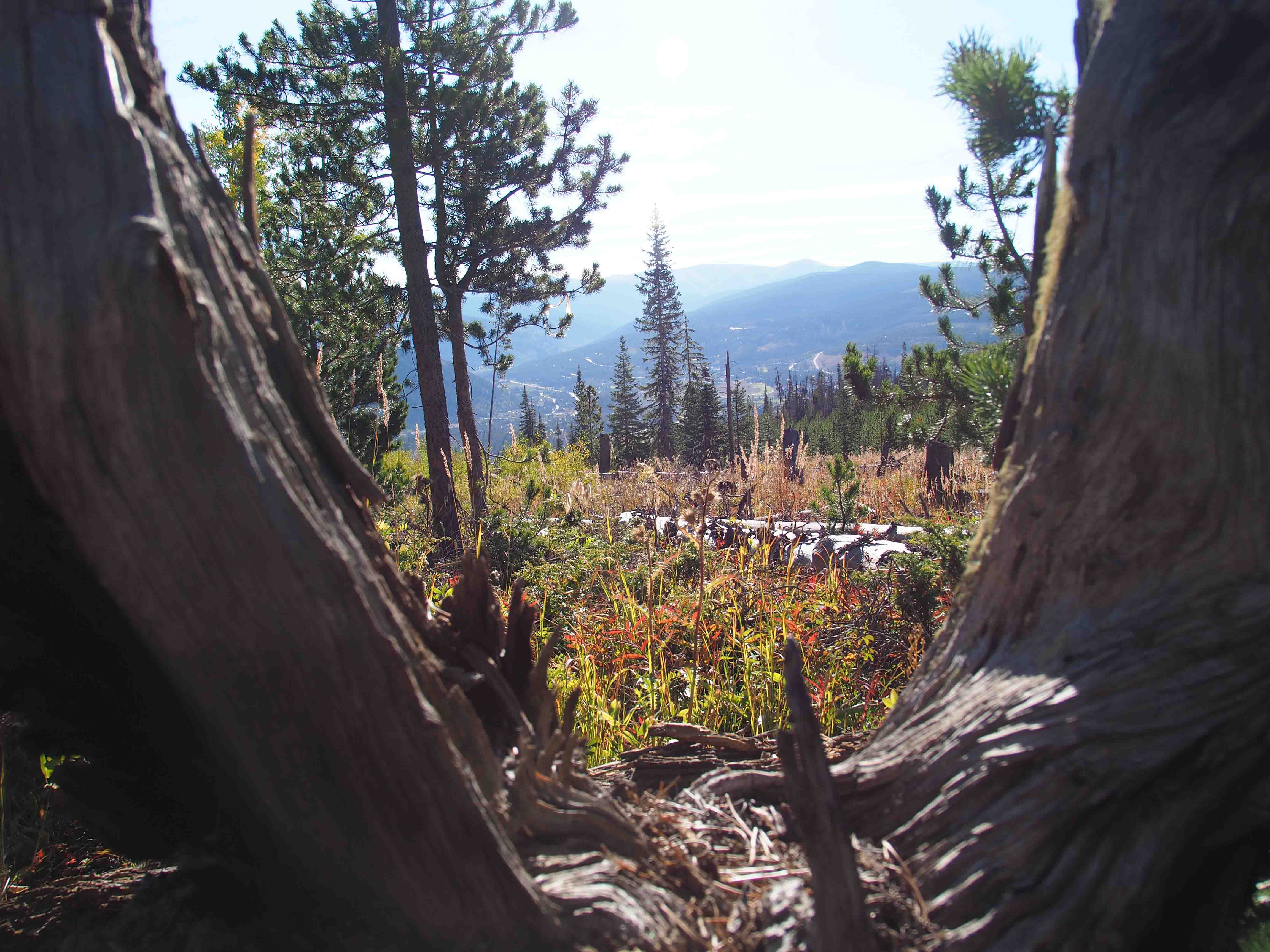
The second mile, though the flattest and easiest with a few trailside campsites, was quite ugly. The pine forest has suffered much devastation from the beetle. Many fallen trees lined both sides of the path and even provided us a few obstacles to cross. With the record high temperatures of September and little rain of late, the creek was dry. Amazingly, there were still a few wildflowers clinging to life which may have been the only pretty part of the second mile with the exception of intermittent views of the golden valley below.

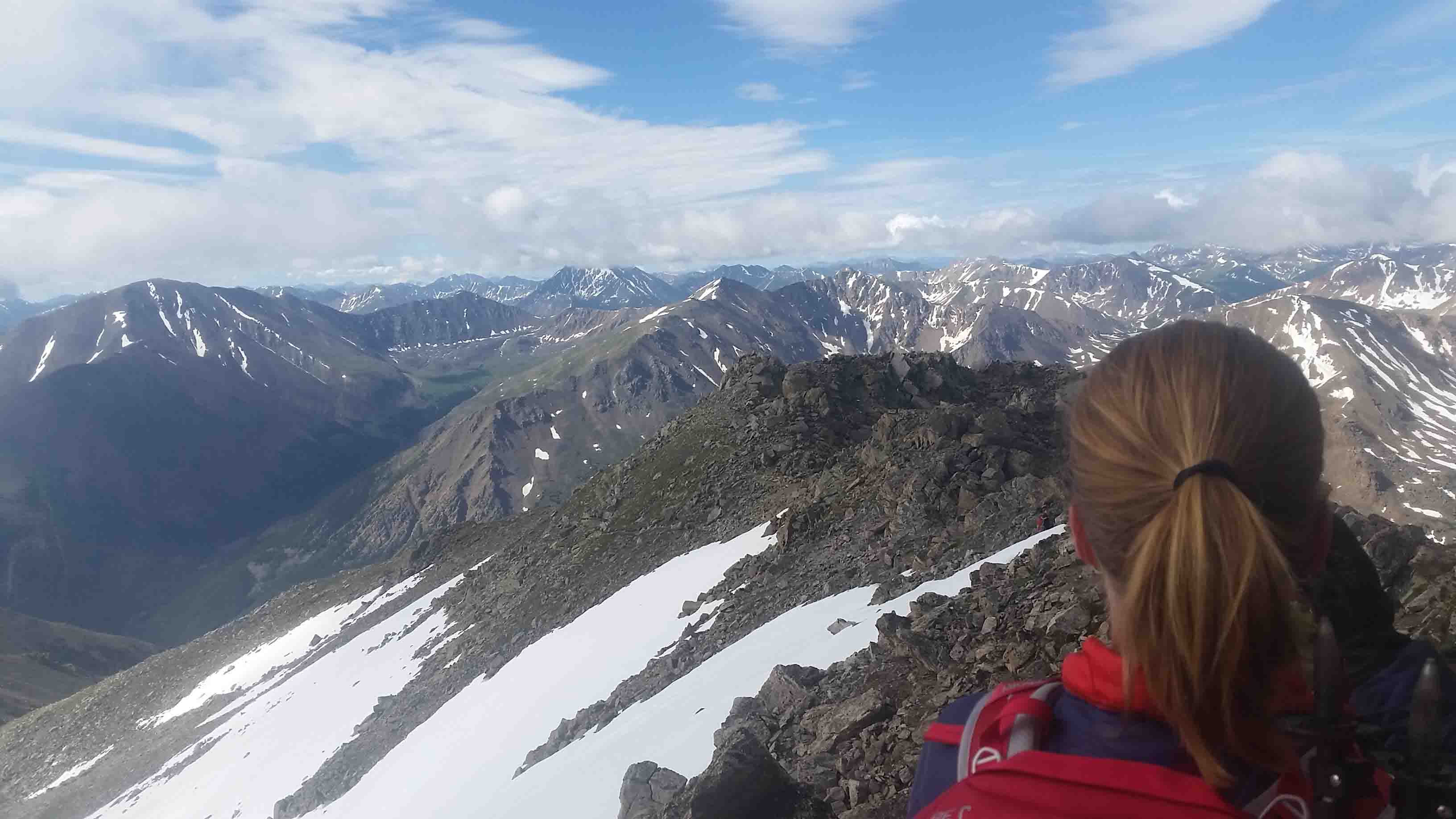
With every 14er, soon we ascended above treeline and entered the tundra. The treeless area offered spectacular views beneath the deep blue sky. While the views were nice, we contended with a strong headwind as we climbed toward a flat area before we had to boulder up to the peak of Mt. Shavano. Fellow hikers commented on the wind’s brutality.

Only three miles into the trail, I was already feeling weak and hungry, and we had eight miles to go. Now with a strong crosswind, we followed the trail to the right across a saddle. As I stepped, I lightly stubbed my toe on a rock. I reached my foot slightly farther than normal to the right to catch my balance and the wind blew clear off the trail! I landed very ungracefully in a patch of rocks. Pain shot through my bruised knee. My hip likely survived as it was protected by my shattered cell phone. David came to my aid and suggested that maybe we should turn around. That was probably an excellent suggestion, and I probably should have agreed, but those who know me know that is not part of my MO.

I told him that I was not going to quit, so he walked slightly ahead to my left while holding my left arm to block the wind. Upon reaching the boulder field, we found intermittent relief from the wind and opted to stop and eat in the cover of some rocks before we even reached the first peak! After refueling, I felt much better and we summited Mt. Shavano (14,229′) around noon. The panoramic views were stunning.

With it being October, there wasn’t any danger of inclement, summer thunderstorms, so we had plenty of time to maneuver across the boulder field, up and down 500 feet to Tabeguache Peak. Since I tend to get altitude sickness or a severe migraine (I haven’t figured out which since a headache and nausea are symptoms of both), I certainly wanted to knock out both peaks at once versus coming back to climb Tabeguache Peak on its own.

The one mile to Tabeguache Peak (14,155′) took us about an hour. The path came and went as climbed along the rocks. We hardly spent any time on Tabeguache Peak. We only signed the log and congratulated a few fellow hikers who had also made it to the small summit before we turned around. It felt easier on the return to Mt. Shavano, but by this time my headache was really kicking in, and we had a solid four plus miles to go.

Once we got below treeline, I just started crying. My head was pounding, and I was extremely tired and nauseated. I felt like I needed to eat for some energy, but I could hardly get a handful of nuts down. My Gatorade wasn’t much help either. I was burning up. I torched my lips as I failed to smear sunblock on them, and it was certainly too windy to wear a visor. All I wanted to do was lay down and rest. In the meantime, David’s knee locked up so while he was trying to help me, he was peg-legging down the mountain for the last mile and a half. We were so slow! It took us almost 12 hours to hike 11.25 miles.

While we had headlamps, fortunately we made it back to the aspen grove just before dark as the sun set. I’d like to say we stopped and admired the beauty, but a few quickly snapped photos is all I could muster as I was desperate to sit down. I’ve never been so excited to reach the car! These two peaks mark my 11th and 12th 14er since I started climbing them two years ago. While I don’t want to scare anyone since they were only Class 2, at the time it felt like the hardest thing I have ever done…harder than my marathon or triathlon. Personally, I believe it was simply the circumstance of starting the task on an empty tank, and that they probably weren’t that much harder than the other ten I have completed. I never felt in danger, but I sure felt exhausted and learned my lesson to ditch hiking a 14er unless I’ve gotten a full night’s sleep. As that is what my body needs! Despite the beating, I think we both feel accomplished and happy we finished. ETB

Shop

Check out the photographic note cards and key chains at my shop.  Each card has a travel story associated with it.  20% of proceeds are donated to charity.


photographic note card, mountain goat in colorado
MOUNTAIN GOAT
Best Adventure Travel Blog

Closing Weekend at Estabrook

What a nice weather we got for closing weekend at Estabrook. We were so lucky! The forecast called for rain, but we enjoyed a weekend of sun. A thunder shower rolled in one night and it looked like things might turn ugly as we were leaving today.

Heather and I went for a hike Saturday morning while David fished and Jaz read. The afternoon took David four-wheeling along the logging roads while we chilled out. We tried out the new Italian place that was packed. I thought it was fair, though we may not have ordered appropriately as the pizza looked pretty tasty. We finished out the night with family games.

On Sunday, while the girls played chess, we tried fishing once more. Not too much luck. I caught some bait…a tiny rainbow in the Platte that was the size of a minnow! Sad we have to wait until next summer to enjoy the place again. ETB

SHOP

For notecards and key chains, visit My Shop on this website.

colorado trail

Segment 7 of The Colorado Trail

With Segment 7 of the Colorado Trail complete this weekend, I have now finished Segments 1-10 (170.5 miles) over the past two summers. Only 315 miles more to go…I suppose I’ve made a small dent.

David and I visited Breckenridge Friday night which coincidentally coincided with Oktoberfest (in September) and were fortunate enough to meet Cat for dinner at Blue Stag. After a great meal, Cat was nice enough to shuttle a car with us to our pick-up point at Copper’s East Lot. Continue reading “Segment 7 of The Colorado Trail”

me enjoying the view on mount massive

Engaged on Segment 8 of the Colorado Trail! Also Backpacked Segments 9 and 10…

David and I set out to hike segments 8-10 of the Colorado Trail (the “CT”) from Copper to Leadville over five days which averaged just under eleven miles a day after including our side hike to the fish hatchery. On the sixth day, we tackled Mount Massive, the second highest peak in Colorado. It was an eventful trip! Continue reading “Engaged on Segment 8 of the Colorado Trail! Also Backpacked Segments 9 and 10…”

Awesome Fourth of July Weekend at Estabrook!

Estabrook

David and I made it up to Estabrook on Wednesday and set out for a short reconnaissance hike since we had heard all the bridges along the creek had been knocked out by all the high water this spring. The first two bridges made of a steel trellis and wood planks were washed aside. At the first bridge we waded through the cold creek which was still a few feet higher than normal. At the second bridge, other logs got knocked into what could be used as a crossing so we carefully stepped across the logs to one of our old kids’ campsite. The next bridge was out as well, so after searching for edible mushrooms, we turned around and took the logging road up to Eagle’s Rock and an overlook over Johnson’s Gulch. The road was intermittently marshy sometimes with a light stream of water flowing down the slope.

The meadow beneath the aspen stand was home to countless wild flowers and a cool looking yellow spider. I think we found seven varieties of mushrooms. David knew that a few were edible, but without his mushroom book we stuck with one variety which he knew the name. They went quite well on pasta! I supposed the bear wanted some mushrooms too as it visited us for the fullmoon night.

Upon our return, the rain began falling harder with every step. The road even wetter, we didn’t even bother removing our shoes to wade through the creek. By the time we reached the porch, we were soaked and cool, but it made for a nice afternoon by the fire.

Brian, Erin, and Ellen arrived Thursday night while Mike, Mario, and Moria arrived Friday afternoon. David and I, along with our Thursday guests found a nice hike for Friday morning, Silver Dollar Lake. It is only 1.5 miles one way to the lake and 2.2 miles one way if we wanted to extend the hike to Murray Lake. I have wanted to complete this hike for sometime. I tried this winter, but the trail wasn’t decipherable.

Silver Dollar Lake and Murray Lake

After an hour drive with David speeding along the dirt roads, we arrived at the trailhead. We began the hike climbing a few switchbacks through the evergreen forest. Soon we reached treeline as we overlooked Naylor Lake. The trail turned to a muddy mess at times from the recent snow melt. We slowly made our way to Silver Dollar Lake after stopping along the way to admire more magnificent wildflowers. With all the spring rain, the wildflowers will just get even better this summer!

At the lake, a young boy was flying a drone around! It was sort of cool, since he had a camera, but we were in the wilderness for some peace and quiet so we kept climbing to Murray Lake which was lovely. Only one other person sat along its shore, and he joined us for lunch as the approaching clouds cooled us off. It was time to head back to the cabin. We hung out on the porch, enjoyed happy hour, and eventually settled in for a tasty BBQ dinner prepared by Moria in honor of July 4th!

Eagle Rock and Johnson’s Gulch

Our next day’s hike was an adventurous one. Everyone was game to at least wade through the creek twice, so we took the same hike as Thursday morning up to Eagle Rock and the Johnson’s Gulch overlook for magnificent views and a bonus spotting of wild turkey. Some of the boys wanted to venture up the creek without the bridges, so a few folks headed back to the cabin while the rest of us looked for creek crossings. We waded across not far from the next bridge that was out and made it to the bear’s cave. If there is anything positive to say about the flooding waters is that they knocked the ugly logs that were stuck in the creek near the bear’s cave down river which made for a much prettier view at my favorite place in the world.

Finally we found a few newer bridges in tact, but one crucial one was out. The creek was just low enough to cross. Any higher it may have been harrier than it already was as we David had to rescue Mike’s dog, Marley ten down the creek. After stopping for a few photos at the hanging bridge, we waded through the water once more at Johnson’s Gulch to take a higher path along another logging road back to the house.

I think we probably logged 8 miles, enough to work up an appetite for taco and margarita night at Estabrook, a must! Dessert of S’mores, cards, and some dancing followed for a fun night! What a way to spend the Fourth of July, in the mountains with great company! ETB

SHOP

For notecards and key chains, visit My Shop on this website.

Mountain Goat Keychain thumbnail

Fredericksburg, Texas and Beyond

What a wonderful early birthday and Easter weekend rendezvous!  David found a cute little apartment over one of the shops on the main street of Fredericksburg and planned a fun two night stay.

Fredericksburg holds a special place in my heart from winning my first medium pony championship at the Gellespie County Fairgrounds to spending time around that area when I attended camp Mystic as a kid.  I was so excited to return as an adult, especially given the last time I tried during my road trip around the USA the weather was lackluster at best.  Sleet blew sideways, and VANilla’s doors froze closed!

Admittedly, the forecast called for dreary weather this weekend, so I hoped my luck would be slightly better than February 2011.  It wouldn’t take much as we headed northwest from San Antonio beneath cloudy skies.  Our first stop was outside of Boerne at the Cave Without a Name.

The Natural National Landmark is a limestone, solution cave which is created by a combination of water and acid that erodes the rock.  The cave is tens of thousands of years old as evidenced the remains of prehistoric animals, though the cave went largely unnoticed until the 1920s when a moonshine distillery was installed in the uppermost cavern during the Prohibition.  It wasn’t until 1935 when local children found the cave and were the first to enter its main chamber 90 feet below ground!

The owner of the property, Jim Horn, decided to open it to the public in 1939.  As part of the opening, Mr. Horn held a state-wide contest, offering $250 for the best name.  A young boy suggested the cave was too beautiful to have a name and was awarded the prize.

As we followed the 126 step staircase to its main cavern, I couldn’t help but think of the children who clambered down and back up the walls with only the light of a lantern.  We took an hour tour of six chambers which covered only 0.25 miles of the 3.5 mile cave.  Researchers are still exploring the cave which requires diving in the underground extension of the Guadalupe River which runs through it.  They still haven’t found its end.

IMG_1336 river

I expected the continuous 66 degrees would feel cold, but the cave was a nice temperature for us and several cave critters including bats, cave frogs, and salamanders.  I loved seeing these species as I think it is fascinating that an animal evolves to be blind or are born blind since the darkness provides no use for eyes.

20150403_112701 frog

The cave is home to a variety of formations including stalactites, stalagmites, cave bacon, soda straws, draperies, columns and more.  I particularly liked a dome structure, not because it was the prettiest formation, but because it was a type of formation I hadn’t seen in other caves.  It is truly amazing to realize how long it takes for the formations to grow.  We saw a small blob on the ground, not even an inch high, and it is 80 years old!

80 years old
80 years old

Another awesome feature in the cave is the rimstone dams.  One area looked like terraced rice fields in China only the small dams held crystal clear water in pools.  The water was so clear that at times we couldn’t see it, and at other times we thought a four-foot deep pool was only one-foot deep.

It was nice that cave tours took place upon arrival as well.  There were not any scheduled times so the group was really small, just four of us.  To see the cave on a scheduled time, however, it is possible to go in the evening for a concert like Italian Pops.  Apparently the acoustics are great.

Upon finishing up our tour, we continued north to arrive in Fredericksburg for a late lunch. We squeezed into thebuzzing bar area at the Fredericksburg Brewery.  That is about the best description I can give to the place.  We should have heeded the TripAdvisor reviews.  The room temperature beer was fair and the food not much better, maybe worse.  I ordered the fish tacos which were decent, but David ordered the fish and chips which frankly tasted like a fish dock.  I don’t know how he ate them.  Overall, I suppose it didn’t really matter.  We were both hungry and just trying to get some sustenance before we wandered along the crowded main street with a German influence.

Window shopping is our cup of tea, so we weaved between the shoppers as we glanced through the glass.  Occasionally we found a boutique interesting enough to stick our head inside, including the fudge shop and a gallery owned by an artist David knew.  What surprised us the most, however, was to find the National Museum of the Pacific War in such a small Texas town.

Truck owned by artist

In 1971, the Nimitz Foundation was founded to establish the original Nimitz Museum in the former Nimitz Hotel.  These efforts slowly evolved into the museum today.  Not being a World War II history buff, I didn’t know anything about Nimitz.  A Fredericksburg native, Nimitz was serving as Chief of the Bureau of Navigation in Washington, DC when the Japanese attacked Pearl Harbor.  He was handpicked by President Roosevelt to relieve Admiral Kimmel at Pearl Harbor.  He commanded an aggressive combat team that made all the right moves in the Battle of Midway which is considered the Navy’s greatest victory to this day.  In 1944, he was promoted to Fleet Admiral, only one of four at this time.  He also signed the Japanese Instrument of Surrender on behalf of the United States while stationed on the battleship Missouri in Tokyo Bay on September 2, 1945.  I can only believe I have never heard of him because I couldn’t stand history as a kid, as he seemed like one impressive guy.

The skies had cleared and with the weekend forecast sounding dreary, we didn’t want to spend any time inside the museum’s walls.  We thought we might have time for that later in the weekend, so instead, we simply enjoyed the sun while walking around the peaceful courtyards. We also checked out the massive propeller, canons, a mast, and submarine that lined the front of the building.  Soon after our stroll, it was time to check into our cute apartment, The Angel Inn, and relax before David took me for a lovely early birthday dinner at the Vaudeville Supper Club a block away.

Dressed up a little more than necessary in Fredericksburg (or Denver for that matter), we walked to the restaurant to be seated for our 6 o’clock reservation.  The entry to the Supper Club is through a lovely courtyard complete with a fireplace and fountain that we enjoyed after our five course meal.  The tasting menu included a variety of dishes that I wouldn’t have expected to go together and even included some items I probably wouldn’t have ever tried.  That being said, the fusion worked well, and the meal was spectacular…especially the pork belly ravioli topped with lobster and resting in an asian broth.  What a way to cap off a great day!

Our next day included another adventure to a cave, only this time an entirely different kind of cave.  We joined the masses at Enchanted Rock State Park as we waited in rather long traffic line just to get in the park.  Since neither of us enjoys crowds on the trail, instead of following everyone up the path to the top of Enchanted Rock, we chose to take Loop Trail to Echo Canyon Trail and then find our own way to the top of the rock.  Plus, walking around the weathered dome, which was thought to possess magical and spiritual powers by several Indian tribes due to its night-time creaking and groaning noises, added some distance.  I think we were able to get in a full 3 mile roundtrip.

This route was lovely.  We probably only ran into ten people as we meandered along the wildflower lined trail past Moss Lake and the climbing areas to a place on enormous pink pluton batholith that looked scalable.  For the most part, we could scramble up with relative ease and didn’t need our hands to help.  Therefore, make-shift route turned out much easier than I expected.  There was no way avoid the crowd  on the top of the rock, though fortunately it is quite large, so we settled for an area slightly protected from the wind if that exists.  The last time I was on top of this rock my hair was blowing sideways.

February 2011
February 2011

On the west side of the rock, we found the sign that pointed to the “cave” entrance.  It wasn’t hard to spot as the ranger said, “Just follow the 10,000 people going up to the top and then follow the 5,000 that go to the left!”  The cave was more like a giant crack in the rock which required some flexibility.  We entered after a group of four who weren’t prepared. The area was pitch black, and a headlamp is highly desirable.  Worst case, the flashlight on the cell phone comes in handy, but maneuvering through the cave definitely requires both hands at times.

Not everyone in the group ahead of us had lights and one person had significant problems laying on her back and sliding through holes not much bigger than David.  We waited so long, I felt like we’d get trapped in between groups.  With a slight tendency toward claustrophobia, I found myself uneasy at times while wishing they would speed up!  Fortunately, no one caught up to us until the very end so we got play around with photos and even enjoy an apple in the middle of the narrow cave.  A little wet and dirty with a few bumps on our heads, we eventually exited cave near our make-shift path.

Instead of turning down, we returned to the top of the rock along our previous trail and finished our lunch before following the masses to the parking lot.  It was awesome, and we finished in time to enjoy some wine and the view of Fredericksburg’s bustling main street from our balcony.

For dinner, we tried the “second best” restaurant in Fredericksburg, Cabernet Grill, on Saturday.  Its outdoor atmosphere with a water wheel and fish pond was neat.  The cuisine was tasty, though the difference between the #1 restaurant and #2 restaurant on TripAdvisor is substantial!  Regardless it was a fun day and lovely atmosphere.

We had to wave good-bye to Fredericksburg on Sunday, but not before we enjoyed a fantastic lunch at the Vaudeville Bistro.  I had the lump crab quiche while David devoured buttermilk fried chicken.  Both were excellent, especially David’s jalapeno cornbread.  I ate most of it off his plate.

20150405_104748 quiche

Before we reached San Antonio, we stopped at Guadalupe River State Park, a place where David sometimes rafts and kayaks.  With the drought, the water has been relatively low, so he hasn’t gotten to do too many river sports of late.  The water level didn’t affect us today, however, as we just hiked along the river banks on Bald Cypress Trail.  The river was lined with enormous trees whose roots and trunks were smoothed by the river’s flow during rainier times.  In jeans and a sweater, we weren’t dressed for a big hike, so we weren’t at the park long.  We were really just planning to take a look at the river because for some strange reason I wanted to check it out.  Of course, I always find it peaceful to walk by water, I can’t say I have too many fond memories of actually swimming in the Guadalupe while at camp.  The lovely spring, aqua color turns mossy green by summer and it is home to snapping turtles and water moccasins!  I took free swim at camp just for a free period, not to actually swim.  Being near the water, however, did give us the idea to go to Texas Coast on Monday though.

I was surprised to find out Corpus Christi and its beaches are only two hours away from San Antonio.  After a leisurely morning, we packed up David’s paddle board and headed to the coast.  We stopped for lunch at Snoopy’s and chowed down on some tasty fried seafood platter before we set up our chairs on the beach just ten minutes away.

I enjoyed a book and a walk on the beach while David surfed the waves.  I would have walked farther, but the beach was peppered with Portuguese Man-O-Wars.  Anyone who has grown up going to the Gulf in Texas knows to stay away from those guys as they deliver a super painful sting while alive or dead!  Though its appearance resembles a jellyfish, it is a siphonophore and its stings leave welts on human skin for three days.  Discovery on man-o-wars washed up on the beach can lead to a beach closure!  I suppose we were lucky as I passed at least 100 of them and was careful not to step on their long, venomous tentacles.

David could have paddled boarded for hours (and probably much longer than I could have sat on the beach), but we needed to get back home for dinner with the girls.  Delicious sushi and Rice Krispie Treat Eggs (that we made Easter night) called our names.  What a great weekend in the surrounding areas of San Antonio, especially given how bad the weather was supposed to be (we hardly saw a sprinkle)!  ETB

Shop

Check out the photographic note cards and key chains at my shop.  Each card has a travel story associated with it.  20% of proceeds are donated to charity.


photographic note card, lichen
LICHEN
Best Adventure Travel Blog

Painted Mines, the Incline, and Christmas at the Broadmoor…A Cracking Time in Colorado Springs

I had the greatest day. While I got off to a slow start, my day was action packed once I reached Painted Mines Interpretive Park in Calhan, about 20 miles East of Colorado Springs. I heard about the park from a photography group that takes an annual trip to shoot the colorful formations. I thought I had signed up to go, but then realized I failed to RSVP, so I was on my own.

Sometimes I think going alone is better anyway. I tend to hike faster than photographers and slower than the average hiker as I go off into lala land while admiring nature’s wonders. Today was no exception. The group of forty was going very early. All morning the sky was covered by a large, grey cloud…like a snow cloud that I’m certain blocked the sunlight and the vibrant colors it brings out on the rocks. While many times, an overcast day is the best time to shoot, in this instance it wasn’t, and by the time I arrived the skies were clear! I’m so glad I went alone and delayed my arrival.

Painted Mines Interpretive Park was slightly farther out of the way than I expected. My planned hour drive was closer to an hour and a half. Occasionally I wondered if I really should trust my GPS as I passed through very rural farm country. After miles, I finally came up Calhan, a very small community with a few shops and gas station much to my relief. The park was just a few miles away.

The map of trails indicated hikers could follow a few loops to historic areas where Indians and early settlers once lived and to geological areas. I opted for the geological area. 55 million years ago, the area was a hardwood tropical forest which was later covered by white sandstone known as the Dawson Arkose Formation. Its stone and clay layers have been weathered by wind and rain to produce the current badlands and hoodoos.

It didn’t take long to reach the formations with very narrow walking paths. This solidified my awesome choice of going alone. I can’t imagine fitting three people in certain areas, much less forty, especially having to maneuver on uneven, snow-covered terrain at times. And I had a ball using the contraption my mom brought to me from China. I could take a selfie from several feet away with a collapsible metal pole that held my phone and extended!

FullSizeRender (16) selfie

Each badland area, located on either side of the main, sandy trail was unique. Some areas were larger than others. Some displayed an array of pink, orange and white hues, while others did not. Hoodoos, unusually shaped spires towered above vibrant layers of colors in some areas and didn’t exist in others. The only constant were the bunnies that hopped from one hiding place to the next as I wandered through the formations.

After spending close to an hour on this 0.6 mile trail, I decided to follow another trail that climbed to an overlook. At this point, the park seemed like mostly prairie land and not too exciting, but the information board suggested hikers could spot wildlife, so I decided to follow one of the loops. While the sign posting is good, I might caution that there are two parking areas. When I looked at the map, I only saw one, and the loop I was following seemed different from the picture I remembered. This was because I focused on the wrong parking area. It certainly didn’t cause any problems, it just seemed weird until I noticed the other parking area on a different road as I followed as I strolled around the loop.

I can’t say the rest of the park was terribly interesting, though it did provide an amazing view of the snow covered Pikes Peak, and I got in a decent walk. I didn’t follow the other 2 mile loop that passes by a small lake as while I was down near Colorado Springs, I wanted to try my luck at the Incline in Manitou Springs.

OLYMPUS DIGITAL CAMERA

Boy does the Incline have a reputation. It was once a cog railway, built in 1907 and used to access water tanks at the mountain top that provided gravity fed water pressure to the cities of Manitou Springs and Colorado Springs. Soon after its construction, it also became a tourist attraction. The railway operated until 1990 when a rock slide knocked out the tracks. Since the Pikes Peak Cog Railway opted not to repair the tracks, the trail steadily gained popularity as a hiking destination and fitness challenge. Due to the land which the Incline traverses being owned by three entities and the challenges of limited parking which costs $5, the Incline was part of several legal battles which were finally settled in January 2013 after reaching the US Congress!

The trail remained open until August 2013 when it was closed for repairs. It just reopened a few weeks ago. Honestly, as my heart beat rapidly beneath my heavy breath, I couldn’t understand the draw of this trail. It gains 2,000 ft, from 6,600 to 8,600 in less than 1 mile and the view ahead of the climb was of not terribly aesthetic railroad ties and an occasional rusted barrel. I could tell when the trail increased in steepness just by seeing double stacked railroad ties and opposed to singles that I to scramble over. At times, I could reach my hand out in front of my chest and touch the next step up! It was important to lean forward and step on the ice carefully as to not sail backwards down the stairs.

I hiked for 25 minutes before I looked at my phone to see the time with the looming summit in my view. Good grief, how long was this going to take me, I thought. I didn’t have the luxury of stopping as I began the trail at 2:30, thus I only had two hours of daylight! I finally bothered to turn around and look at the view when I reached the “bail out” point three quarters of the way up. This was when I realized why people might want to torture themselves for something other than exercise. I have to admit, I don’t generally enjoy city views in the mountains, but this view was spectacular! Just looking down the hundreds of stairs I had climbed was cool.

The whole time I was slowly stepping up the Incline, I couldn’t help but wonder how many floors I had climbed. Just the previous day, I had climbed 53 floors in 13 minutes on the revolving stairs at the gym. I also wondered how my two hundred squats and lunges in my PiYo class twice a week were helping me. Further I thought of the firemen who climbed up the World Trade Center with all their gear in the smoke. I sure felt a lot a respect for them. I had a lot of time to think given it took me 1:03 to summit. The decorated Christmas tree brought a smile to my face as I heaved to catch my breath. You’d think after climbing multiple 14ers, it wouldn’t be that hard at half the elevation and less than a mile, but I have to say it was a good challenge. My time was a far cry from Olympian Apolo Ohno’s time of 17:45 which is a whole minute behind the fastest time. I suspect if I were still playing soccer or if I tried the climb during my marathon training, I would have finished much faster. Now a days, I’m just happy to complete the things I try.

I remained at the summit for about three minutes before I decided to take the Barr Trail down. This is the common route down as the Incline can be very crowded. I suppose one benefit of going at 2:30 is that not too many hikers were attempting to tackle the climb in the late afternoon. Only five people were at the summit when I arrived, and one guy told me it would take about an hour to get down, whether I returned down the railroad ties or followed the 2.5 mile path. I’m actually not exactly sure of the path’s length. He said 2.5 miles. The sign at the bottom of Barr Trail said 4 miles to the summit. Most of what I read said 2.5 to 3 miles with a round trip of 3.4 to 4 miles including the Incline.

Regardless, I expected the trail would be easier to descend than the icy Incline. Since I was by myself and strapped for time, I began jogging down the trail. The views of the snow dusted mountains to the southwest with the pink clouds overhead were lovely. I wished I could have gone slower to enjoy it a bit and take out my good camera which was packed in my backpack. Instead I snapped a few shots on my phone, though I think some random filter was on given the pink sky and red rocks look blue! As I descended, I soon reached some icy patches where I slowed to a walk. It didn’t take long for me to take a step and do a pirouette.

While my dance move may sound graceful, I can promise it wasn’t. Most of my turn was around my right knee (ouch), until it gave way enough for me to catch myself with my left hand as I fell. I think I would have scored a half point higher than a fallen ice skater! I continued on passing many which was not the case on my ascent as I was being passed. One girl was cursing as she was trying to maneuver the ice and rocks. I mentioned that I nearly bit it (my butt never hit the ground), and she and her two friends replied, “We already have.”

I reached some more ice, and thought I better hold on the wood railing. I wrapped my hand around the log, took a step and did the splits. Whew, my body was not made for that much stretching. It felt like I pulled every muscle in my left leg! Admittedly, I had my microspikes in my bag, and I could have strapped them on, but each time I thought about it, I’d get to a long dry stretch. I’d think oh there can’t be much more ice as I’ve descended over 1,000 feet. Of course, there was more ice, and I finally met my demise with me feet sliding out from under me and landing on my side. Funny, falling hurt far less than saving myself! I popped up as fast as I fell in order to get my hand out of the snow. I didn’t feel too bad about falling though, as each person I spoke to on the way down fell at least once! Gluttons for punishment I suppose.

It took me just under an hour to descend at my slow jog and penguin walk. Toward the end, my legs were tired and unfortunately on the ice I had to keep all my muscles from waist down tensed to take tiny steps and stay upright. The good news was I finished and my day was far from over. I swung by 24 Hour Fitness for a shower and treated myself to visit at the Broadmoor decked out in Christmas lights. I walked along the lake surrounded by trees decorated in white lights. I admired the gingerbread houses in the upstairs lobby. And I enjoyed an amazing fruit and cheese plate at The Hotel Bar while meeting a few nice ladies, Lynn and Judy.

The Broadmoor’s displays were wonderful, and I think I found a new favorite place and winter tradition (minus the Incline). I liked the Incline, and I can see how it would be a draw to locals because climbing stairs outside beats the gym, but coming from 80 miles away, I think I have other trails to explore. All in all, my day was spectacular, and I will definitely return to enjoy the Broadmoor and to check out the cute town of Manitou Springs among other things! ETB

Shop

Check out the photographic note cards and key chains at my shop.  Each card has a travel story associated with it.  20% of proceeds are donated to charity.


photographic note card, yosemite falls
REFLECTIONS
Best Adventure Travel Blog

Emerald Mountain on Thanksgiving

What better way to make room for Thanksgiving calories than to hike up to the quarry at Emerald Mountain in Steamboat! I followed the snowpacked road to its summit with no need for snowshoes or microspikes now that I have some new hiking boots from North Face. Anyone with a narrow foot should try North Face boots!

OLYMPUS DIGITAL CAMERA

Emerald Mountain is clearly a place for locals to go exercise and socialize. Some folks were running the trail while others were letting their dogs run free. I don’t recommend this location for any hiker who is afraid of dogs. There were more dogs than people, none of which were obeying the “leash law.” I got to greet several happy mutts!

OLYMPUS DIGITAL CAMERA

The Emerald Mountain area offers a network of trails, though it was a bit hard for me to figure out all the options, so I followed Blackmer Drive almost two miles to a spectacular view of the town of Steamboat and it’s snow covered, ski slopes.

OLYMPUS DIGITAL CAMERA

Afterward, I got to dive into turkey, mashed potatoes, dressing and a variety of pies with my family and friends. I doubt if I burned as many calories as I ate, but at least I exercised a little. Happy Thanksgiving to all. ETB


Golden Gate Canyon State Park

Well, I’ve been trying out tennis lately and have been remiss about going to the mountains, especially with travel to sea level as of late.  It’s amazing how quickly I got out of hiking/altitude shape, and I only went up to about 8,800 feet!

Today I joined a group at Golden Gate Canyon State Park located probably 25 miles west of Denver.  I had only been to the park once before and hiked some trails on the western side.  Today we aimed to hike Mountain Lion Trail, a 6.7 mile loop described as difficult in the park’s pamphlet on the eastern side.

After some confusion about where to meet, as many trailheads lead to Mountain Lion Trail, we finally turned into a cohesive group at the Nott Creek parking area, the most eastern side of the park, around 10:20 without our hike organizer.  We soon set off to tackle the trail that loops through the only hunting area in park during hunting season…great!  After having bullets whiz by me in September on the Colorado Trail, I wasn’t entirely enthusiastic about visiting a marked area for gunfire, though I suppose we had safety in numbers.

IMG_6906 view

The weather forecast called for 65 degrees by noon and we warmed up quickly as we began our climb on an open path beneath a sunny sky.  Soon we entered the trees and followed the creek along a path dusted with snow.  As we continued climbing, the hikers spread out, thus we stopped to regroup.  Breaking a sweat and then stopping in the shade and snow chilled us to the bone…the temperature was far from 65, especially with the wind!

We reached a trail intersection where we could continue on Mountain Lion or follow Burro Trail that passes by an offshoot to Windy Peak.  A few members of the group wanted to climb Windy Peak, so we bailed on our original plan and turned left to follow Burrow Trail.  At the junction for Windy Peak, the wind was whipping and that was at the base.

Being cold, I opted to skip Windy Peak and all but two guys followed my lead.  We walked slightly further to a rock outcropping for a short lunch, but I didn’t stay long as I needed to warm up my toes! A few others were in agreement to get moving again.  The trail led us downhill to a few different junctions where we connected to a service road to make it to the parking area.  It was a nice hike.  I would have liked to do the whole Mountain Lion Trail.  By taking Burro Trail, we probably shaved off a mile or so as we finished up in less than 3 hours.

Congregated in the parking lot, we enjoyed the warm sun!  I’m dreading this week of ten degree temperatures as frankly, it was a lovely day in Colorado and I felt frigid!!  Regardless, it was good to out and enjoy the mountains.  It’s been far too long.  ETB

Shop

Check out the photographic note cards and key chains at my shop.  Each card has a travel story associated with it.  20% of proceeds are donated to charity.


photographic note card, snowy waterfall in oregon
SNOWY FALLS
Best Adventure Travel Blog