End of the Season at Estabrook

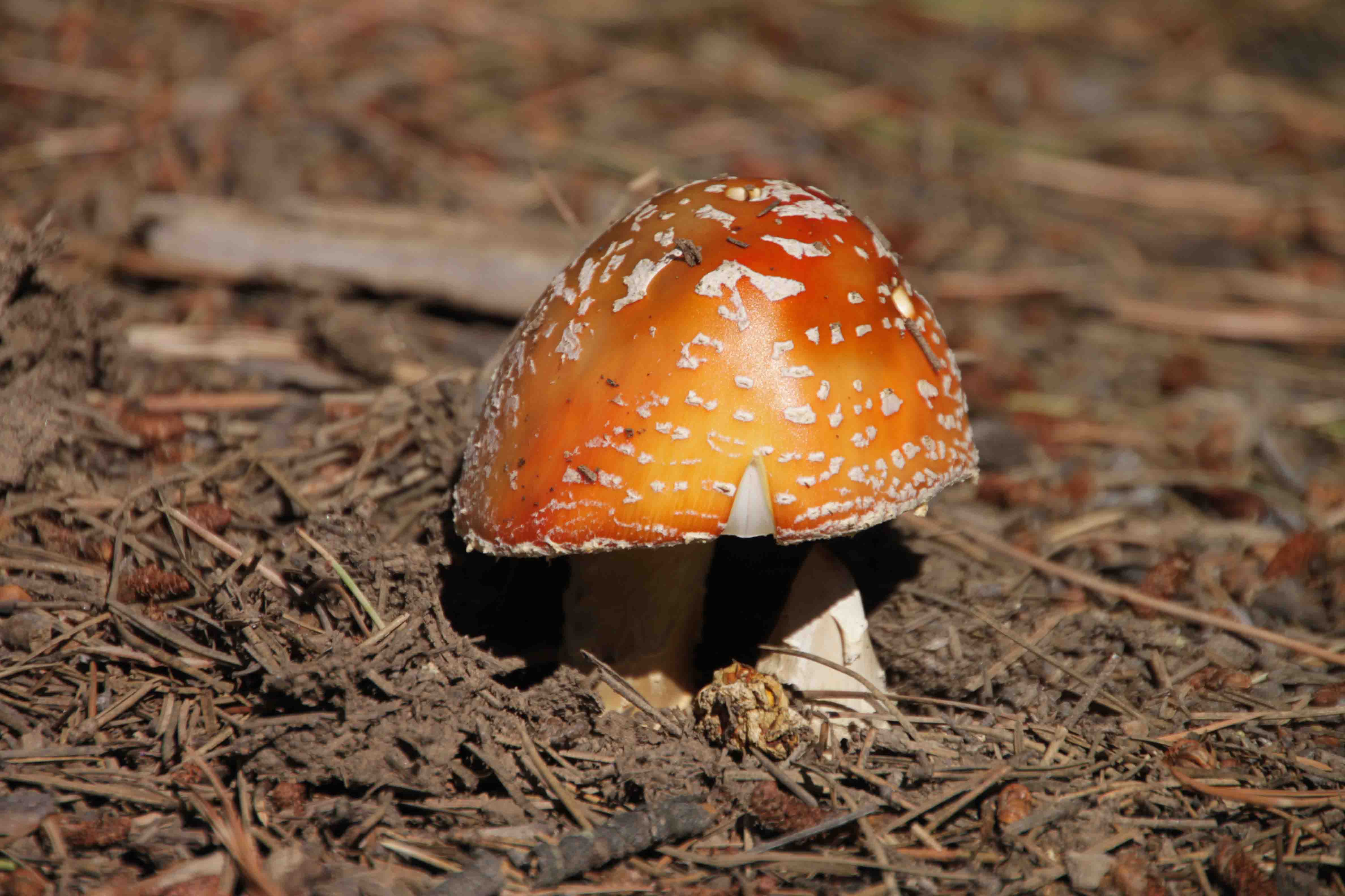
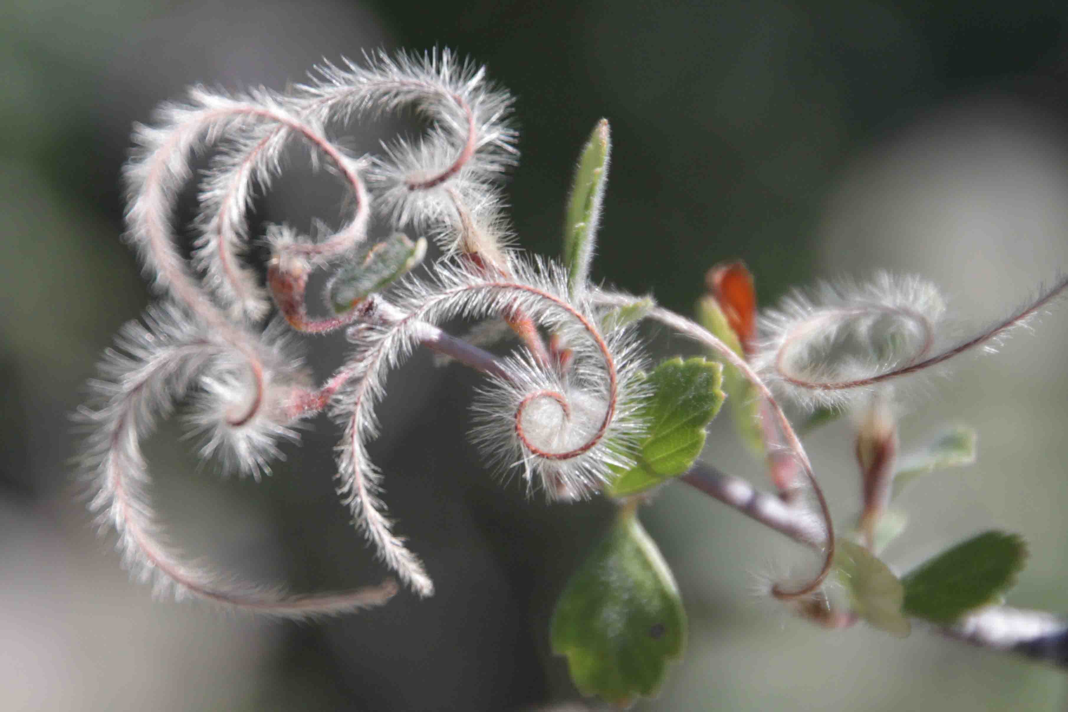
Two of the last three weekends I’ve gotten to spend at Estabrook, what a treat! Of the two weekends, the first one I spent much of the time hiking the Colorado Trail with Bart, Sue and Jim and I blogged these events. I also took my token walk up to the Bear’s Cave with Jim, Brian and Erin. For some reason, following Craig Creek through the unkempt forest and crossing some dangerously old bridges never gets tiresome. We continued on over the hanging bridge, to Johnson’s Gulch, and followed the logging road along the mountain top back to the house. Along with hikes we enjoyed margarita night, s’mores and fireside chats.

This past weekend called for closing time. Cat and Suman helped me out with the chores, but not before we had some fun. While Cat got in some practice mountain biking time at Buffalo Creek for her upcoming race, Suman and I ventured to Georgetown to ride the train! We took the long, pretty way over Guanella Pass into Georgetown. It was a perfect choice. The yellow aspen twinkled beneath the bright sun in the brisk morning breeze along Guanella Pass Road. The bighorn sheep seemed to think the best grass was roadside…what a treat to see them!

After a leisurely drive to and through town, we arrived at the Georgetown depot early enough to browse the shop and shoot some photos along the creek before boarding the train from Georgetown to Silver Plume for the 12:10 departure. I believe the round trip is just over an hour and the Georgetown Loop Railroad offers a variety of options and departure times. We chose a Parlor Car which provides tables and chairs, free snacks of the Crack Jack style and Coke products, alcoholic beverages for purchase, and the car is enclosed. This first class experience cost us $35. Coach cars, which are open air and bench seating without food and beverage service are $9 less. Dinner options are also available.

The train was completely full. We stretched our legs in Silver Plume for ten minutes, but were not able to explore the tiny town, hopped back on board, and returned back to Georgetown where we spent the afternoon browsing the antique shops and then enjoying tea at the Dusty Rose Tea Room. We just went back in time about 100 years I think. If only we had dressed for the occasion! http://dustyrosetearoom.com/

Regardless it was a fun time to stroll through the old town and to learn the history of the short-lived Georgetown Loop. In 1877 word of monumental silver discoveries in Leadville spurred a rush to the new ore fields 45 miles southwest of town. Union Pacific, anxious to join in the bonanza, planned several routes, one west from Georgetown over Loveland Pass. Unfortunately, Clear Creek Valley at Georgetown posed a problematic 6% grade, too steep for a locomotive. Union Pacific’s chief engineer was able to design a track that looped over itself and reduce the grade to 3.5%, but by the time the remarkable feat was completed three years later, other less complicated routes had been discovered and plans to continue the Georgetown line over the Divide were abandoned.

The Loop’s ingenuity, however, became a tourist attraction, and people from all over began taking the railroad from Denver to Georgetown and over the loop to Silver Plume. From Silver Plume, visitors took the Argentine Central Railroad to the top of Mount McClellan or rode the Aerial Tramway up Sunrise Peak. Tourism lasted until WWI and the arrival of the automobile ended the Denver line, but the reconstructed Georgetown Loop is here for anyone to enjoy. http://georgetownlooprr.com/

We took a different way home through Evergreen and enjoyed a night of margaritas and Settlers before we opted for another somewhat different activity on Sunday. We ventured to Castle Mountain Recreation at Wellington Lake and attempted hiking to the “castle”. Obviously, hiking is not a different activity, but actually paying to go to Wellington Lake hasn’t made the list often. It is a lovely site. The lake is large (167 acres). The giant rocks overhead look like their namesake, the “castle”. The mild and sunny October day with yellow aspen sprinkled in the forest of evergreen along the mountainside couldn’t have made for a better setting. http://www.castlemountainrec.com/

IMG_6604 beg of hike

Camping, fishing and boating is also available, though I can’t say much about that as we were simply there to hike. After we paid $5/person and $5/car, which seemed a bit steep, we began our adventure on the other side of the lake near the boy scout camp. The manager told Cat to follow the trail from the parking lot to the waterfall and at the waterfall we would find the trail to the castle. He said we would climb 2,000 feet in 2 miles.

To start, there wasn’t a trail at the parking, only a road! Luckily, some folks were just finishing up their hike, so we asked them. The husband made the hike sound like a simple loop, “the road forks, the right side is easier, or you can go left and follow the creek up a steep trail.”

Great, we thought as we walked 100 feet and found several forks in the road. We followed the fork to the farthest right though in hindsight should have headed toward the picnic tables in the middle. Our road took us to an opening in a fence with a sign “” with arrows on each side. Above “scouts” was “waterfall” with an arrow pointing diagonally to the left. Trails went to the left, right, and somewhat straight but veered to the left. Logically, we went straight, veering left as the diagonal arrow seemed. This was wrong. We should have followed the due left scouts arrow. We found this out two hours later after a grand adventure to the castle.

For much of the way, we did follow a steep trail up the mountain. Overlooks afforded us fantastic views of the lake. We kept looking for the waterfall and could hear water once in a while, but we could never find it. We continued up, even when the trail became poor and non-existent mostly because the boulders were awesome, the adventure was fun, and we were hopeful to find a trail to walk down as we didn’t want to descend the same way we went up!

Unfortunately, we eventually reached a point where we were not going up or around, so we found a decent place to descend. So while we didn’t reach the top, we certainly created our own experience. We never felt afraid either, as despite being lost, we always had our reference to the lake so we knew where we were, just not the trail. Suman, however, has decided she will no longer hike with me or Cat! Though we descended in a completely different spot, we ended up at the misleading sign. This time we chose left. In a few hundred feet, we found another sign pointing to the “castle” trail.

I can’t believe we made it so difficult on ourselves. It’s amazing how much difference a few hundred feet make in so many things in the world. For that matter inches and centimeters at times. Anyway, after a leisurely lunch by the waterfall, Suman indulged us and let Cat and I attempt the climb to the castle again. We didn’t want her to have to wait too long, so we hiked as fast as we could up the rather steep, granite scree trail.

We made it to the base. Climbed up the edge of the rock on one side then stop. It looked like we could have hike around the front face or maybe the back, but it would have required some investigating, time and energy that we may have had, but needed to save for another time. After enjoying the view for a minute or two, we faced a treacherous return. I’m not sure if the loose scree or the packed trail was harder to hike down, but many times it was harder to stay on our feet than our bushwacking earlier in the day. I would have enjoyed having my hiking poles on this one. I really enjoyed the hike, and I think I will have to donate to Castle Mountain Recreation again, as I want to spend more time on the summit.

I understand it can be reached from the Rolling Creek Trailhead for free, though it requires leaving the trail and bushwacking as well. It is also much farther so a $5-$10 may be worth it! Overall, it was a wonderful two weekends at Estabrook with good friends and fun activities. ETB

Shop

Check out the photographic note cards and key chains at my shop.  Each card has a travel story associated with it.  20% of proceeds are donated to charity.


photographic note card, maple leaf
MAPLE LEAF
Best Adventure Travel Blog
Aspen on the Colorado Trail Segment 5

The Colorado Trail – Segment 5

Since setting my goal to hike the Colorado Trail in mid-August, I’ve been able to hike the first four segments, though not in order. Today, with the help of Jim, I logged Segment 5’s 15.1 miles, so I have now completed the first 72.2 miles of the trail!

Segment 5 offers absolutely magnificent views. I thought Segment 4 was a fantastic segment to complete during the fall in order to see the changing aspen leaves, but Segment 5 may take the cake! The colorful aspens were definitely the highlight.

Continue reading “The Colorado Trail – Segment 5”

close up of aspen leave

The Colorado Trail – Segment 4

I’m feeling exhilarated and exhausted simultaneously. Segment 4 of the Colorado Trail was simply magnificent! I highly suggest hiking this segment during the fall when the aspens and willows change from green to golden. I know through hikers may not have this luxury, but day hikers shouldn’t miss this part of the trail in the fall.

How to Get There

The trailhead can be found 8 miles from Bailey down County Road 68 in the Pike National Forest. The road changes names to FS-560, but consistently staying to the right at any splits results in arriving at the Rolling Creek Trailhead parking area. A forest service road extends from this parking area 0.3 miles up to another parking area directly across from the trail to the right. Continue reading “The Colorado Trail – Segment 4”

yellow flower

The Colorado Trail – Segment 1

Parking the Cars

JB and I wanted to hike the first segment of the Colorado Trail (“CT”) which begins in Waterton Canyon and ends 16.8 miles later at the South Platte River Trailhead located near the ghost town South Platte. As such, we took a road trip, each driving 130+ miles!

Our morning began at 6:30 am, where we met at the Woolly Mammoth parking lot. From there we caravanned to the end of Segment 1 to drop off a car so that we’d have transportation upon completing our one way 17 mile adventure. Then we backtracked to Waterton Canyon to begin our hike at 8:45 am.

HAPPY HIKING!
pretty plant

The Colorado Trail – Segment 2

Many thanks to my friends, Harlow, Erin, Brian, Justin, and Kristin for getting me one step closer to my goal of hiking the entire Colorado Trail or should I say 30K+ steps closer according to my fitbit.

Getting to Segment 2 of the Colorado Trail

I took a tip from my friend Jim and planned for three of us to hike the trail in one direction and three of us in the other, so we had cars at both ends of Segment 2, the next section I planned to tackle. As such, at Harlow’s suggestion, we met at the Twin Forks PNR on 285 to trade vehicles so that we would end up with our own cars at the end. Given Erin, Brian and Harlow drew the downhill direction, they would finish before us and this way we didn’t have to try coordinating at day’s end.

HAPPY HIKING!

The Rockies: Hiking to Heart Lake

After four months, Jim and I finally found a weekend where we were both in town the same day…WOW! We took advantage of it and went on an awesome hike to Heart Lake. Tanya recommended it to me, and we thoroughly enjoyed it.

Lucky for me, Jim is organized, had the directions to the trailhead printed and was familiar with the James Peak Wilderness Area. It was my first time to the Moffat Tunnel. I’ve heard of good hikes near there, though I didn’t realize Heart Lake was one of the options.

The first thing to know about hiking the trail is to skip using the pit toilets in the parking lot. Hiding behind a tree would be a better option, and I’ll leave it at that. The other important tip is that Heart Lake requires following the East Portal Trail toward Rogers Pass. The signs at the trail intersections don’t mention Heart Lake, so it is best to know Rogers Pass is the way to go. It is also good to know that Heart Lake is the last lake on the trail and requires a steep climb above the treeline before it can be found off to the right. None of this is indicated on the trail, though there are many other signs to Crater Lake, Arapaho Lakes, Rogers Pass, and more.

The trail begins to the right of Moffat Tunnel and climbs through aspens, past old buildings, across South Boulder Creek, and through meadows of wildflowers. We found one daisy-like flower that was fluorescent blue that looked like those fake flowers you find in the store. I was so shocked.

We continued along the trail which seemed almost like a creek bed as it was so rocky. The path led us through the pine and spruce forest and past trail intersections at 1.25 miles and nearly 2 miles. Soon we used a log bridge to cross Clayton Creek and then other creeks.

As we continued gaining elevation, overall just over 2,000 feet in 4.35 miles, it seemed like the water never stopped. Both sides of the trail were so lush! A beautiful double cascade tumbled down the mountain to the right as wildflowers grew from the rocks in between. Lakes were everywhere (I think we saw four before we made it to Heart Lake). Water trickled from the base of several. Water filled the path too. We hopped from rock to rock trying to dodge the muddy slush.

The trail included variety with amazing rock formations, waterfalls, creeks, wildflowers, meadows, trees, lakes, and tundra. Now I know why we met so many people along the way, though all the hikers either spun off to Crater Lake or stopped at Rogers Lake, thus the tranquility of Heart Lake Basin was left just for us.

Above the treeline, the gusty winds beneath the cloudy sky cooled us quickly, thus we sought shelter from one of the few rocks along the shoreline to enjoy our packed lunch. As soon as we rested our backs against its surface, the sun poked out. What a nice break! Toward the end of lunch a few drops of rain indicated it was time to pack up.

It wasn’t until we descended the ridge that I realized the steepness. No wonder I had to stop and catch my breath on my way up to 11,300 feet. As the sky darkened, the rain continued to fall until raincoats became a necessity. The showers spilled from the daunting clouds for almost our entire descent. The creek bed we ascended, was now a creek. While our outer gear was pretty damp by the time we reached the car, we were dry and warm underneath and really enjoyed a nice day! And to top it off, we reached the parking lot just as the train went through the Moffat Tunnel which has an interesting history (http://en.wikipedia.org/wiki/Moffat_Tunnel)! The 8.7 mile hike was a good warm up for Segment 2 of the Colorado Trail that I am doing tomorrow. ETB

IMG_5797 moffatt tunnell

Shop

Check out the photographic note cards and key chains at my shop.  Each card has a travel story associated with it.  20% of proceeds are donated to charity.

photographic note card, elk in rocky mountain national park
ELK
Best Adventure Travel Blog

The Rockies: Sights of Steamboat Springs

A few days in Steamboat Springs offered a variety of fun activities from hiking to tennis and paddle boarding at Catamount to dining out at a choice of restaurants to simply relaxing with friends and family.

My visit started with a hike to Gold Creek Lake along trail #1150. Ellen recalled the hike being mostly flat and pretty. The book of hikes in the area reported the roundtrip was just over six miles. It sounded like a perfect adventure for both of us as six miles is my favorite distance and Ellen needed a flat hike due to a problem with her achilles tendon.

Upon leaving the house, Gary asked if we had our hiking poles since it was “hilly”. I suppose I should have read the description in the book and noticed the 1,000 feet of elevation gain so Ellen didn’t have to suffer through the incline. Certainly none of the hike was difficult, but with an injury that is aggravated when walking up hill, this may have not been the best choice. To Ellen’s credit, with a few times resting her ankle, we followed the lovely trail beneath aspens, pines, and across the creek as we admired wildflowers all the way to a breathtaking lake where we enjoyed our lunch. Our trek down was much faster on this clear day, one of the few we have had this summer.

On Monday, we took a break from hiking and spent the day at Catamount, Steamboat’s Country Club. Ellen and I played tennis with my sister-in-law, Katie, and my niece and nephew, Sam and Mollie. It was so much fun! Tennis may have to replace my recent soccer void. After lunch, we tried out paddle boarding. It was my first time. Nice to try…glad I did it…but not my thing. While we played, my brother Bart was at work and Gary worked on projects at the house as well as dinner. It’s nice that he enjoys cooking, so we got to enjoy a nice dinner on the deck.

My final day in Steamboat called for rain. All morning was overcast and cool. We chose a short hike to Lake Dinosaur. I think it took longer to drive to the trailhead, which is unmarked, on the rough 4-wheel drive road than it did to walk the 0.75 miles to the lake. I’m told on the drive up, it is not uncommon to spot a deer, bear or moose. Today, however, the animals were elusive. They must have been hiding from the looming storm. I think we spotted a chipmunk and a bird.

On the other hand, the meadows of wildflowers were absolutely magnificent! Reds, whites, purples and yellows popped on the lush green slopes. The marshy trail crossed the flat grassy area, making it an easy stroll to the tranquil lake. After a short time by the water, we returned to the car and prepared for a bouncy descent back to the house. What a nice end to a lovely visit to Steamboat Springs! ETB

Shop

Check out the photographic note cards and key chains at my shop.  Each card has a travel story associated with it.  20% of proceeds are donated to charity.


photographic note card, moose in wyoming
MOOSE
Best Adventure Travel Blog
mushroom on the colorado trail

The Colorado Trail – Segment 3

Inspiration

Recently many of my friends have been talking about hiking the Colorado Trail. One friend from Texas planned to hike the entire 485.8 miles in 3 weeks this summer. He just finished on Monday and picked up his car and excess belongings that he left at my house. Another friend is hiking a portion with her son starting tomorrow. And finally, another friend is hiking all the segments over five years. He has completed multiple trips, some day hikes and some backpacking trips, along the trail this summer.

These conversations coupled with recently finishing the book Wild by Cheryl Strayed which many people had suggested to me to read in the past two years (probably because I took a year away to travel and hike) inspired me to hike my first segment of the Colorado Trail or the CT today. Continue reading “The Colorado Trail – Segment 3”

The Rockies: Four Fourteeners…One Day!

To bag four peaks in a day, our weekend started on Friday at 4pm when we were supposed to leave the church for Kite Lake Campground. While the scout troop was organized, the adults weren’t incredibly punctual resulting in a departure around 5. Eventually, we made it to the Subway in Conifer and joined the rest of the mountain traffic as 285 narrowed to two lanes after our short dinner. The delays, however, provided the most beautiful sunset after we passed through Grant, over Kenosha pass, and down into the green valley of farmland situated just perfectly beneath the super moon, dramatic clouds, and pink sky. I was pleasantly surprised by my point and shoot pictures while caravanning 65 mph down the highway!

Soon we reached Fairplay, where we turned right on Highway 9 toward Alma. Upon reaching the middle of Alma, we turned left onto a rugged, dirt road and traveled a very rough 6 miles in the dark to Kite Lake. It was so rough, that my Fitbit which requires five fast taps on its face to switch to sleep mode, managed to change its mode on its own from the vibration of my steering wheel. It was nearly 9pm by the time we prepared to set up camp. All the scouts, the scout leader, and other adult chaperones popped up their tents beneath a sky full of stars and bright moon. I was the only one opting to sleep in the car which was currently toasty warm from the heater. Had I been willing to get chilled above the treeline at 12,000 feet, I probably would have fiddled with my camera to see if I could shoot the big dipper shining over Mt. Democrat. It was magnificent. Unfortunately, I know very little about night photography and knew it would take me an hour to figure it out, in which time I would be frozen. Instead, I took advantage of the campground pit toilets and settled in for a good night sleep in the car.

I’m not sure a good night sleep in the car can be used in the same sentence, especially when I nabbed the last spot in the parking lot directly in front of the trail head information board. Climbers began their treks at 4am. The bright light of the moon nor the headlights of each car that drove to the end of the lot throughout the night and then turned around didn’t help matters either, though it was all that I expected. I wonder what it would be like to climb a 14er on full night’s sleep?

We planned to tackle the four peaks beginning at 6am. I was so toasty warm in my sleeping bag, I almost didn’t want to venture outside, but I was bright-eyed by then and ready to go. While I was wandering around from the campsite, to the toilets, to my car, a young lady asked if I could change her $20 so she could pay for parking. I couldn’t change a $20, but I just gave her $5 as if it weren’t for her, I would have had no idea I needed to pay $3 to park. A large sign stood to the left of the parking lot, but in the dark, it was indiscernible, especially with cars parked on the road in front of the sign. What a lucky way to start my day…much better than returning from four fourteeners to find my car towed or ticketed. That would have stunk. It turns out, our group was less than punctual, so I had time to find Tanya and tell her about the parking and camping fee as well. Toes frozen, the group finally started toward the trail a few minutes before 7am.

The trail travels through a grassy basin of alpine flowers, across a creek, and past Kite Lake before it begins ascending over rocks. The path rises at the rate of approximately 1,000 feet per mile as it passes by remnants of mineshafts, shacks, and rusty equipment leftover from the silver and gold mining days of the 1860s. I was unaware these fourteeners had been extensively mined, as I hadn’t visited http://www.14ers.com, so these historic sites were a pleasant surprise. All I really knew about this hike was from an article in 5280 magazine I read approximately a year ago and a few tidbits from a friend who had made the climb last weekend.

To sum up the information, I knew I could bag four peaks in a day, the official roundtrip mileage was 7.25 miles though my girlfriend suggested it was more like nine and that the descent from Bross was steep. Given the route was listed in 5280 magazine, I assumed the climb ranked on the easy side (if there is such a thing as an easy 14er) as well. For the most part, the information I had was correct, though the mine shafts weren’t our only surprises for the day.

Back to our climb. We began as a group of around 18 and planned to hike at our own pace, but to regroup at each peak, and to always descend in pairs should we wish not continue climbing each of the four mountains. Based on this plan, I intentionally slowed my pace, as I did not want to freeze at the summit. It also gave me a chance to see if a slower pace would reduce my chance of getting a headache (not so). The slow pace did give met a good look at several pikas that scampered across the massive rock field. It’s the most I’ve ever seen. By the time we reached the first saddle between Mt. Democrat (to the left) and Mt. Cameron to the right, the group was so spread out that the first set of climbers were already feeling cold when I arrived and about half the group was still behind me. As such, we reassessed. As much as it would have been nice to have the whole troop together on the summit, it was important to keep everyone warm and moving, so we carried on up the face of Mt. Democrat.

As I climbed over the large rocks, I compared this trail to my recent ascent on Mt. Elbert. I thought to myself, “There are a lot more rocks, but at least the trail ascends gradually over switchbacks.” I thought too soon as I was met with a section so steep, the climbers coming down looked like they were having a harder time than I was going up. I sure wish the new shoes I ordered made it to REI before the promised Saturday delivery. I could have used some tread. The steepness leveled off as I passed by some snow and the remnants of another mining cabin before finally reaching the summit. I really hope the miners left the Mosquito Range with TONS of silver! I can’t imagine wanting to climb any fourteener more than once with anything more than a pack. Working in this landscape had to be tough.

With only a light breeze and the bright sun shining above, we enjoyed a lovely stay on top of Mt. Democrat, 14,148′, as we snacked on our bars, trail mix, beef jerky, fruit, sandwiches and more. The views varied from the summit. We could see the other 14ers we wanted to tackle, the surrounding mountain ranges and what was once the world’s largest molybdenum mine in Climax, Colorado. Molybdenum has the sixth highest melting point of any element and is therefore used in superalloys. I never expected to see such a place from the summit of a fourteener. Around 9am, it was time to continue on as we had rested for a while. I hadn’t even finished descending to the saddle from Mt. Democrat before my Fitbit buzzed at me to let me know I had hiked 10,000 steps which is usually the equivalent of 4.5 miles. I must have weaved significantly on my way up given the roundtrip mileage from Kite Lake to the summit of Mt. Democrat and back is said to be 4 miles.

At the saddle, those who needed a little relief took a bathroom break. I must admit, this is not an easy feat given there is absolutely no tree cover. From here, we hiked approximately a mile along the ridge to Mt. Cameron. Technically, Mt. Cameron doesn’t count as a fourteener because its summit doesn’t rise 300 feet above the saddle. Whoever made that rule clearly doesn’t suffer from headaches or altitude sickness. Anytime I’m over 14,000 feet, I’m counting it, and Mt. Cameron’s rounded mound clocks in at 14,238′. Frankly, I don’t know how any of these mountains count individually as I thought there was a requirement to gain 3,000 feet of elevation which seems rather hard to do when beginning at 12,000 unless you ascend and descend to all the saddles. Regardless, the others count in the rankings, which is fine by me!

The climb to Mt. Cameron’s summit was much easier than the climb to Mt. Democrat. The smooth trail gradually climbed through interesting rock terrain peppered with green leafed, white flowers. Though the two mountains were right next to each other, the landscape was entirely different from the color and size of the rock to the shape of the summit to the plant life. I was quite fascinated by the variety and couldn’t help but stop to enjoy some of the fantastic views as well. To my right, in an offset diamond shape, I could see how Kite Lake earned its name, and to my left I could see wto lakes that both looked like hearts! Last in the group of teenagers, a few scout leaders, and Tanya, I took a long time to land at the summit of Cameron which was basically like standing in a wind tunnel. The fast hiking kids patiently waited as long as they could and they just started toward Mt. Lincoln as I topped Mt. Cameron. Tanya snapped my picture to prove I made it, and she continued on with me after my brief stop.

I actually prefer not to stop for very long anyway as my headache seems to worsen and I stiffen up, so trekking across the desolate landscape to Mt. Lincoln was perfect. If the dark clouds hadn’t begun peppering us with pellet snow, I would have said I felt like I was in rocky, sand dunes of the desert, but it wasn’t quite warm enough for the middle of a summer day. It was fascinating again to see the difference in terrain. The rock had turned from almost black on Mt. Democrat, to chaulky on Mt. Cameron, to reddish brown on the way to Mt. Lincoln, named for the president. The “expansive desert” turned to a narrow ridge that led to Mt. Lincoln’s pointy peak of grey rocks. Lincoln’s peak was small, though may have been my favorite, despite the view of mining roads below. I just loved the rocky outcrop, though admittedly there was about one foot of the trail that I could not look down without a wave of nausea overtaking me. It also didn’t help that ice began accumulating on the rocks, and I watched one guy fall down in front of me and heard another slip behind me.

IMG_5633 path to lincoln

Amazingly, as soon as we reached the summit, however, the snow pellets stopped stinging our face and the sun came out. This was a welcome relief as we settled down for another quick snack which included Pringles, Goldfish and all the other aforementioned goodies. I was also quite mind boggled by the sight of two mountain bikers at the top of Mt. Lincoln…REALLY?!? They had ridden up the mining road and then carried their bikes the rest of the way. A pack was enough to carry on my back. So the forecast had called for significant lightning somewhere in Colorado after 2pm. We were at the summit of Mt. Lincoln, 14,286′, around 11am with three down and one to go plus the descent. Armed with this information, already being pelted with snow and knowing I’m a slow downhiller, I kept glancing over my right shoulder. Dark clouds and showers blanketed the distant ranges. “Let’s mosey,” I suggested after I tugged on my windbreaker, and we turned back toward Mt. Cameron and then veered to the left to follow the trail to Mt. Bross, 14,172′, and named for a miner.

The trail followed flatly across the side of the mountain as it offered more amazing scenery including an incredible view of Mt. Democrat. About a half mile from the summit, the trail split. The trail to the left expanded to a road which led to the summit, while the trail to the right circled around Mt. Bross’ peak to the descent. According to the posted signs, the Mt. Bross summit was closed to climbers as it is private property. I had recently seen on news coverage, however, that the Colorado Fourteeners Initiative had worked out an agreement with the owners to allow climbers access to the summit. I don’t know which information was correct, but it didn’t seem to stop dune buggy type vehicles from driving up the road. It was a shock to see power vehicles on a fourteener as well. This hike was certainly not short of surprises. I have to admit, the road was an easy walk to a wind-laden, flat summit on which we spent about one dull minute. While it was an anti-climatic final peak, the descent back to Kite Lake’s grassy meadow and lovely waterfall was far from boring.

The trail drops 1,500 feet over seven tenths of a mile of extremely loose rock. At times, the descent was so steep, I ditched my hiking poles and sat on my bottom to slide down. So much for my new hiking pants that now have a tear in the rear pocket! I guess I should be thankful I wore pants, as I used to always wear shorts. In one spot, I also has a small panic attack, but this was because I’m not too fond of ledges, I knew the tread on my shoes was worn out, and I felt like I’d slide right off the mountain if I mis-stepped. My friend had mentioned the descent was steep. She wasn’t kidding. For my own edification, upon return home I visited the 14ers website to see the rating and description of the combined trail. The combination ranked a class 2 and the descent didn’t earn much of a warning. In addition, these are some of the easiest fourteeners. I’m not sure I’m cut out to complete all 54, but I hope to get a few more under my belt over time. I’ve crossed ten off the list since I climbed my first fourteener last July. This hike ranks near the top of my list. I’m thankful I got to join Tanya and her son’s scout troop. It was nice of the fast hikers to accept me as the straggler of the four peakers as the other half set out to conquer the first peak and then go fishing. What a great day! ETB

Shop

Check out the photographic note cards and key chains at my shop.  Each card has a travel story associated with it.  20% of proceeds are donated to charity.


photographic note card, log cabin
LOG CABIN
Best Adventure Travel Blog

The Rockies: Mt. Elbert, The Tallest Mountain in Colorado…My First 14er of the Season

What a lucky ten days I’ve had, starting with a random act of kindness when a gentleman approached me on the sidewalk near my drive way and asked for a few minutes of my time to give me a DVD of a movie, to the rain gods blessing our girls trip to Mt. Elbert providing the best two days of weather we’ve had in the mountains for the last two months, to stopping off at West Side Books (as they carry my photographic notecards) on my way home to pick up a small gift only to get a book for free! I’m not usually a horoscope reader, but with all this luck I read my June/July horoscope by Susan Miller after the fact, and she was right on!

This is the sixth year, our fearless leader Karla, has organized a sojourn to climb a 14er. It began as a celebration for her 40th birthday, though she hasn’t reached the tender age of 46 yet. Last year was my first year to participate, and as soon as the date was scheduled, I was signed up again this year. As always, the trip includes repeater hikers and new faces. The only restriction is, “women only.”

This year the trip included first timers; flat-landers from Kansas, Ohio, and Pennsylvania; and seasoned veterans from Denver. About twelve of the 28 girls, the largest group yet, planned to meet in Leadville for lunch at High Mountain Pies. Most of the drive to Leadville was through a sprinkle, a drizzle, or a solid shower, as our wipers cleared the rain and road water away from the windshield.

The restaurant was tiny with only a few tables for indoor seating, though the fenced in backyard was enormous. With the sky overcast, the tables soaked in rainwater, and the temperature a cool 50 degrees, for a few minutes we debated whether we should find another lunch spot, but the pizza smelled divine and the bathroom called our names, thus we ordered.
It turned out to be a good decision to stay.

The staff quickly squeegeed the outdoor tables and soon thereafter the sun poked through the clouds! To top it off, the pizza was superb. No sooner did we finish lunch, did it start to sprinkle. The mountains, covered in dark clouds, looked even worse. As such, we made an executive decision to stroll around town instead of looking for and setting up camp in a deluge. After browsing though an antique shop and a second hand store that had some useful winter gear for a few of our flat-landers, we warmed up over a cup of coffee as the skies cleared.

The mountains came into view, so we caravanned to the Mt. Elbert – Northeast Ridge Trailhead located five miles down a relatively decent dirt road lined with several campsites leading to Halfmoon Creek. Karla always likes to know where the trailhead is before we search for a campsite. Jess and Nilou left us at the trailhead parking lot, while they scoped out a campsite. They returned in record time with a great spot just a ¼ of a mile down the way. They promptly claimed, “The site found us. It was the only one available.”

It was a great site for us, as with 28 girls, we probably had 15 cars, and we were located across from the overflow parking area for the Mt. Elbert Trailhead. While “No Camping” was allowed at the trailhead, no signs were posted at the overflow area; therefore, we essentially had two spots next to each, of course one was much more picturesque than the other. While there were many amazing things about camp, the best may have been that it had stopped raining! Some girls pitched their tents beneath trees, while others prepared to sleep in their cars. We wandered around enjoying the creek that gurgled along-side our awesome site. With a lot of patience, brown paper bags, and pine needles, we finally got the wet wood to burn into a toasty campfire.

Soon the rest of the group trickled into the San Isabel Forest. Karla prepared an excellent carb-load dinner – cold pasta with shredded chicken, cabbage, snap peas and asian dressing. We formed a circle in our camp chairs around the fire, each us taking turns explaining how we ended up on this amazing adventure!

4:30 a.m. arrived early, though I don’t many ladies slept well. It was a cold night camped at 10,000 feet. Our packs were stuffed with rain gear, cliff bars, sandwiches, chips, fruits, dessert, water, and Andrea even brought a flask of whiskey to celebrate summitting the highest mountain in Colorado at 14,433 feet. The Mt. Elbert – Northeast Ridge Trail is rated Class 1 (the easiest), begins at 10,040 feet, and gains 4,700 feet (because it goes up and down) to finally end at the top of the second highest peak in the 48 contiguous states. The roundtrip hike is nine miles.

We started on our 9 miles around 5:15, a few minutes later than planned, though relatively timely given we were rounding up 28 girls…that’s sort of like herding cats. Dressed in multiple layers, ski caps, and gloves, we donned our headlamps, and ventured up the trail in the dark.

The rocky path ascended immediately and veered to left at the Colorado Trail Junction. We individually crossed a make shift bridge across the shallow creek and continued up the trail through the lodge pole pine forest as the orange glow of the sunrise glimmered above the low lying clouds and behind the mountain range.

We followed the switch backs until we reached a flat portion of the trail surrounded by a green ground covering and pine forest to which I commented to Tanya, “I’m really enjoying this part, but that only means we’ll have to gain all the elevation over a shorter distance.” This comment will come into play later.

We hiked for about 2.3 miles through the forest up wood and rock steps before we finally reached the tree line. This steep section stretched out the group as some of the flatlanders struggled with altitude sickness despite acclimating for a week and the super fit zoomed toward the top without a picture while the rest of us filled out the middle. Upon leaving the trees, we enjoyed a magnificent view of the cloud filled valley with the sun gleaming overhead. The fallen trees that lined the trail were blanketed in frost. A twisted one looked like a brown and white candy cane.

After several photos, we followed the path as it zig-zagged through the tundra. With all the rain, I was expecting to see a bunch of wildflowers as they have been magnificent this year, and we saw tons last year on Mt. Yale. Unfortunately, the flowers were lackluster.

Slowly, the tundra turned to rocks and the path began steepening again. Marmots sunned on the piles of stones as pikas chirped and scampered beneath them through their tunnels. It took forever to finally find one. One with calico markings poked its head out of its hole right by the trail that followed the ridge in a very steep section up to the first false summit. By this time, I had stuffed my good camera, with my heavy lens into my backpack, so it wouldn’t be smacking into the rocks as I leaned forward and lumbered up almost vertical trail.

I have to say, the trail was extremely well maintained and for the most part was smooth. We finished one steep portion in order to earn a 30 foot flat segment and geared up for the next steep section. Is there another word for steep? I can’t imagine the grade. A few times a felt like I was going to fall backwards. My feet slid. Occasionally I stepped sideways or backwards to keep my balance, though admittedly, there wasn’t any loose shale which was nice! I think my problem was the lack of soccer. Having quit in January and not supplemented my exercise with any other kind of cardio, my lungs and legs were challenged, but for the first time ever, I started out hiking a 14er without a headache, so I had that on my side, though I felt one coming…it was only a matter of time.

With the sharp incline, this part of the path was a doozy and we spread out even more. Tina zipped past us. Tanya and I hiked together. Others lagged behind. We could see the next false summit. I wondered out loud, “How many false summits are there?” as I heard the girls saying there were many. This false summit was the one we could see for much of the hike, and it turned out to really be the only one. The last one hundred feet to the rock pile cairn, I walked at a snail’s pace…that’s what my headache, the thin air, and legs whose muscles didn’t feel like they wanted to flex did to me. I turned to Tanya, “Am I going too slow for you?” “A little,” she responds as she passes me. She nicely waited for me, as once we reached this flat area, we could see all those who had summitted and we only had a short distance to cover. We could summit together in a few minutes!

That sight was the most encouraging sight of the day. With an added zip in my step, we topped the mountain 4 hours and 15 minutes after we started! We joined four other girls from our group that had been resting on the far side of the summit for the last 30 minutes and Tina that had reached the peak a few minutes before us. It was an absolute pleasure to be able to sit on the highest point in Colorado and not freeze to death. Oh what a glorious day…clear skies and no breeze!! The panorama offered views of Twin Lakes as the low clouds has dissipated, all the 14ers that were below us, and more. We snacked, snapped photos, napped, and celebrated each time more girls joined us.

Of course, everyone up there congratulates everyone else. There isn’t a stranger on a mountain summit. Posters are passed around to use in photos. The log book is signed by all. Climbers search for the survey marker. It’s exciting no matter what, but it’s more exciting when a couple from the group gets engaged! Congratulations Sarah and Joyce!! They overslept an hour, so we weren’t up there to see the proposal (shucks), but what a perfect day for them!

The first group of girls descended after an hour on the summit. Tanya and I spent almost 1.5 hours soaking in the sun before we started down. Cindy and another Sarah joined us. We encouraged the girls still ascending as we were slowly picking our way down the trail. My bladder really wished I had the ability to hike down a trail quickly. Much to its dismay, I go almost as slowly down the mountain as I do up and the tree line was a terribly long distance away!

On our descent, we found two of the Kansas girls at the first “false summit” enjoying their lunch. They said, “We’re starving”. I bet, I thought. I had to eat goldfish as I exited the tree line and half of my peanut butter sandwich just as I was beginning the last steep ascent and that was hours earlier. It’s amazing how many calories are burned just on a hike. It’s also amazing how much a body physiologically changes due to altitude or relative lack of oxygen. Those of us that live in Denver have the advantage of extra red blood cells.

IMG_5585-1 kansas

We finally made it to the tree line which surely seemed like forever. Cindy and Tanya waited on me while Sarah went on to the campground. With the sun blazing overhead, though just about to enter the shade of the forest, we debated whether to shed some more layers. We did. Tanya also changed her shoes while I shortened my pants to crop length…both good choices.

We entered the forest, descended the stone steps, eventually made it to the smooth, flat trail, descended the wooden steps and finally made it to the split in the trail with the Mt. Elbert sign. Whew…only a mile to go! Thank goodness, as I had just sucked dry my camelback. The last mile seemed like forever though I think it’s because we didn’t remember what we hiked in the dark very well. Soon we crossed the creek, stopped at the restrooms at the trailhead, and headed back to camp. We had finished climbing Colorado’s highest mountain in just around 7 hours after having spent at least 1.5 hours piddling around enjoying one of the best summer days I’ve ever had on a 14er.

We chilled at the campground while we waited on everyone to finish up. Twenty-six of the twenty-eight summitted…not too shabby. Our day and night wasn’t complete yet. One of the reasons Karla picks a 14er in the Collegiate Peak range is because it is near Mt. Princeton Hot Springs. We checked into our three cabins and most of the girls enjoyed the warm spring pools. I was probably one of the few, if not the only one that stayed at the cabins but didn’t go to the hot springs. They just aren’t my thing, and my headache seemed to come and go all night…on for an hour, off for an hour, but amazingly I felt better than I normally do, though I guess that’s not saying much. As I said to Karla, “I’m not sure why I torture myself.” And she replied, “It’s that 14er bug.”

She’s right. There are so many feelings that go along with climbing a 14er. The mind over matter comes into play. It’s a competition with yourself. There’s sense of accomplishment. Of course there is all the nature and beauty the earth has to offer. Then there is the sense of camaraderie. Many of us don’t know each other at the beginning of the trip, but we are all rooting for each other to make it to the top. And as I mentioned before, there isn’t a stranger on the summit…human kindness at its finest form shines like the sun. It’s just a good competitive accomplishment.

So after the hot springs, everyone retired to their respective cabins, ate dinner and played games. Ours included bacon and cheese brats with pasta salad, grilled veggies, cous cous and more. We capped off dinner with Cards Against Humanity. I turned in early along with four others. Since I had the couch, those who wanted to stay up past ten went to another cabin. I didn’t hear about any end of the night festivities as I left early to say “hi” to my brother and sister-in-law at Estabrook and to prepare for my sleep study. I’m certain the girls went back to the hot springs this morning, and my guess is Tina taught a yoga class to stretch some of those kinks out of our bodies. I’m so thankful Karla organizes this trip, as I know it is a pain, and I can’t wait for Mt. Massive next year!!! ETB

Shop

Check out the photographic note cards and key chains at my shop.  Each card has a travel story associated with it.  20% of proceeds are donated to charity.


photographic note card, Blue Columbine
BLUE COLUMBINE
Best Adventure Travel Blog